Contemplating the Network Effect

In a recent Metrolinx Blog article (Phil Verster explains the network effect and how it will create new transit possibilities for generations of customers), the CEO discusses how the presence of a frequent, well-connected network of transit will change the way people move around the Toronto area.

This is little surprise to those who long advocated for a view of transit that addresses not just core area commuter traffic, but the wider need for travel around the region without using a private vehicle. GO Transit was conceived as an alternative to highway building in the 1960s, but expansion beyond relief for core-bound highway traffic is minimal. One need only look at traffic on Highway 401 (among others) to see the scale of travel markets that have not been addressed by transit in the past half-century.

Looking east to GO Exhibition Station from Dufferin Street, August 1972

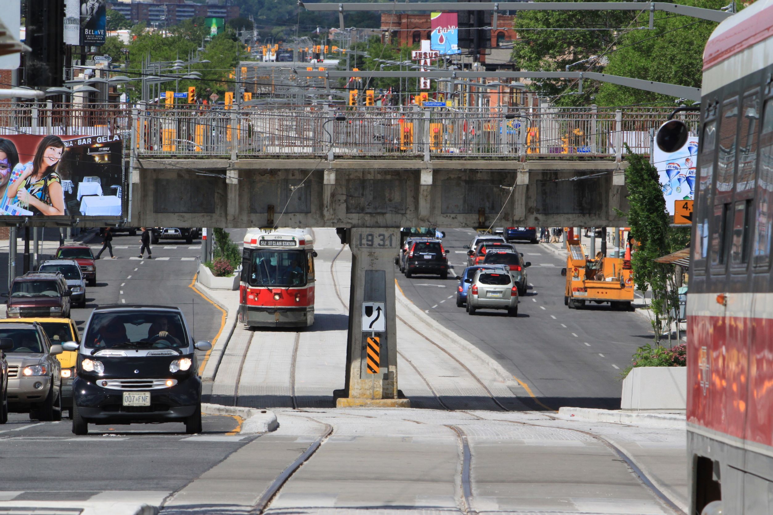
Verster’s focus is the GO Expansion program. Important though that is, GO is hobbled by the geography of Toronto’s historical, radial railway network. There is only one cross-city line within Toronto (CPR) and one crossing the southern part of York Region (CNR). Both of these are busy freight routes where insertion of passenger services would be challenging, assuming that the railways even agreed to such a scheme, and their locations do not coincide with major population and job centres.

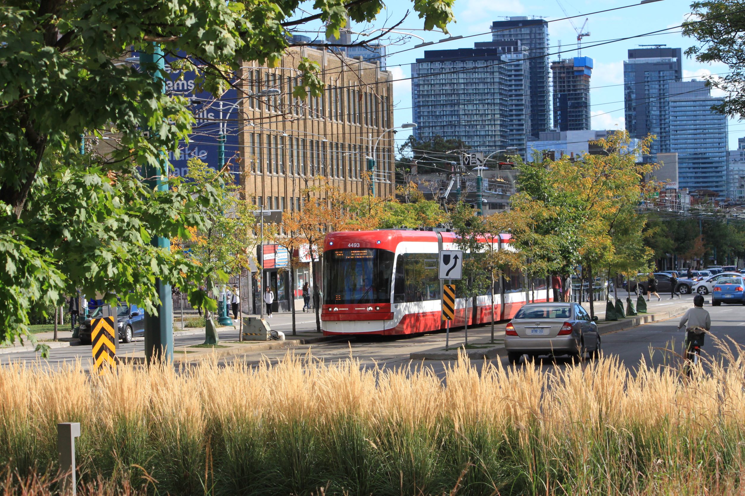
The railway network was created primarily to serve freight, and the early industrial districts of the region lie along rail corridors. The node at Union served not just passenger traffic, but also as an interchange with the harbour. That was very much the case until trucks took over much of the shipping market and highways became the focus for development. GO Transit inherited railway corridors whose locations fit a century-old industrial pattern. Modal interchange shifted to rail and truck terminals in the suburbs, and railways shifted much more to a line-haul role with trucks handling local distribution.

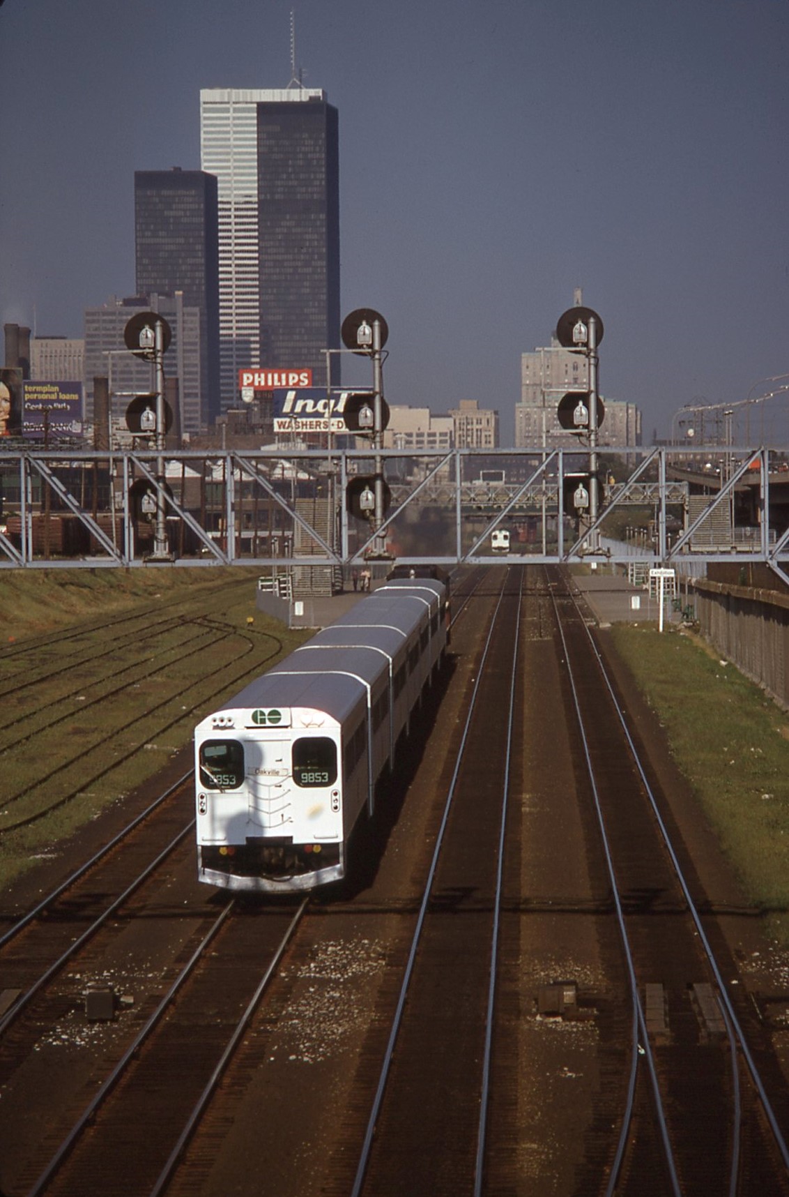
GO’s first half-century was a comparatively easy one taking the low-hanging fruit of existing rail corridors, building massive parking facilities along these lines, and basking in the arrival of thousands of commuters. That model does not work any more because the web of travel demands is much more complex than the legacy railway network. Parking garages are expensive and they occupy valuable real estate at stations.

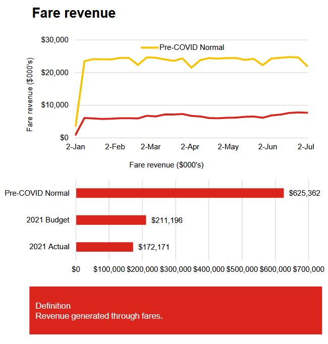
Parking lots are a quick and relatively cheap way to address the “last mile problem” of linking stations to their customers, and GO is one of the largest operators of parking facilities in North America. As of April 2019, GO transit had 85,055 parking spaces while the rail network carried 219,000 daily boardings (the equivalent of 109,500 round trips). That is almost four parking spaces for every five commuters. (I have ignored the GO bus network here because it is much less dependent on park-and-ride demand.)

That model simply does not scale up, nor does it provide a “network effect” because it is highly dependent on personal vehicles. The system is capacity-constrained by would-be riders’ ability to get to the trains.

Continue reading

TTC CEO’s Report: August 2021

Updated August 26, 2021 at 3:00 pm: The TTC has advised that the planned implementation of the 128 Stanley Greene bus has been deferred, contrary to information in the CEO’s Report. See the discussion under the 2021 Service Plan heading for more information.

Although there is no TTC Board meeting in August, the monthly CEO’s Report provides an update on TTC operations. Here are some points of interest and clarifications from the TTC on questions I sent about the report.

This article looks at ridership trends, the 2021 Service Plan status, service reliability and vehicle reliability.

Ridership, Revenue and Crowding

As Toronto reopens, ridership has started to grow, and as of the start of July had surpassed the level of early April when the stay-at-home order choked off the last attempted restart. The system as a whole reached 35 per cent of pre-covid levels. Buses still have the most boardings (44 per cent of pre-covid), but growth is stronger on the subway and streetcar networks in recent weeks. The TTC expects that this trend will continue through the summer and fall as in-person participation in school, office and other activities picks up.

Fare revenue is running well below historical levels thanks to the low ridership, and is also below the budgeted level because a stronger recovery was forecast in late 2020 when the budget projections were struck. The shortfall is part of the overall budgetary gap that the City faces in 2021 with pandemic-related costs.

As ridership picks up, so will bus crowding although the effect varies by route, location and time-of-day. The TTC does not break out this information in detail, but the data below show a clear trend into early July. An important consideration here is that the TTC’s recovery plan allows for greater crowding once the overall level of ridership crests 50 percent of historic values.

There simply are not enough buses and streetcars to accommodate twice the current riding level (i.e. a return to about 70 per cent overall) at current crowding levels. That said, the TTC’s fleet is substantially larger than its day-to-day requirement including provision for service and maintenance spares. There is room for growth in the total service operated provided that a way is found to pay for it. This will be an important issue going into the 2022 budget discussions.

In the chart below it is important to remember that these are all-day, all-system numbers. Many trips that are counter-peak, or offpeak, or on routes that tend not to accumulate large numbers of riders, are included in the total. A figure of 7 percent may not look like much, but the value is diluted by counting many trips that would never be crowded anyhow.

The issue, which the TTC does not report, is the proportion of trips on busy routes and times that are crowded. This results in a disconnect between rider complaints and reported average crowding levels. A basic aspect of transit is that when loads are not even, more people are riding on crowded buses than those that are nearly empty. The perceived level of crowding will always be higher than the average, but riders cannot board an “average” bus trip especially if that trip occurs on a route or at a time when they do not travel. Such is the inherent problem of reporting average values.

Continue reading

The Sigmund Serafin Subway Paintings

About 50 years ago, there was a housecleaning at TTC’s head office at 1900 Yonge Street. A room in what was then the Advertising Department stuffed with archival material was to be cleared out because they needed the space. A call went to the transit fans interested in preservating things that would otherwise be lost. This included a set of water colours by Sigmund Augustus Serafin who produced images of what subway station designs would look like long before the days of computer graphics.

These date mainly from 1957 when the Bloor-Danforth-University subway was still in the design stage. Few of the stations were built exactly as shown here. The quaint presence of the red “G” trains that ran on BD for only six months is a wonderful touch. Other vehicles include PCC streetcars and GM buses that predate the “New Look” era. Many buildings in the backgrounds no longer exist.

For decades these paintings lived in our family house, but in 2016 with what appeared to be a “friendlier” crew with Andy Byford in charge, I decided that it was time for them to go back to the TTC and the City Archives where they now reside. The TTC had thoughts of publishing them as posters, but that idea never bore fruit. The original mats around the paintings were in less than perfect condition when I received them, but the watercolours were and are almost like new.

Reproductions are on display at Bay Station, but they do not do justice to the originals. In anticipation of the TTC’s 100th birthday on September 1, 2021, here is a gallery of the paintings with photos I took while they were in my hands.

Click on any photo to open a gallery of larger versions.

Continue reading

Service Reliability of 39/939 Finch East

This article continues my analysis of corridors where RapidTO “red lanes” have been installed or proposed to speed bus operations. Previous articles in the series are:

This article reviews travel times and headway reliability (the intervals between buses) primarily through the pandemic era to July 2021 with April 2018 data as a pre-pandemic reference.

The High Points

Finch Avenue East is a corridor with a considerable amount of service through the combination of several express and local branches. Service will improve on weekends starting in September with the reintroduction of express service, but that is beyond the scope of this analysis.

As on many routes, travel times fell in March 2020 with the onset of the pandemic shutdown, the drop in road traffic and a big drop in transit demand. Through March, the travel time pattern changed from a pre-pandemic character with traditional peaks to an almost flat travel time value all day long. This drop, corresponding to a condition with little interference from traffic, probably represents a “best case” of the improvement that a transit priority lane can bring to Finch Avenue East.

This effect was primarily on weekdays on Finch with a smaller drop on weekends. The AM peak completely disappeared, and the PM peak has only re-emerged in recent months.

Travel times are climbing through 2021 and are in some cases back to pre-pandemic values, although not during peak periods.

Speed profiles for the local and express services based on the second and third weeks of July 2021 differ somewhat, but not as much as on other routes. However, a speed profile indicates how fast buses are moving when they are moving, and a stopped bus only counts as a “zero” once regardless of how long it sits serving passengers or waiting for a traffic signal.

Average speeds for buses at some times and locations on Finch exceed the posted 50 kph speed limit. This is no surprise to anyone familiar with suburban traffic patterns. Whether this will persist as traffic volumes build remains to be seen.

As in many of these route analyses, the weak point is headway reliability. All the speed in the world is of little benefit if a bus does not show up reliably and regularly. This can be compounded by vehicle crowding when buses are running in packs rather than on an even spacing.

The article includes charts of headways (the time between buses) in the first week of July 2021, a period when conditions were about as favourable as we will see for weather and the level of demand. At several points on the route, both the local and express service headways can vary quite widely with large gaps and groups of buses travelling together.

The average headways are close to the scheduled values indicating that all of the scheduled trips were operated. The problem simply was that they were not reliably spaced. This problem exists during all operating periods and on weekends, not just weekdays.

Continue reading

Have Your Say on the TTC’s Plan for Lawrence and Leslie Bus Services

Updated Aug 21/21 at 5:00 am: Link to survey corrected.

Updated Aug 22/21 at 12:05 pm: For some unknown technical reason, the survey closed sooner than it should have done. The TTC is working with their vendor to get this fixed.

Updated Aug 22/21 at 10:00 pm: The survey is available once again.

The TTC plans to restructure the 54 Lawrence East, 954 Lawrence East Express and 51 Leslie routes as part of the changes for introduction of Line 5 Crosstown late in 2022. They are conducting a survey of rider opinions on their proposals that is open until August 30.

Route 54 now operates between Eglinton Station and Orton Park / Starspray via Eglinton, Leslie and Lawrence. The proposed new route will begin at Science Centre Station (Don Mills & Eglinton) and will run north on Don Mills, then east on Lawrence. Note that there is a separate proposal as part of a Scarborough route reorganization to split off the Orton Park service as a separate route.

Route 954 now operates during peak periods express between Starspray Loop and Lawrence East Station. The proposed route will be extended to Science Centre Station over the same route as the local 54 Lawrence East service. There is no word on whether hours of service will be expanded beyond the peak period. Note also that after mid-2023 when the SRT shuts down, there will not be an RT service from Lawrence East Station to Kennedy Station, although plans are now underway in a separate study for reconfiguration of routes after the RT closes.

Route 51 Leslie now operates between Eglinton Station and Leslie/Steeles via Eglinton and Leslie. Route 56 Leaside now operates between Eglinton and Donlands Stations via Eglinton, Laird, Millwood and Donlands. The proposed route would combine 51 Leslie with 56 Leaside to provide one route from Donlands Station to Leslie/Steeles. (A peak period short turn would duplicate the existing Leaside via Brentcliffe service, and only about half of the 51 Leslie buses would run north of Eglinton.)

The combined effect of these changes would remove routes 51, 54 and 56 from Eglinton between Yonge Street and Don Mills (except for the short jog between Leslie and Laird by the combined 51 route). Only the 34 Eglinton bus would remain.

Also, service on Lawrence between Leslie and Don Mills would be provided only by the infrequent 162 Lawrence-Donway bus which does not directly serve the intersection at Don Mills.

For further info on the 2022 service plan, please see TTC 2022 Service Plan Consultation.

Metrolinx Announces Construction Plans for Queen Station

Construction of a new lower level station at Queen and Yonge will close roads in the area for an extended period according to a new blog article from Metrolinx. Between early 2023 for about four and a half years, Queen street will be completely closed from Victoria to James Street.

Source: Metrolinx

James Street will also be closed as well as a portion of the west side of Victoria Street.

Streetcars will divert both ways around the construction site via Church, the Richmond/Adelaide pair, and York. This will require York to become two-way at least south to Adelaide Street (it is two-way only from Queen to Richmond), and new track will have to be installed. Although the map above shows partial occupancy of Victoria Street, it is not clear whether the tracks, long out of use thanks to construction at St. Michael’s Hospital and at Massey Hall, will finally be reactivated.

Source: Metrolinx

Reconstruction of Adelaide Street is already in the City’s plans for 2022. Originally, when I asked about the scope of work, the feedback I received from the TTC was that this would only involve track removal from Charlotte Street (east of Spadina) to Victoria. However, with these diversion plans it is clear that new track will be required at least to York Street.

An obvious question here is what plans Metrolinx has for Osgoode Station, and whether a Queen diversion west of York will be required. It is conceivable that the Adelaide trackage may yet live again further west. There will also be construction effects at Queen/Spadina and King/Bathurst. I have written to Metrolinx asking when details of these projects will be available so that the entire plan for downtown construction will be clear.

Source: City of Toronto, TOInview

A further issue is that there is a major reconstruction of King Street planned in 2023. This would have to be well out of the way before Queen Street could be closed. If there will be track on Adelaide to which a connection could be provided at York, a new east-to-north curve would be an obvious addition at King.

More generally, there should be a plan for the future use of downtown streetcar track to support the various diversions needed for construction and to restore some of the flexibility in streetcar operations that has been lost over the years as less-used bits of track fall victim to various construction projects. A list of potential locations includes:

  • Adelaide Street from Charlotte eastward, not just from York, including connecting curves at York.
  • An east-to-north curve at King and York.
  • Reactivation of track on Victoria between Queen and Dundas.
  • Addition of curves in the SE quadrant at Church and Carlton (reconstruction is planned there in 2022).

I have written to the TTC asking what their plans are.

Too often, chances to improve the network have been missed when track is rebuilt “as is”. This is an excellent chance to rectify past oversights.

A further issue in all of this will be the effect of redirected streetcar (and other) traffic on the cycling network downtown. I will seek info about this from the City of Toronto.

I will update this article when I receive additional information from Metrolinx and the TTC.

How Many “Run As Directed” Buses Are There?

In response to complaints about unreliable service and crowding, the TTC routinely talks about buses that are on standby ready to fill in for overcrowded routes and emergencies. It is common to hear statements such as:

… we have 120 -140 buses each day to adjust service where and when possible to increase ridership levels …

This statement is not true.

What the TTC does have is 120-140 crews for standby buses, but these are not all in service at the same time. They are spread broadly across three shifts as the chart below shows. (The actual counts for August 2021 are 128 crews on weekdays, 155 on Saturdays and 124 on Sundays.)

[Chart methodology: The source data are in the TTC’s run guides for the August schedule period. These show the start and end times for each bus. For charting, the day is divided into quarter-hours, and a crew is counted if it overlaps an interval, even if it is only just starting or ending. For example, a crew from 8:10 am to 4:10 pm counts in the quarter hours from 8:00 to 4:00. Most crews are 8 hours long, but some on weekends are 10 hours long, and there is one oddball that is 8.5 hours.]

The peaks in the chart are caused by overlaps between shifts so that there is no gap while one shift of buses returns to their garages and another enters service.

The first crews report just after 3 am, and the last ones come back after 6 am the following day (times after midnight are shows as hours 24 to 30 in the chart legend). The build-up is a bit slower on Sunday reflecting the later start of service on many routes.

Realistically, the maximum number of “Run As Directed” (aka “RAD”) buses, also known by their internal route number “600”, is represented by the horizontal segments of the chart. For the weekday AM peak period, this means that there are 44 buses waiting for the call to action, not 140.

This is an important distinction on a network where the peak number of buses in service is about 1,500. The RADs provide a buffer of about 3 per cent. This buffer is proportionately larger off peak and on weekends because there is less scheduled service (about 1,000 buses on Saturday and 900 on Sunday).

On weekends and some late evening periods, these buses fulfill the original mandate of “route 600” as subway shuttles. They were originally set up to ensure that there would be staff pre-assigned to work on those shuttles rather than depending entirely on voluntary overtime where operator availability is strongly influenced by the weather. However, if they are running as replacement service for the subway, they are not available to fill gaps on other routes.

The actual usage of the RAD buses is very difficult to determine. They are not tracked by apps such as NextBus and Rocketman because they do not appear in the TTC data feed. Even if they did, they might not be “signed on” to the route they are serving, and there is no schedule against which their operation can be predicted. (NextBus depends on a bus having a schedule in order to make its arrival predictions. The NextBus feed is used by many other apps.)

I have attempted to extract the RAD buses from “full dump” samples of TTC tracking data (rather than route-based extracts), and they are hard to find. Some of them spend much time not going anywhere as one might expect from a bus on standby.

The TTC does not report on the actual usage of the RAD buses, but routinely invokes their existence to explain it is “doing something” about crowding. Some riders might disagree.

Continue reading

TTC Service Changes: September 5, 2021

September 2021 will see expansion of TTC service in anticipation of returning demand including in-person learning at schools and universities. Many express bus routes will be improved or enhanced.

In a reversal of past practice, schedule adjustments for “on time performance” will actually reduce rather than add to travel times in recognition that buses do not need so long to get from “A” to “B”, and that they can provide better service running more often on their routes than sitting at terminals.

Full details of the schedule changes are in the spreadsheet linked below.

Continue reading

Travel Times on 512 St. Clair

This article is a follow-on to How Slow Is The 510 Spadina Car? and an update of The Gradual Slowing of 512 St. Clair (Parts 1, 2 and 3).

Like the Spadina route, St. Clair operates in a reserved lane with many farside stops. The route has also been through the transition from CLRVs to Flexitys, and is subject to many of the same operational rules as the Spadina car. However, there are a few significant differences: St. Clair has fewer intersections (special track work) where slow orders apply, and the transit priority signalling is supposed to be active except at major intersections where cross-street capacity takes precedence.

The charts here are in the same format as those shown in the previous Spadina article for ease of comparison.

Looking west on St. Clair from Caledonia, June 30, 2010. Photo by Steve Munro.
Continue reading

How Slow Is The 510 Spadina Car?

A recent exchange on Twitter piqued my curiosity with the question “Is the Spadina car slower than it used to be”. A quick review of my archived tracking data for this route gave a simple answer “yes”, but there is more going on that just the speed of vehicles.

A related question dates back to a 2005 Globe article by Stephen Wickens comparing travel times on the 511 Bathurst streetcar which operates in mixed traffic to times for 510 Spadina which operates with “transit priority”. The Bathurst car won, much to the TTC’s displeasure.

Spadina looking south to College, September 2018. Photo by Steve Munro.
Continue reading