Some of the material in these articles will be familiar to readers, but my purpose here is to consolidate many thoughts, some old, some new, in one piece. My hope is to inform discussion about transit’s recovery in Toronto and in particular to provide context for the inevitable political debate about what we should attempt, and the managerial issues of knowing whether we have succeeded.
Updated Aug. 30/22 at 1:25pm: Sundry typos and grammatical faux pas corrected. No substantive change to the text.
Since early 2020, the TTC and transit systems everywhere have wrestled with the ridership and revenue losses of the pandemic era. The goal of both management and politicians has been to just “keep the lights on” and provide some level of transit service. Toronto, with the aid of Ontario and Canadian governments, has worked particularly hard to continue an attractive service, at least on paper.
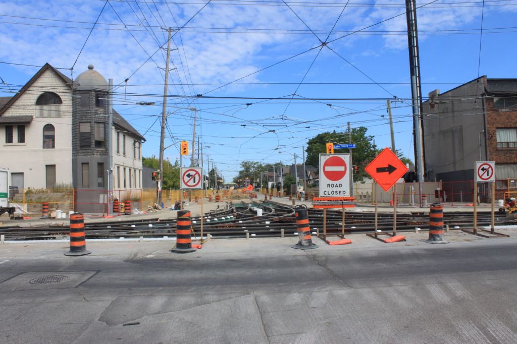
Service quality is a real bugbear for me, and the widening gap between the advertised service and what is actually provided should be a major concern. Next year, 2023, Toronto will likely see the end of special Covid-related subsidies, and a growth in demand back to pre-pandemic levels, although the timing of these events could prove challenging. Meanwhile, City Council “net zero” emission plans call for a major shift of travel onto transit. This will not happen with a business as usual approach to transit.
The focus must shift from muddling through the pandemic to actively improving the transit system, and to doing that with more than a few subway lines whose first riders are almost a decade away.
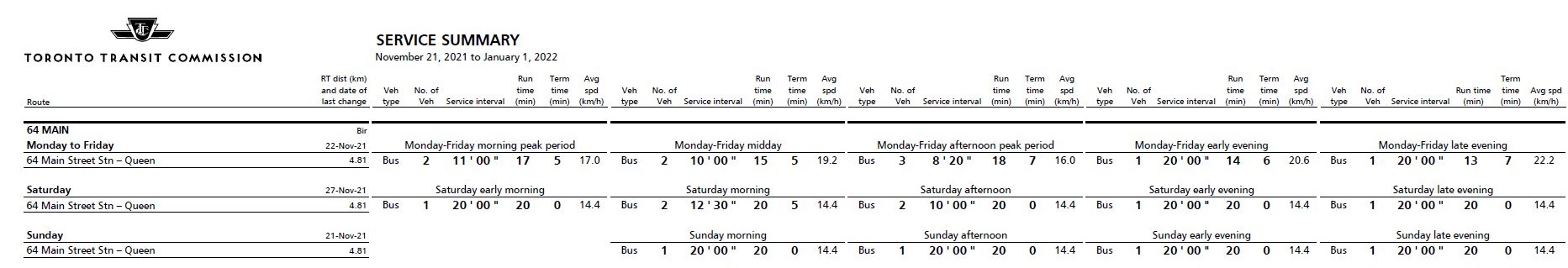
Key to running more and better transit is a solid understanding of how the system performs together with a planning rationale for growth. This brings me to two documents: the TTC’s Service Standards and the monthly statistics included in the CEO’s Report.
In this first of two articles, I will review the Service Standards and discuss some general principles about reporting system behaviour. In the second, I will turn to the CEO’s Report.
There are two essential problems:
- The actual machinery of the Service Standards is not well understood, and the current document was endorsed by a previous TTC Board almost without debate. Superficially, the standards appear to call for good service, but in practice they hide as much as they show in reporting on quality. The Board did ask for follow-up information on improving standards (more service, less crowding), but management never delivered this feedback.
- To the degree that management reports system performance, this is done at a summary level where the day-to-day reality of transit service and rider experience are buried in averages that give no indication of how often, when or where the standards are not achieved.