“Snowmaggedon” and the Dufferin Bus

On January 17, 2022, a record snowfall hit the Toronto area. Yes, this is Canada, and it does snow here, although people who live in areas without the moderating effect of Lake Ontario rarely have much sympathy on that score.

A post mortem report on the event will be discussed on March 29, 2022, at the Infrastructure & Environment Committee. As the City’s report on the event summarizes:

On January 16-17, 2022, the City of Toronto experienced an extraordinary winter storm that involved extreme cold temperatures, very rapid snowfall, and an ultimate snow accumulation of 55 centimetres in just 15 hours. The below freezing temperatures that followed the storm and lasted for more than two weeks created a unique set of challenges for storm clean up.

The effects on transit routes were severe, and there was little or no service on parts of the network for an extended period.

Snow clearing took a very long time:

Ultimately, 179,442 tonnes of snow were removed from 3,471 km of roads, requiring almost 60,000 truckloads. Removal was conducted over a 30-day period; however, operations were suspended when additional snow events occurred, meaning snow was removed on a total of 23 non-consecutive days.

Toronto’s snow clearing practices tend to focus on major streets and often do not include physical removal of snow. This effectively narrows roads and limits their capacity until the snowbanks eventually melt. A history of warmer winters and fewer severe storms has contributed to a somewhat laissez-faire relationship to winter that failed Toronto in 2022.

The report speaks to several changes in approach to major storms that will be implemented in early 2023, and I will not go into these here beyond noting the effect on transit.

Two related problems do leap out.

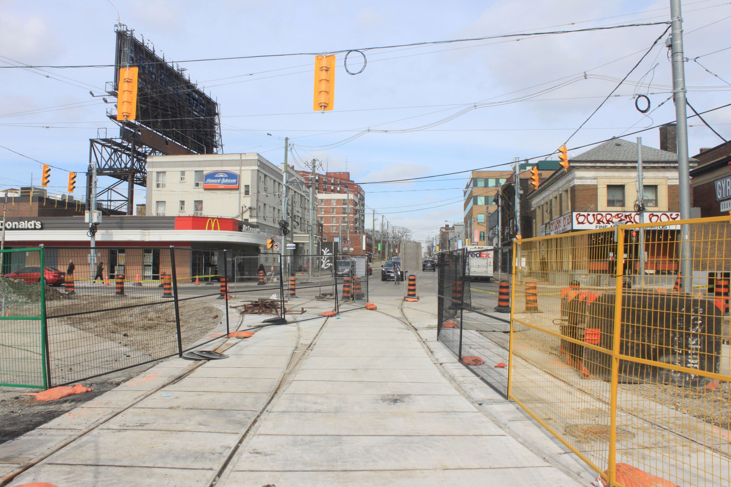
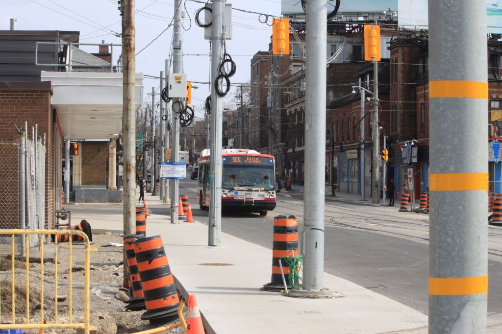
First, the responsibility for various aspects of snow clearing fall to different groups. Roads and sidewalks were plowed by multiple contractors. Sidewalks were, until this year, the responsibility of property owners, but the city’s fleet of sidewalk plows was not yet at full strength, and subject to breakdowns. Bike lanes might or might not be plowed especially if they are simply painted and have no protective barriers.

The result is both a “who does what” clash and a war for space where snow can be dumped before it is carted away, if ever.

Second, the reduction in road capacity causes congestion both by taking lanes out of service, and by parked cars, to the extent motorists can navigate the snowbanks, encroaching beyond the curb lane. This is a particular problem on streetcar routes, but is not confined to them.

Plowing, when it does occur, may not be accompanied by aggressive towing, or at least by temporary relocation of parked cars so that the curb lane can be fully cleared.

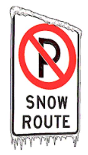
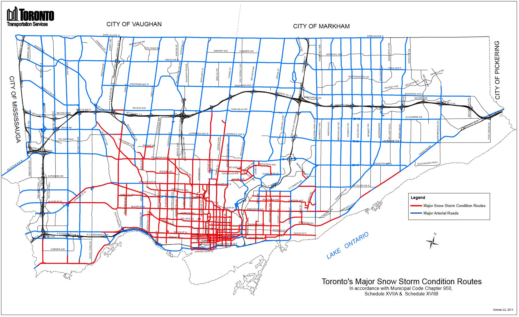
Toronto has a network of designated snow routes for major snow events. Most of the territory it covers is in the old City of Toronto with some outlying areas. When a major storm condition is declared, parking is banned for 72 hours (or more if need be) on the streets shown in red below. Most of the suburban city is not included.

The map below is dated October 2013, and it is due for updating especially if Toronto plans to be serious about the quality of transit service and meaningful schemes for transit priority across the city.

In Brief

The major snowfall on January 17 disrupted transit service, and the effects continued for a few weeks after the event. In some cases, buses had not returned to “typical” pre-storm travel times into February.

The location of congestion problems on routes reviewed here was not distributed along them a a general delay, but could be found at specific locations and times where the effect was “net new” after the storm. This suggests that a detailed study of storm delays will reveal key locations and conditions that should be avoided in the future.

On Dufferin, a major location for delays was northbound to Yorkdale Mall, and this persisted for some time after the storm. Normally, problems on routes like this are assumed to arise from their hilly nature, but that was not always the case in late January.

Continue reading

Ontario Line Station Renderings

On March 27, 2022, Premier Doug Ford and a very chilly bunch of his political colleagues gathered near Exhibition Station for an official “groundbreaking” for the Ontario Line. Never mind that Metrolinx will not award the first of the main construction projects until late April, and the posed set of excavation machinery sat idle in the background. This was very much an event plugging the Tories’ overall platform and positioning construction, wherever and whatever it might be, as an economic engine for Ontario.

Concurrently with the press conference, which revealed absolutely nothing new, a new set of renderings for Ontario Line stations was released. In some cases these were quite large and were intended for media use. I have downsized them where needed to work better online.

Absent from these renderings are any of the development schemes that Infrastructure Ontario has proposed under its Transit Oriented Communities program.

The Premier’s speech contained a basic error in math when he claimed that the Ontario Line would add more than 50 per cent to the Toronto subway network. No. it is the four Ford “priority projects” announced in 2019 that will do this. It’s in the press release. Some speech writer screwed up.

Probably the most annoying part of the press conference was a statement by Metrolinx CEO Phil Verster who spoke glowingly of how well Metrolinx had worked with communities both in Riverside and in Thorncliffe Park to create an acceptable design. This materially misrepresents the very contentious relationship with both communities, and continues Metrolinx’ gaslighting of critics to give the impression that all is well, and it is the critics who are out of step.

If Metrolinx had been truly involved with communities along the line while it was being designed, a great deal of contention could have been avoided.

Continue reading

Service Analysis of 95/995 York Mills, October-December 2021

This article begins a series reviewing the major east-west corridors in Scarborough and eastern North York. Although there are several proposals ranging from BRT-lite red lanes all the way up to a full scale subway for these streets, none of them is going to see much change for the coming decade. Rather than waiting forever for the promise of a new transit dawn in the east, Toronto really needs to focus on making transit service we have today work.

Minutes of community meetings are strewn with “improve the bus service” as a common, long-standing complaint. But nothing substantial happens.

For two years, everyone including the TTC has been preoccupied with the pandemic. For a time, the usual excuses about poor service, notably traffic congestion, really didn’t wash, but now we are on a rebound. Now is the time for TTC management to look at the service they are offering and ask whether it really is the best they can do, that it will attract riders back to the system.

The period covered by this article runs from October 1 to December 31, 2021. Most of this was during a period of ridership recovery, and the effect of Omicron-related drops in demand and in traffic came in the later half of December which is traditionally a slow period anyhow because of the holiday season. Data are missing in late October and early November because of the cyber-attack on the TTC, but there is more than enough to show the overall patterns of route behaviour.

Service on York Mills and Ellesmere

The 95 York Mills and its express counterpart, 995, run east from York Mills Station at Yonge Street.

The local service has three branches:

  • 95A runs east via York Mills, Ellesmere and northeast on Kingston Road to Port Union.
  • 95B splits off from Ellesmere at Military Trail and terminates at the University of Toronto Scarborough Campus (UTSC). This branch operates only during periods when there is no 995 express service.
  • 95C runs only as far east as Ellesmere Station on the SRT. This branch operates weekdays during peaks and midday.

Scheduled service for route 95 York Mills changed on October 10 when the 95A service was extended via Kingston Road to a loop at Port Union Road.

The service summaries for the two periods are below. During many periods, one bus was added to the service for the extension but headways remained the same making the round trip time longer. However, the scheduled speed also went up slightly.

Schedules for this route have not changed since October 2021.

The express service has only one branch:

  • 995 runs to UTSC via the same route as the 95B local service. These buses operate as locals between UTSC and Markham Road, and express from there west to York Mills Station.

Service to UTSC operates as the 995 express weekdays during the peaks and middays. Early evenings and on weekends, it operates as the 95B local.

The scheduled service for 995 York Mills Express has not changed since June 2021.

In brief:

  • Service on 95/995 York Mills operated on the same schedules from mid October 2021 through to year end.
  • Bunching is common. Generally, but not always, it is caused by “blended services” that actually run as pairs of buses.
  • There is little or no evidence of supervisory intervention to break up bunches of vehicles. Some bunches form at terminals where service spacing should be comparatively easy.
  • Cancelled runs were not a problem on York Mills because average headways generally lie at the scheduled values, although individual headway values were widely scattered during all operating periods.
  • The difference in average travel time is only about 5 minutes between the local and express services during most periods when both are offered.
  • Terminal layover times are generous especially at Port Union on the 95A service. Recovery from minor delays enroute should not be a problem.
Continue reading

Ontario Line Environmental Assessment Open Houses: Part IV – Thorncliffe Park

This is the fourth and final article in my series about the Ontario Line Open Houses. See also:

Many issues affect the Thorncliffe Park section of the Ontario Line, to the point where I have split this off into a separate article.

Listening to all of the debates, I cannot help seeing that many problems arose from Metrolinx’ trademark secrecy coupled with a piecemeal approach to planning in a large, important neighbourhood.

The transit line was, in effect, dropped out of the sky as a line on the map fitted as best it could (depending on one’s definition of “best”) through the community without advance consultation. Many wider needs were beyond the project’s scope, and yet it is clear that Thorncliffe Park requires an integrated plan for its future including many elements:

  • The future of lands south of Overlea including an aging mall and its parking lot.
  • Whether low-rise commercial/industrial buildings north of Overlea will remain in the long term, and if not, what will this area become?
  • What should Overlea Boulevard look like as the main street of a future Thorncliffe Park? There is already a plan for the east end of Overlea, but what of the entire street?
  • How will a growing population be served both for public facilities such as schools and businesses providing local, walkable access?
  • What is the target population and demographic? Will Thorncliffe’s growth be driven by a forest of high-priced condos, or a mix of building types and affordability?
  • How will open space and parkland be provided in an area where parking lots are a dominant feature?
  • What is the future of lands in the Leaside Industrial area and how can redevelopment there be linked with the needs of Thorncliffe Park, including the MSF yard’s location?

I fully expect the response to be “this is an important transit project and we cannot wait for an overall plan”. That would be the response of a construction agency eager to do its master’s bidding, not of a city-building agency with a wider outlook. An area plan would be an iterative process that could identify key elements up front, but guarantee a wider scope for the neighbourhood’s future. Most importantly, it would occur in public to bring trust that there was no hidden agenda or deliberate sidelining of community concerns.

The remainder of this article consolidates the Q&A sessions from the online open houses.

Continue reading

Ontario Line Environmental Assessment Open Houses: Part III – South Section

This article continues a series reviewing the open house sessions conducted online by Metrolinx for the Ontario Line in February and March 2022.

The material here is condensed from recordings of the two meetings about the section from Gerrard to Exhibition Station. The questions and answers have been grouped to bring related topics together, mainly on a geographic basis. This is not an exhaustive Q&A as the topics depend on the interests of those participating.

Statements are not attributed to any specific person (if you really want to know who said what, listen to the recordings), but if anyone feels I have misrepresented their position, please let me know through the comments.

The sections prefaced with “Comment:” are my remarks.

Continue reading

TTC Service Changes Effective March 27, 2022

Service on several bus routes will change on March 27, but overall the amount of service operated is almost unchanged from the February 13, 2022 schedules.

There is no change in subway service, and the only planned changes for streetcars are those beginning in early April for reconstruction at Dundas West Station.

The table below shows the budgeted overall service expressed as weekly operator hours compared with the scheduled and actual values. It is clear that the budget planned to ramp up service substantially by late March, but with the less-than-expected ridership recovery thanks to Covid, this has been deferred.

Planned regular service for the new schedules is 6.8 per cent below the budgeted level. Construction-related service is also below budget, but this has somewhat less effect on the operating deficit because much construction service is funded through the associated capital projects.

The next round of schedules will take effect in mid-May, and by that time the usual seasonal cutbacks start to kick in. We will not really see the degree to which the TTC ramps up to budgeted service levels until September. As a point of comparison, the budgeted regular service in January 2020 pre-pandemic was just under 186,000 hours/week.

Many routes will see a mix of service cuts and improvements through reallocation of hours and vehicles between periods of operation. Some “reliability” improvements involve longer travel times and layovers than in current schedules often with wider scheduled headways (the time between buses). Some of these routes will become candidates for a comparative analysis on this site of before and after service reliability later in the spring.

An important change for the March 27 schedule period is that the number of “biddable crews” (work that is scheduled but for which no operator is pre-assigned) has been reduced from about 160 to 55. This reflects an improved balance between operator staffing levels and the scheduled service. These crews are filled on an overtime basis, or possibly by spare operators or re-assigned “run as directed” (RAD) buses. When these crews are cancelled, this translates into service gaps unless the remaining buses on affected routes are adjusted to run on a wider, but even headway. This has been a pervasive problem on some routes as shown in recent articles here about service reliability.

The number of RAD crews will increase notably on weekdays from 53 to 75 8-hour crews. These buses are used to supplement service, and they also serve as shuttles for service interruptions and subway shutdowns.

Continue reading

Ontario Line Environmental Assessment Open Houses: Part II – North Section

This article continues a series reviewing the open houses held by Metrolinx about the Draft Environmental Impact Assessment Review (EIAR) for the Ontario Line. Here I will focus on the section of the route from Gerrard north to Eglinton (Science Centre Station), and in a third article to follow, I will review the southern section from Gerrard to Exhibition.

See also:

The material here is organized by topic rather than in the order that questions were posed. Some topics and locations had no information beyond the basic Metrolinx presentation either because nobody asked, or because a pre-submitted question was not chosen by the moderator.

Although Metrolinx claimed that it would answer all of the pre-submitted questions through the meeting web pages, as I complete this article on March 11 few replies have been posted.

In my consolidation of the discussions, there are three sections tagged as below:

  • Q: A précis of the question asked (this might consolidate related questions).
  • A: A précis of the Metrolinx response
  • Comment: My comment on the Q&A, if any.

I make no excuses for whatever Metrolinx might have said, or omitted, in their answers. Nobody is quoted by name, but if anyone thinks I have misrepresented their position, please leave a clarification in the comments.

This is a long read condensed from about four hours of meeting recordings.

Continue reading

Dundas West Station Reconstruction (This Article Is No Longer Current)

Note: This article is based on the originally announced plans for Dundas West and these were subsequently revised. See the article at Dundas West Station Reconstruction (Revised).

The loop at Dundas West Station will see track replacement and reconfiguration of the 505 Dundas platform. There will be three stages to this work:

  • Early April: Special trackwork replacement on Dundas Street south from Edna Avenue (the north side of the station) including the station entrance.
  • Late April/Early May: Track replacement on Edna Avenue.
  • Mid May through June: Track replacement within the station and expansion of the 505 Dundas platform.

During the first stage, the southbound lanes of Dundas will be closed from Edna to Bloor.

During the first and second stages all transit traffic will be diverted as shown in the map below.

  • Routes 40 Junction and 168 Symington will divert to Lansdowne Station.
  • Route 504C King Shuttle will divert to High Park Station.
  • Route 505 Dundas will divert to High Park Loop.
  • Route 306 Carlton night car will divert to High Park Loop.
  • Route 312 St. Clair-Junction night bus will divert to Keele Station.
Route diversions for Dundas West Station reconstruction Stage 1 April 2022 (TTC)

During the third stage, service will return to Dundas West Station, but with an altered arrangement:

  • Routes 40, 168 and 312 will loop on street via Bloor, Dorval (one block west of Dundas) and Edna. They will drop off and pick up passengers at temporary on-street stops.
  • Route 504C King will continue to loop at High Park Station.
  • Route 505 Dundas and 506 Carlton schedules will be blended to provide even service at High Park Loop
  • Route 306 Carlton night will be converted to bus and will operate to Dundas West Station using the same on-street loop as as the daytime services.

With the realigned 505 Dundas loop track and platform, the overhead will be shifted to match the new setup.

Although a date for resumption of normal service has not been announced, one might reasonably expect that this would occur with the schedule change at the end of June 2022.

I will detail other service changes planned for March 27, 2022, in a separate article.

TTC’s webpage for this project is here. (This link has changed because the TTC updated the page to reflect the revised plans.)

King-Queen-Queensway-Roncesvalles March 2022 Update

Construction has resumed, although not exactly at a “breakneck” pace, at the complex junction of King, Queen, The Queensway and Roncesvalles. Here are photos showing the current state of things.

Slip Lane Removal

On the southwest corner of the intersection, there used to be a “slip lane” that allowed eastbound traffic veering from The Queensway to King Street to bypass the signalled intersection. This was fine for motorists, but a danger to pedestrians. In the new intersection layout, this lane has been removed and the sidewalk will be expanded to make this a conventional 90-degree junction.

King Street Realignment

King Street formerly met Queen at an angle, but this has now been straightened out. With the new intersection geometry, the two streetcar lanes split apart east of the intersection. This will align the future tracks on the north side with sidewalk “bumpouts” for the northbound and southbound carstops.

Track and Overhead Construction

Many new overhead support poles have been installed around the intersection, and they are festooned with coils of future span wires. West of Sunnyside Loop, excavation of the trackbed has started together with construction of foundations for centre support poles.

Planned Restoration of Streetcar Service

In the announcement of February 2022 service changes, the TTC anticipated that 501 streetcar service would be restored to Sunnyside Loop in the May 2022 changes.

In May, the 501 bus shuttle will be shortened from Broadview to University, but streetcars will continue to operate only to Bathurst Street (Wolseley Loop). I have asked the TTC for an update on streetcar service restoration and await a reply.

Ontario Line Environmental Assessment Open Houses: Part I – General Thoughts

After the publication of the monumental draft Ontario Line Environmental Impact Assessment Report (EIAR), Metrolinx organized four online “open houses” to present an overview of the report and to address questions. These took place in late February and early March during a 30-day period for public comment that ends on March 9. Those of you with a desire to spend many unproductive hours hours waiting for occasional pearls of wisdom to emerge can do so through the Metrolinx Engage website:

  • North segment: February 22 and 24
  • South segment: March 1 and 3

In two separate articles, I will summarize the major questions from each pair of sessions. However, there are general issues raised by the draft EIAR and the process for public input that deserve their own debate.

Politicians and managers who never read beyond the glossy brochures, or, maybe, the Executive Summary, might mistake sheer volume as a measure of transparency, an heroic effort to inform and involve affected communities.

Back in the days of real telephone directories, the size of the phone book was, among other things, a measure of how grand a community might be. Big thick book equals lots of phones and lots of people, a matter of pride even if the type got smaller and smaller as years wore on. But for all its heft, the directory had a basic organizing principle: if you knew how to spell someone’s name, or even made a reasonable guess, you could find their address and phone number.

The many thousands of pages in the EIAR and its sundry appendices, not to mention equally large reports that preceded it, are bricks in a wall of obfuscation, not revealing windows into our future. Nobody (no, not even I) has read every page if only because there is only so much time to devote to the subject, and there is a lot of badly organized, repetitive information. Key topics one might expect based on past projects (including the Relief Line South study) are missing because these details will not be worked out until after the design/construction contracts are awarded, and the opportunity for public comment only a distant memory.

If the desire were to construct a project that would frustrate public participation, it is hard to imagine how Metrolinx could have “improved” on what they achieved. An exercise in going through the motions. A triumph of superficiality disguised by the sheer volume of reports.

Continue reading