Metrolinx will hold two online open houses covering the draft Environmental Assessment Impact Report as it relates to the southern portion of the line from Gerrard to Exhibition.
Last June, I posted a long article about plans for the Waterfront East LRT and the designs as they were then proposed. See Waterfront East LRT: June 2021 Update.
Although the next full project update will not come to Toronto’s Executive Committee until the end of March 2022, a revised proposal for the treatment of Cherry Street was presented to Waterfront Toronto’s Design Review Panel on February 23. I have only included a selection of illustrations from the presentation deck in this article, and I recommend that interested readers browse the full set.
As described in the June 2021 update, the link from the existing Cherry Street trackage under the rail corridor to New Cherry Street will be made through a new tunnel through the rail berm east of the existing Cherry Street underpass. However, the original plans for the area involved a small forest of, yes, cherry trees and this has proved impractical. The water table is very high and the underpass is a low point in the surrounding terrain. Any high water event would flood the area.
The new design starts from the premise that the water should be controlled and included as part of the landscape with a marsh around the new transit corridor as the proposed solution.
The illustration above shows the area where Distillery Loop is today. The Cherry Street signal tower is a landmark that, in the proposed alignment, would be shifted east. An alternative scheme leaves the tower where it is and the streetcar tracks swing east around it.
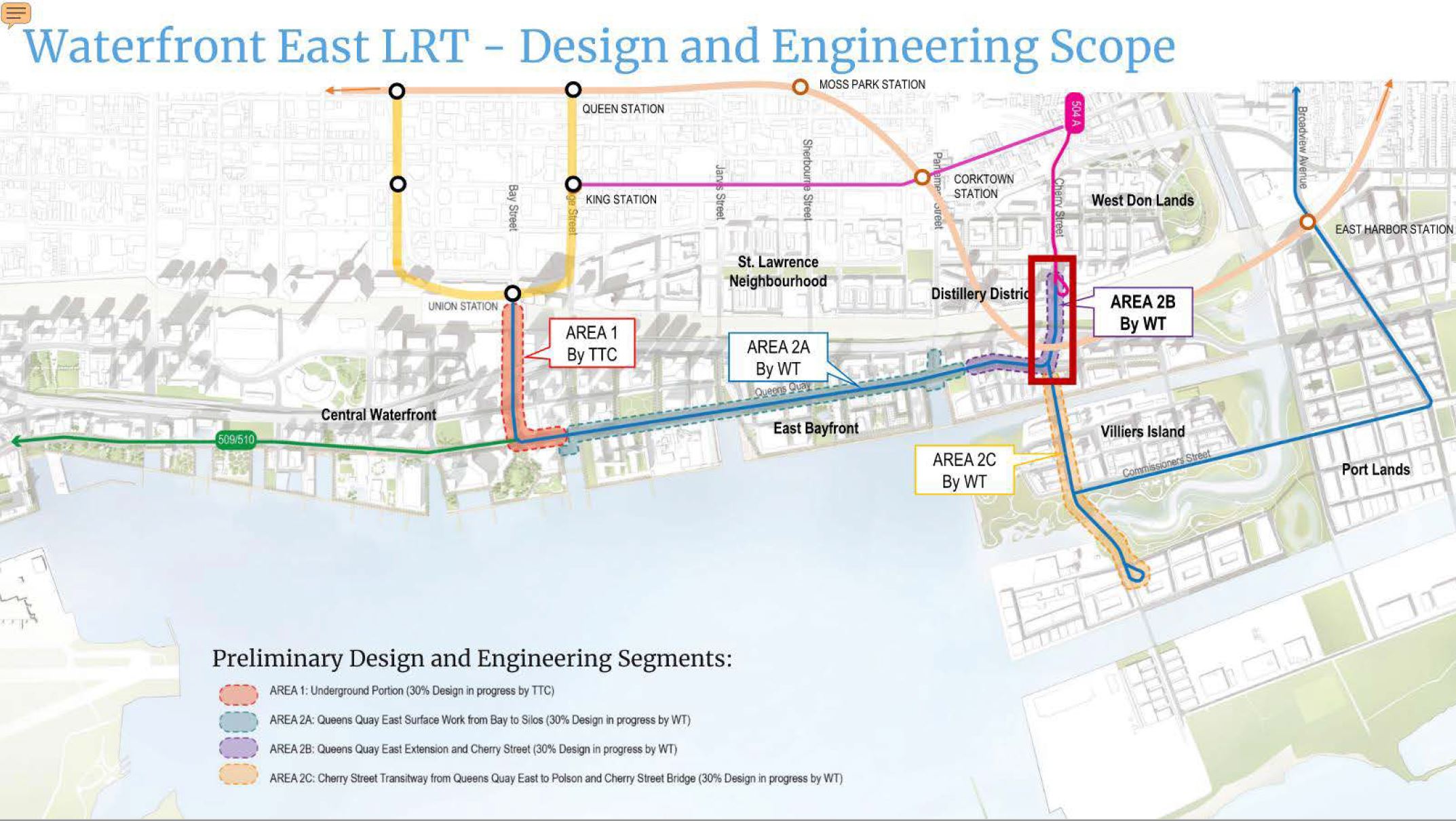
To put this in a wider context, here is a map of the overall waterfront area showing various projects. Only the area outlined in red is the subject of the current report.