Relief Line South Station and Alignment Plans

Detailed study of the southern portion of the proposed Relief Subway Line from Pape & Danforth to Osgoode Station is now underway including public consultation sessions on the design. Two of these have already occurred as I write this on April 29, but one session does remain:

Monday, April 30, 2018, 6:30 to 8:30 pm at Morse Street Junior Public School, 180 Carlaw Ave (south of Queen)

The first session was held near Pape & Danforth on April 23, and it was a packed house because construction of this line will have a major effect on properties along the route through Riverdale. Much of the detailed information is not available online because of the size of the files. This article contains snapshots of station and alignment plans along the route at a resolution sufficient to see the details while staying within reason for online viewing. (All of the illustrations are clickable to see a larger version. Some of them have artifacts of viewing large files at a reduced scale, notably the partial graying-out of some text.)

Commentary on the designs is my own except as noted.

Thanks to the City of Toronto Planning Department for provision of the electronic versions of the plans from which the illustrations here are taken.

For further information, please see the Relief Line South website.

Continue reading

506 Carlton Streetcars vs Buses: Part III – Fine Tuning The Charts

This article is a followup to two previous analyses of the 506 Carlton route’s behaviour:

Based on feedback from readers, I have experimented with alternative presentations of the data that better illustrate what is happening on the route. These versions will be added to the repertoire of charts I will use in future analyses, notably for the 505 Dundas route which is the next one in line for review.

Continue reading

TTC Service Changes Effective Sunday, May 13, 2018

The May 2018 service changes bring:

  • Addition of two AM peak “gap trains” on 1 Yonge-University-Spadina and other operational improvements.
  • An update to the schedules for service on the King Street Pilot to reflect the improved travel time on the street and to reduce vehicle queues at terminals.
  • Changes to all routes serving Main Station during construction that will close the loop to transit vehicles.
  • Diversions of the Parliament and Carlton routes around track construction at Gerrard & Parliament.
  • Changes to Don Mills bus schedules to reflect actual operating conditions and Crosstown construction effects.
  • Seasonal changes to reflect declining ridership to post-secondary institutions during the summer.
  • Summer improvements including extension of 121 Fort York Esplanade to Cherry Beach during all operating periods, improved weekend service on 92 Woodbine South, and later service to the Zoo.
  • There is a new summer route 175 Bluffers Park on weekends between Kennedy Station and the park’s parking lot.
  • Service cuts and running time reductions on 6 Bay.
  • Weekend reliability improvements on 96 Wilson and 165 Weston Road North.
  • Weekday reliability improvements on 199 Finch Rocket.

2018.05.13_Service_Changes

Here are the highlights:

1 Yonge-University-Spadina

Two “gap trains” will be added to the morning peak schedule to provide additional service as needed southbound on Yonge. One train will be stationed in Eglinton pocket track, and the other on the hostler track at Davisville.

Trains leaving service in the evening to Wilson Yard will now do so southbound from Vaughan rather than northbound at Wilson. This avoids conflicts between the yard movements and southbound service.

King Street Pilot

Running times on 504 King will be reduced during almost all operating periods, and the saving will be converted into slightly shorter scheduled headways with no change in total vehicles. The four peak period ALRV trippers will be replaced by six CLRV trippers. Flexity cars will now be formally scheduled to cover part of the service with priority going to runs that stay out all day.

514 Cherry service will be improved during the AM peak, weekday early evening, Saturday afternoon and Saturday early evening periods by the addition of one or more cars.

Peak period crewing practices will be changed to step back operation to reduce terminal delays.

Main Station

Main Station Loop will be closed until September 2018 for construction. During this time routes serving the station will be reorganized:

  • 20 Cliffside and 62 Mortimer will be interlined as a single route from Broadview to Kennedy Station.
  • 23 Dawes will be extended west to Woodbine Station.
  • 64 Main will be extended north to Eastdale.
  • 87 Cosburn will loop on street via Danforth and Chisholm.
  • 113 Danforth and 135 Gerrard will be cut back from Main to Victoria Park Station.
  • 506 Carlton will be extended east to Victoria Park Station via Gerrard covering the mileage of the shortened 135 Gerrard route.

Parliament & Gerrard

During the reconstruction of this intersection, buses will divert:

  • 65 Parliament will divert via Sherbourne between Dundas and Carlton.
  • 506 Carlton will divert via Dundas between Sherbourne and River.

Bay Bus

Service on 6 Bay will be reduced by the elimination of one or two buses during most operating periods, and headways will be widened as a result.

This route suffers from excessive running time as shown in a previous analysis I published, and I will be updating this with current data in May.

506 Carlton Streetcars vs Buses: Part II – Headway Reliability & Capacity

Updated April 24, 2018 at 6:15 am: The axis title on the headway history chart at the end of this article has been corrected from “Minutes” to “Seconds” to reflect the units by which headways are stated in the chart.

In Part I, I reviewed the travel times for buses and streetcars on 506 Carlton since September 2017. In Part II, I will turn to headway reliability – the degree to which service actually operates with evenly spaced vehicles – as well as the capacity of service provided. A followup section looks back to September 2015 to compare operations over a longer timespan.

When the TTC reports on service quality, they have a very limited target: that vehicles leave their terminals no more than 1 minute early or 5 minutes late. Performance stats at the route level have not been published for three years, although there are plans to resume this practice soon. However, there are problems with summarizing data at the level the TTC reports:

  • Results are consolidated for entire days and months so that variations are smoothed out, and the raggedness both in hour-to-hour and day-to-day performance is hidden.
  • Relatively poor performance in peak periods can be masked in averages by better performance in the off-peak. Even though there are fewer off-peak vehicles, there are more off-peak hours and hence more trips.
  • There is no measure of service quality except at terminals even though that is not where most riders use the service.
  • The absence of mid-route measurements means that there is no penalty in a missed “target” for line management quality over the length of a route.
  • The six-minute window (+1 to -5) allows pairs of vehicles on routes with short headways to depart from terminals while still being considered “on time”.
  • Route capacity is wasted because some vehicles run half-empty close behind their leaders, and the average rider experience is that vehicles are infrequent and crowded. The TTC has no metric to identify and monitor this problem.

Service on 506 Carlton has been erratic for many years and the shift to bus operation in February 2018 has not improved route performance. Although buses are scheduled closer together for capacity reasons, headways remain erratic and in some cases the variation in headways has widened since the move to bus operation.

Looking at these charts, it is a wonder that anybody tries to ride this line at all. It is a textbook example of providing bad and slowly declining service on what was once a trunk route in the system. As density builds up along the “shoulder downtown”, routes like Carlton have an important role, if only the TTC would make the effort to provide more attractive service.

Continue reading

506 Carlton Streetcars vs Buses: Part I – Travel Times (Updated)

Updated April 23, 2018 at 9:30 am: A section has been added following the original article to discuss travel times over the full route from Main Station to High Park including weekend data.

With the temporary conversion of the 505 Dundas and 506 Carlton routes to bus operation for much of 2018, there is a chance to compare how these routes operate with each vehicle type. In this and future articles, I will review travel times across the routes as well as headway reliability.

Data for 506 Carlton that I have collected runs from June to October 2017, and from January to March 2018. For the purpose of speed comparisons, weekdays from January 8-19 (streetcar) and March 19-28 (bus) 2018 are used. This avoids major storms as well as periods when schools were closed and traffic was lighter than normal.

There are seasonal variations in travel times due to the nature of streets and neighbourhoods transit services run through. As the year progresses, it will be possible to compare data for warmer months when the streets are busy between 2017 and 2018 data, although this must be tempered with the effect of diversions that were in effect during 2017.

There is a slight improvement in travel time at certain periods of the day and certain locations/directions for buses, but this is not large or widespread even in off-peak periods. Buses tend to reach higher peak speeds between stops where conditions permit, but in many cases the speed profiles are comparable for the two modes.

Bus headway reliability has been a topic of some discussion on Twitter along with the capacity of the replacement service, but I will turn to those issues in the second part of this analysis.

Route History

The 506 Carlton route changed from time to time over the past year, and this affects the travel times reported here.

  • June 18, 2017: Service diverted via Dundas and Bathurst both ways for streetscape work on College. This increases travel times on the west end of the route starting in mid-June.
  • June 19 to July 9, 2017: Service diverted via Queen between Parliament and Coxwell for construction on Gerrard.
  • July 10 to 25, 2017: Service diverted to Coxwell-Queen Loop for construction on Upper Gerrard. Bus shuttles provided service east of Coxwell.
  • July 26, 2017: Service returned to Main Station. West end diversion via Dundas continues.
  • October 14, 2017: Service resumes standard routing.
  • February 18, 2018: Conversion to bus operation. Western terminus extended to High Park Station.

Chart Formats

The charts presented here are similar to those I have used in previous articles with some minor changes.

In the chart sets containing percentiles of travel time values, there are three groups of charts.

  • The first three pages show the 85th percentile values by hour through the day. Most trips fall within this range, and using the 85th percentile shaves off the worst of the peaks.
  • The next three pages show the 50th percentile values by hour. The format is the same as in the first group, but the values are the medians – half of the trips take longer, and half take shorter.
  • The last four pages show four percentiles from 25th (only 1/4 of trip take this time or less), 50th (median), 85th (most trips) and 100th (maximum values) for four one-hour periods through the day representing the am peak, midday, pm peak and early evening.

For the collection of 85th percentiles, the travel times rise and fall through the day. Detailed comments appear later in the article, but a few points are worth noting here:

  • Travel times in the summer (until Thanksgiving weekend) were longer than in the fall and winter.
  • Some of the highest values fall not in the AM peak but in the late morning.
  • Where there is a spike up, this indicates a delay severe enough to push the 85th percentile to a high value. Where there is a spike down to zero, there was no service over thr route section and direction during the hour in question (for example below, on September 22 between 11 am and noon).

Data are grouped based on the hour when a vehicle enters the section being measured, in this case crossing Yonge Street westbound.

Sample 85th percentile values for 6 am to noon

The charts with the four percentile bands give a sense of the range of values. At the low end, the 25th percentile (purple) gives a sense of the best case times as only one quarter of the trips achieve this time or better. At the high end, the 100th percentile (red) shows the maximum that can occur. This might only be one vehicle or it could be several. The space between the lines gives a sense of how spread out the values are.

Sample percentile values for the AM peak hour

The charts showing average speeds are organized differently to show vehicle behaviour over the length of the route.

  • There are 20 pages to each set of charts, one for each hour from 6-7 am to 1-2 am.
  • To allow the charts room to “breathe”, the data are split into the east and west half of the route divided at Yonge Street, and there are separate chart sets for westbound and eastbound travel.
  • Westbound charts should be read left to right. Eastbound charts should be read right to left.
  • To the degree that the blue (streetcar) line hangs below the green (bus) line, this shows areas where streetcars travel, on average, more slowly than buses during the hour in question, averaged over the period. Where the blue line rises above the green line, the streetcars are faster.
  • One can get a sense of the evolution of travel times for both modes over the course of the day by stepping through the pages to view the rise and fall of values.
  • Late at night, the number of vehicles in service falls, and with that the number of data points. Charts for the period from 1-2 am have less granularity as a result.

Methodology: From the tracking data, we know where each vehicle is every 20 seconds, and from this can derive the speed at that location and time. The route is subdivided into 10m segments, and the calculated speeds are allocated to wherever the vehicle is observed at a given time. The total is then divided by the number of observations to produce average speeds. The downward notches in the charts correspond to places where vehicles stop, or at least slow, typically on the approach to a transit stop or signal. Not all trips stop at all locations, and so a non-zero average can result. Where the downward “notch” approaching a stop is wide, this indicates vehicles queueing on the approach due to congestion.

Continue reading

A Beautiful But Confused Trolley Ride

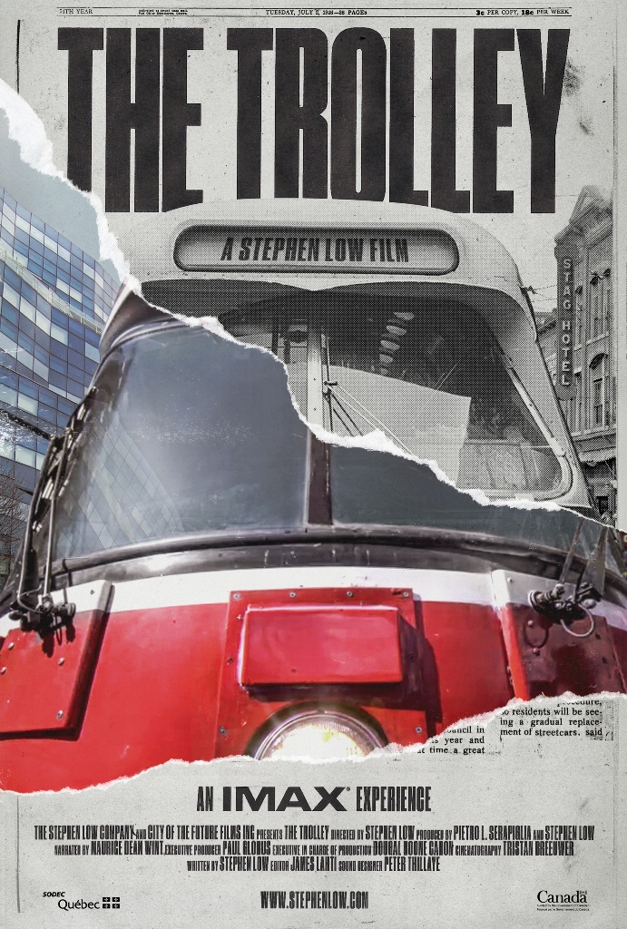
The Trolley, directed by Stephen Low, Canada, 2017.

World Premiere at HotDocs, Cinesphere (Ontario Place), Saturday, May 5, 2018 at 3:00 pm. Free tickets available at the HotDocs Box Office while they last. A possible extended run has not yet been announced.

An IMAX film about streetcars! A railfan’s dream movie! No longer need we catch glimpses of streetcars in exotic locales making ever so brief cameo appearances. Here is a whole documentary about streetcars and how they were, almost, the lost solution to many transit problems.

If only it were that straightforward.

We open on a sad streetcar boneyard, aged cars piled up for scrap and almost certainly beyond recall even by dedicated restorers. They are relics of an era when the streetcar ruled transit systems, when they were the backbone of transit throughout North America and Europe. A time when some cities would even have fake streetcar lines in souvenir postcards showing what modern, up-to-date towns they hoped to be.

This film seeks to be both educational and a piece of transit advocacy showing how streetcars, or Light Rapid Transit as they are now called to disguise their plebeian past, could be the foundation for a transit renaissance. But The Trolley runs aground, so to speak, by jumping around in time and space without pursuing a single thread to its end.

The first problem is that it is Toronto-centric, and a bit out of date at that. There is lots of footage of our older cars, but almost none of the new Flexitys thanks to the age of the filming. I kept waiting for an elegant shot of Spadina or Queens Quay filled with new cars, but instead saw only a few of the prototypes, including one inexplicably in a distinctly non-Toronto colour scheme.

On the historical side, the film touches the expected high points of the rise and fall of streetcars from early electrification, the development of larger cars like the Peter Witts, the apex (at least for North America) of the PCC, and the decline as streetcars faced competition from subways, but far worse from the automobile which served growing suburbs beyond the reach of worn out systems. The change was helped along by the automotive industry, the subject of a Senate investigation back in the 1970s, but the damage had been done decades earlier.

Certainly, subways have been promoted as a way to get streetcars out of the way of motorists, notably in Toronto, but major networks such as in London and New York co-existed with streetcars for decades. The first subway in North America, in Boston, was for streetcars, and it remains in use as part of the “Green Line”.

Streetcars were central to the economies of cities moving people around in vast numbers before autos were widely affordable and especially in wartime when fuel was scarce. But so were subways in the cities that had them, and it is transit as a whole that deserves the credit. Some systems fared worse than others thanks to warfare, a common problem for all infrastructure. In a particularly tasteless voice-over, there is a picture of a Hiroshima car that is described as “paying the ultimate price”. (With luck or good sense, this may have been edited out since the version I saw at an early April press screening.)

As a long-time documentary viewer at cinemas and on television, there are certain basics I expect from this type of film, notably accuracy. One can advocate, but at least get the facts right, keep the timelines straight, and don’t claim causality where it does not exist.

The film’s bouncing time sequence does not help, and we do not trace the streetcar through one arc from birth, through rise, to near disappearance and then renaissance. That, plus the Toronto focus, sets up a fundamental factual error.

The Trolley implies that the streetcar renaissance began in North America and cites the Flexity as a recent example. In fact, Europe never completely lost its streetcars, despite widespread wartime damage and competition from automobiles. Surviving systems there modernized and showed what could be done both with vehicle design and the evolution of surface transit to provide higher capacity on protected rights-of-way without the cost of subways.

Toronto’s first renaissance began in 1972 with the City’s decision, one in which I was deeply involved as a young transit advocate, to keep its streetcars. At the time, the opposition came from still-strong auto-oriented thinking and the unexpected appearance of a new technology touted by Queens Park as the “missing link” between subways and buses. The politicians and the boffins didn’t want to hear about streetcars or LRT or any suggestion that their pet project was, politely speaking, misguided.

Indeed, the CLRV owes its existence to the demise of the provincial high-tech project and the desperate need of the then-government to produce something transit could actually use. A TTC design for new streetcars from the mid 1960s was dusted off and became, much changed, the CLRV.

This episode is completely absent from The Trolley, and yet it shows the depth of official ignorance of what LRT could do.

In fact, Toronto’s newest cars descend from European designs that have evolved over the decades independently of North American systems, and the LRT renaissance in North America owes its existence to off-the-shelf European cars.

An articulated Flexity tram in Marseille, France.

A few systems both in North America and in Europe kept some of their old cars (New Orleans and San Francisco are the best known on our side of the pond), but vintage cars can be found on systems like Lisbon’s and Milan’s. The latter’s Peter Witts date from the 1920s and about 100 (of the original 500) have, with much rebuilding, been kept alive and in regular service. But they are not the only cars in the fleet, contrary to the impression The Trolley might give.

Classic yellow Peter Witt trolleys designed in the 1920s still serve in Milan.

The strongest argument for LRT is the variety of uses this mode can see all the way from complete right-of-way segregation, including underground operation, to mixed traffic like a traditional streetcar. The fight is always over taking road space away from cars, a battle that is more successful in cities where public transit has an established presence.

There certainly was a streetcar renaissance in North America, and Toronto’s 1972 decision started the process which saw new systems in Edmonton and Calgary, as well as San Diego. Other lines followed, although an attitude that “only streetcars mean your city is up-to-date” from a century before led to rather odd decisions about where some new lines were built.

The Trolley ends with footage from the Easter Parade in The Beach a few years back, and plays the event as a celebration of the streetcar rather than the local parade it has always been. This, rather than a view of modern Toronto streetcars, is an odd place to end the story.

Is The Trolley worth seeing? Yes, if only for the glory of views from many cities splashed in high-definition across an IMAX screen. However, as advocacy and education, The Trolley falls short thanks to bad research and a confused story line.

Illustrations courtesy of The Trolley.

Service Capacity on 501 Queen

This article arose from a recent Twitter conversation where I was asked whether the capacity of of 501 Queen route had been reduced because crowding appeared to have increased.

Crowding has many sources including service reliability (even distribution of demand among available vehicles), scheduled frequency (how many vehicles are supposed to arrive per hour), actual service provided and the type of vehicle used.

Past articles have looked at service reliability and running times. The mid-February 2018 schedules brought a formal change to the vehicle type on which the 501 schedules are based. For many years, the capacity alleged was based on the longer ALRV (articulated) streetcars, but the service was actually operated by a mix of the shorter CLRVs and ALRVs. This was due to two factors: the declining reliability of the ALRV fleet, and the desire to increase capacity on 504 King. The new schedule assumes that CLRVs will be the primary vehicle type used, and the number of cars per hour (or conversely the headway or time between cars) has been adjusted to reflect this. However, a review of service over recent years shows that the actual capacity operated on Queen is at best comparable to that of a few years back, and more commonly is lower with some of the decline being fairly recent.

The charts in this article have the same format as capacity charts in my articles about the King Street Pilot, most recently the March 2018 update. Of particular note is that the capacity operated on King has been growing with its transition to the larger Flexity cars, and now regularly peaks above 2,500 per hour, peak hour/direction. The capacity on Queen never reaches 2,000/hour because less service is offered there.

501 Queen service was beset by several disruptions and diversions over the past few years notably a water main and streetscape project west of Spadina in 2016 and 2017, and a series of track construction projects reaching over the entire length of the route from southern Etobicoke to Neville Loop. Another upheaval is planned for 2019 with the reconstruction of the King/Queen/Roncesvalles intersection, entrances to Roncesvalles Carhouse and trackage on The Queensway west to Parkside Drive.

Continue reading

A Few Questions For Metrolinx (II) (Updated)

Updated April 15, 2018 at 6:00 pm: Comments about projected demand at Park Lawn Station have been added at the end of this article.

In a previous article, I reviewed the Metrolinx technical report on the performance of proposed new GO and SmartTrack stations as part of their overall network. At the time, there was some debate about the validity of the report’s analysis.

Metrolinx has now produced a backgrounder to this report which gives greater details about their methodology and results.

This information is interesting not just in its own right as part of GO’s planning, but also in its implications for the City of Toronto’s expectations for GO/SmartTrack service. The service levels listed in the City’s report date from a Metrolinx plan approved by their board in June 2016. The levels shown in the backgrounder are different, and reflect the change to a mix of local and express trains in the GO corridors. The backgrounder takes pains to emphasize that the service plan is not definitive, but the express/local mix of trains is an essential part of GO’s strategy as approved at a recent Board meeting.

The report begins with an introduction common to such documents laying the basic process for “business analysis” of new proposals. This is summarized in the following diagram. The model focuses on a few key factors:

  • The degree to which riders are lost from GO because the addition of stops reduces the competitiveness of GO travel versus driving.
  • The degree to which riders shift to a new station thereby reducing their travel time.
  • The number of new riders who previously drove and are enticed onto transit by the new station.

This scheme underpins recent changes in the planning for services notably through the benefits conferred by a combination of express services (avoided delays from new stations) and level boarding (reduced station dwell times generally). The technical details of “level boarding” have yet to be revealed, but the analysis assumes a benefit through the elimination of the step between platforms and the interior of trains.

The benefits of electrification in reducing overall travel times and allowing for more closely spaced stops are not mentioned at all, and travel time comparisons are based on an electrified service as a starting point. Metrolinx has effectively discarded one of the arguments they used in advocating electrification in the first place.

Continue reading

Who Will Pay For SmartTrack?

Toronto’s Executive Committee will consider a series of reports on the proposed SmartTrack project and related matters at its meeting on Tuesday, April 17, 2018.

These reports set in motion several aspects of the GO/RER/ST program, although the primary focus is the funding the the new SmartTrack stations which is a city responsibility. This article deals with the main report and the first two attachments.

Attachment 3 is a compilation of the information on the proposed new stations that has already been discussed in my previous articles on the public meetings.

Attachment 4 explains the link between SmartTrack and plans for significant changes to the road network in the St. Clair, Keele, Old Weston Road area including widening of St. Clair through the railway underpass and extensions of various roads to fill gaps and provide additional paths for traffic flow. The new station at St. Clair and Old Weston/Keele would be constructed based on the new layout, and work on these projects will be co-ordinated.

Attachment 5 was prepared by Metrolinx. It sets out the status of the many changes to various rail corridors that are within the City of Toronto.

Attachment 6 illustrates the planned new south platforms and concourse at Union Station, an expansion project separate from the renovation of the existing station now underway. Of note in the design is the replacement of four tracks by two making room for a pair of much wider platforms than in the older part of the station. From a service design point of view, these tracks and platforms will likely be the new home for the Lakeshore services as this will allow them to operate along the south side of the rail corridors free of interference with traffic from the more northerly corridors like Milton/Kitchener/Barrie to the west and Richmond Hill/Stouffville to the east.

(Metrolinx has already talked about the need to consolidate trackage and platforms in the old part of the station to improve capacity both for train service and for passengers, but that is beyond the scope of the city reports.)

The current report deals only with the SmartTrack stations. Specifically it does not address:

  • The Eglinton West LRT which, having replaced a part of the original SmartTrack scheme, is still bound up with ST as part of the total budget number for this project.
  • Operating and maintenance costs for GO/ST service.
  • The cost to the city of “fare integration” or even exactly what this will mean.

A further problem, as I discussed in a recent article, is that recent changes in the Metrolinx/GO service design for various corridors has changed the mix of local and express trains on which the SmartTrack scheme rests. Metrolinx has still not explained how they will operate the number of trains the city report claims will stop at all of the “local” SmartTrack stations, and they are quite testy on the matter when pressed. For its part, the city assumes a service level (and hence attractiveness of service) greater than what Metrolinx has, so far, committed to operating.

The works that are included in the report are:

  • Six new GO/SmartTrack stations at Finch, Lawrence East, Gerrard/Carlaw, East Harbour, Liberty Village and St. Clair/Old Weston.
  • Additional city requirements for station facilities that are not strictly required for operation of the transit service.

Continue reading

King Street Update: March 2018 Data (Part II)

The King Street Pilot project is well regarded for the improvement in travel times it brought to transit riders, and for the large jump in ridership on the route. In past articles, I have reviewed the statistics for travel times, but another important aspect is the reliability of headways – the intervals between streetcars. Early results showed a distinct improvement, but this has not been sustained. Moreover, headway reliability outside of the pilot area remains quite erratic, especially near the terminals.

This brings us to the TTC’s assertion that if only the service would depart on time from the ends of its many routes, the problem of irregular service in the middle would look after itself. This is a completely bogus claim on two counts. First off, erratic service at terminals is the norm, and regularly spaced departures usually depend on hands-on service management by supervisors on the street. Second, service has a fair latitude to be considered “on time”, and even with this leeway, gaps and bunches quickly form that exceed TTC targets.

In theory, if travel times are more consistent thanks to the pilot (or any other transit-supportive changes), then it should be easier to keep service properly spaced. Reality is somewhat different from theory.

This article examines headway behaviour at Yonge Street for the 504 King car, as well as the combined service of the King and 514 Cherry cars. Although these are thought of as “blended” services, like all branching TTC routes, there is no co-ordination between the two routes and the Cherry cars fill gaps in the King service by accident, not by design. Beyond the limits of the Cherry cars (Sumach in the east, Dufferin in the west), the King service is as erratic after the pilot’s introduction as it was before.

Also included is a review of 514 Cherry service on the outer ends of the route. Only recently has the service to Distillery and Dufferin Loops become more reliable and the improvement has more to do with revised schedules than with the King Street Pilot.

Continue reading