May 11, 2021, brought a shower of money, or at least promises of money, onto plans for rapid transit in Toronto. The federal government announced a total of $10.7 billion to fund a 40 per cent share in the Ontario, Scarborough, Yonge North and Eglinton West projects.
May 12 brought another, albeit smaller, promise of $180 million each from the federal and provincial governments to fund expansion of the streetcar fleet on which Toronto already planned to spend $208 million.
On May 13, a funding announcement for the Hamilton LRT line is expected. This is a project the province had tried to kill.
Combined with their recently announced national transit funding program, the federal Liberals are making a real splash in the transit pond, at least for big-ticket capital projects.
Before we all head out for a socially distanced beer or champagne celebration, there are important caveats.
Why 40 Per Cent Isn’t Necessarily 40 Per Cent
When the federal government agrees to fund a project, the dollar value is (or more accurately will be) “as spent” dollars without any provision for inflation. If Queen’s Park says that the Ontario Line is going to cost $10.9 billion, that’s what the 40 per cent is calculated on. Add-ons or inflation will be entirely on Ontario’s dime, unless a future federal government takes pity.
The last time a subway project ran out of money due to a hard cap on the “commitment” was with the Sheppard Subway’s terminus at Don Mills. Ironically, it was a conservative provincial Premier, Mike Harris, who capped spending on that project, and Toronto did not have enough money to continue east to Victoria Park, much less beyond to Scarborough Town Centre.
Cost overruns on the Vaughan subway extension were shared by Toronto and York Region.
The announced costs for the four Ontario key projects in Toronto are:
- Ontario Line: $10.9 billion
- Yonge North: $5.6 billion
- Scarborough: $5.5 billion
- Eglinton West: $4.7 billion
- Total: $26.8 billion
“The federal government is contributing 40% of each project, up to a total of $10.4 billion” according to Infrastructure Canada’s announcement. This could give leeway for allocations to move between projects, but sets a total on the group.
This puts all four projects in a box, and will make adding costs to them very difficult because there will be no matching federal dollars. The dubious nature of the spending, notably on the Eglinton West underground alignment, appears to be of little concern to the feds who do not want to be seen as interfering in local decisions.
That stance takes an odd turn when we see that there are conditions on this support, although I suspect that many are window dressing.
The federal government understands that every taxpayer dollar invested in public transit must have multiple benefits including creating good jobs, building more equitable and inclusive communities, and tackling climate change. That is why the federal government’s funding is dependent on satisfying conditions including demonstrating how the investments will drive down emissions and build resilience, substantive environmental reviews, ensuring affordable housing along the line, incorporating accessibility, mitigating local concerns, maximizing benefits for communities including through Community Benefit Agreements, and meeting employment thresholds for underrepresented communities including Black, Indigenous and people of colour, and women.
Just what is meant by “substantive environmental reviews” and “mitigating local concerns” is anyone’s guess especially in light of Canada’s rejection [22 MB PDF] of a requested environmental review of the Ontario Line. In brief, the feds hold that there are provincial and municipal processes in place to address concerns, and moreover that there are few areas of federal jurisdiction touched by the Ontario Line.
Metrolinx projects already provide accessibility and include Community Benefit Agreements. These “requirements” simply reinforce what they are already doing.
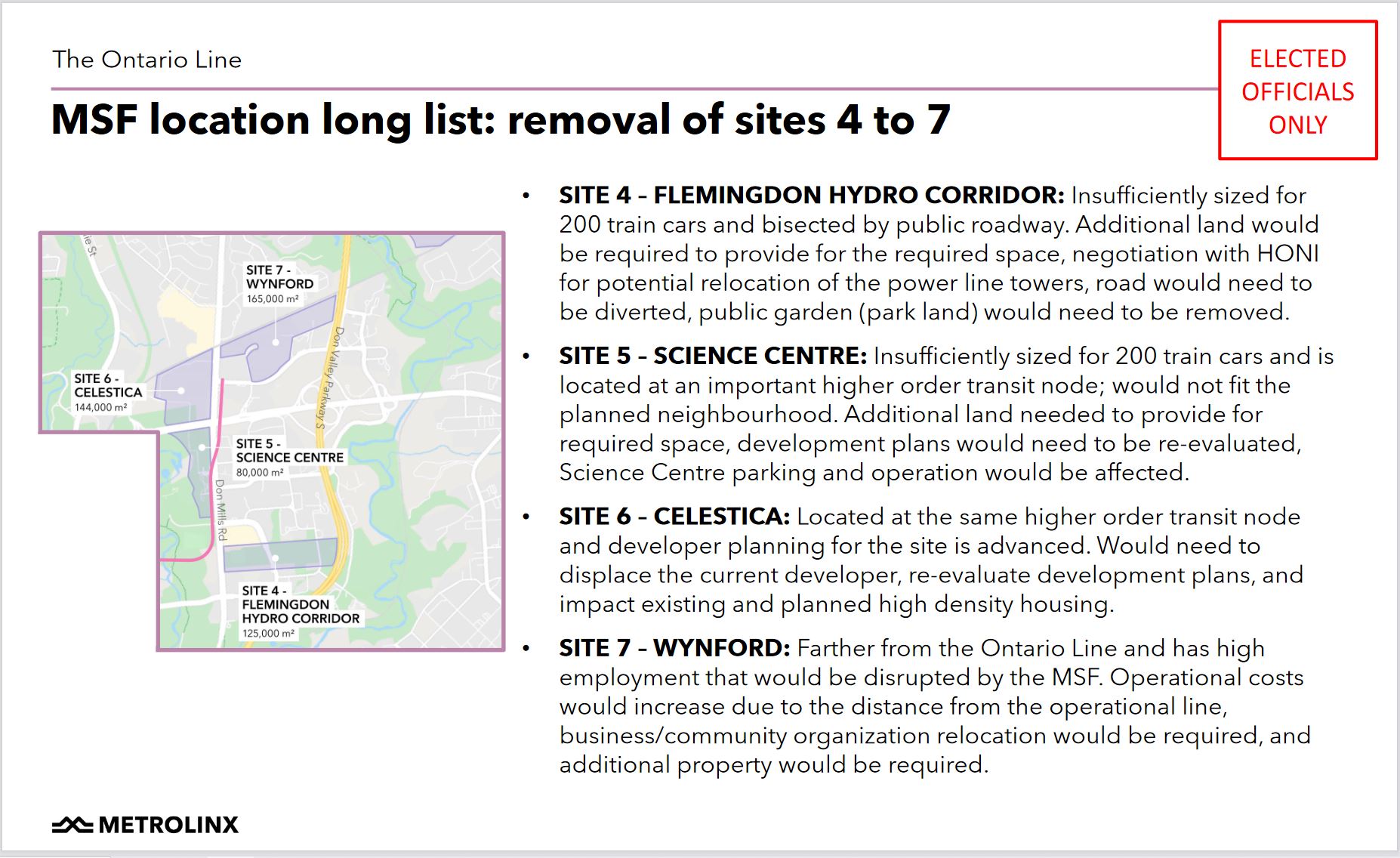
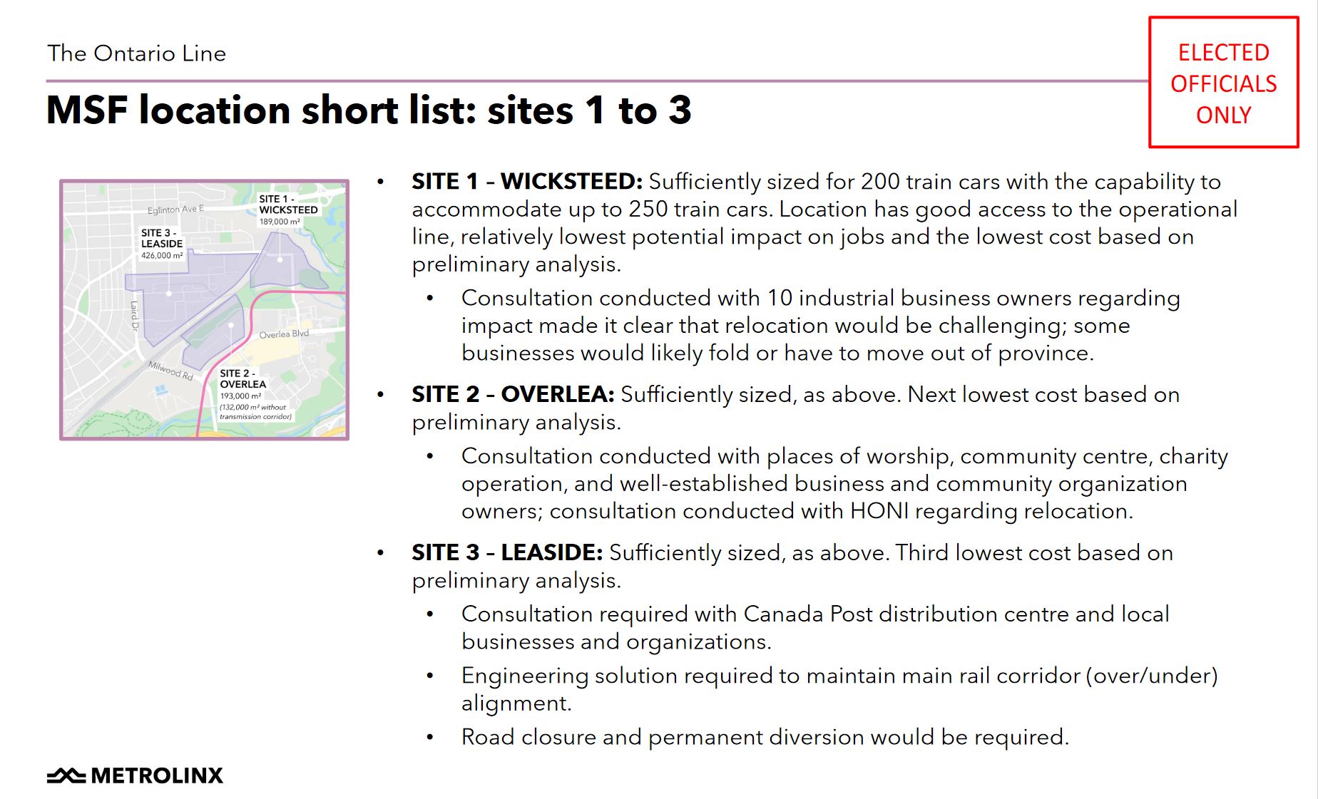
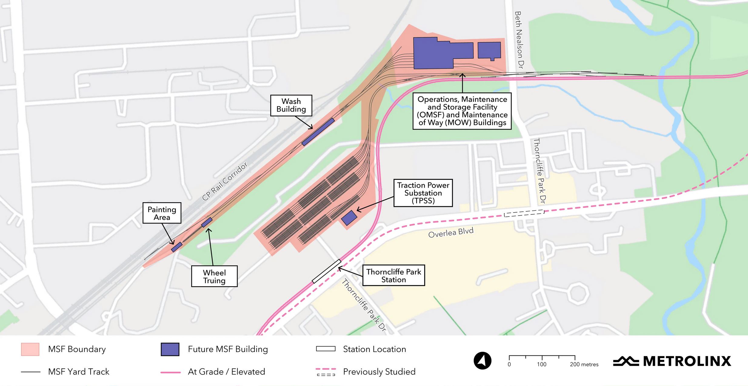
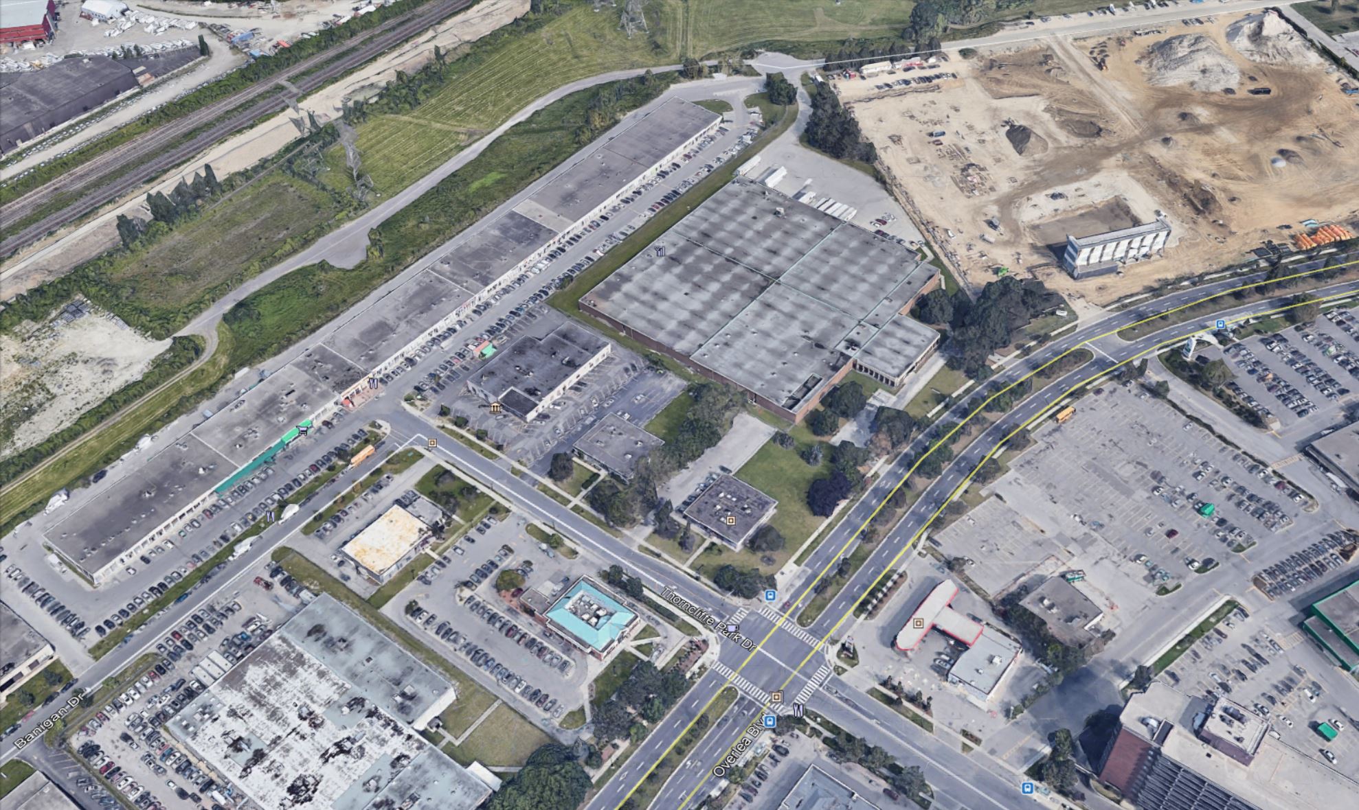
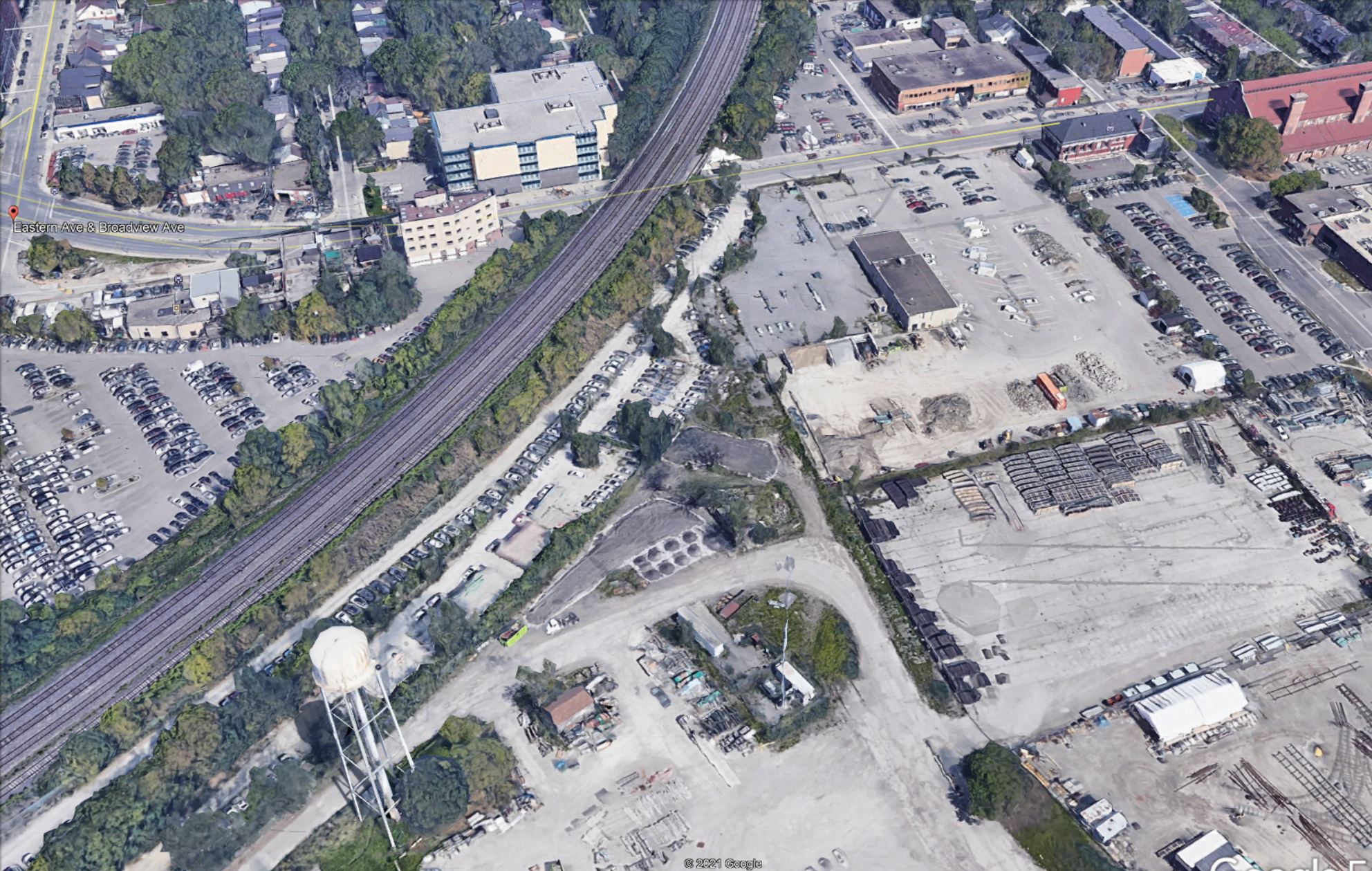
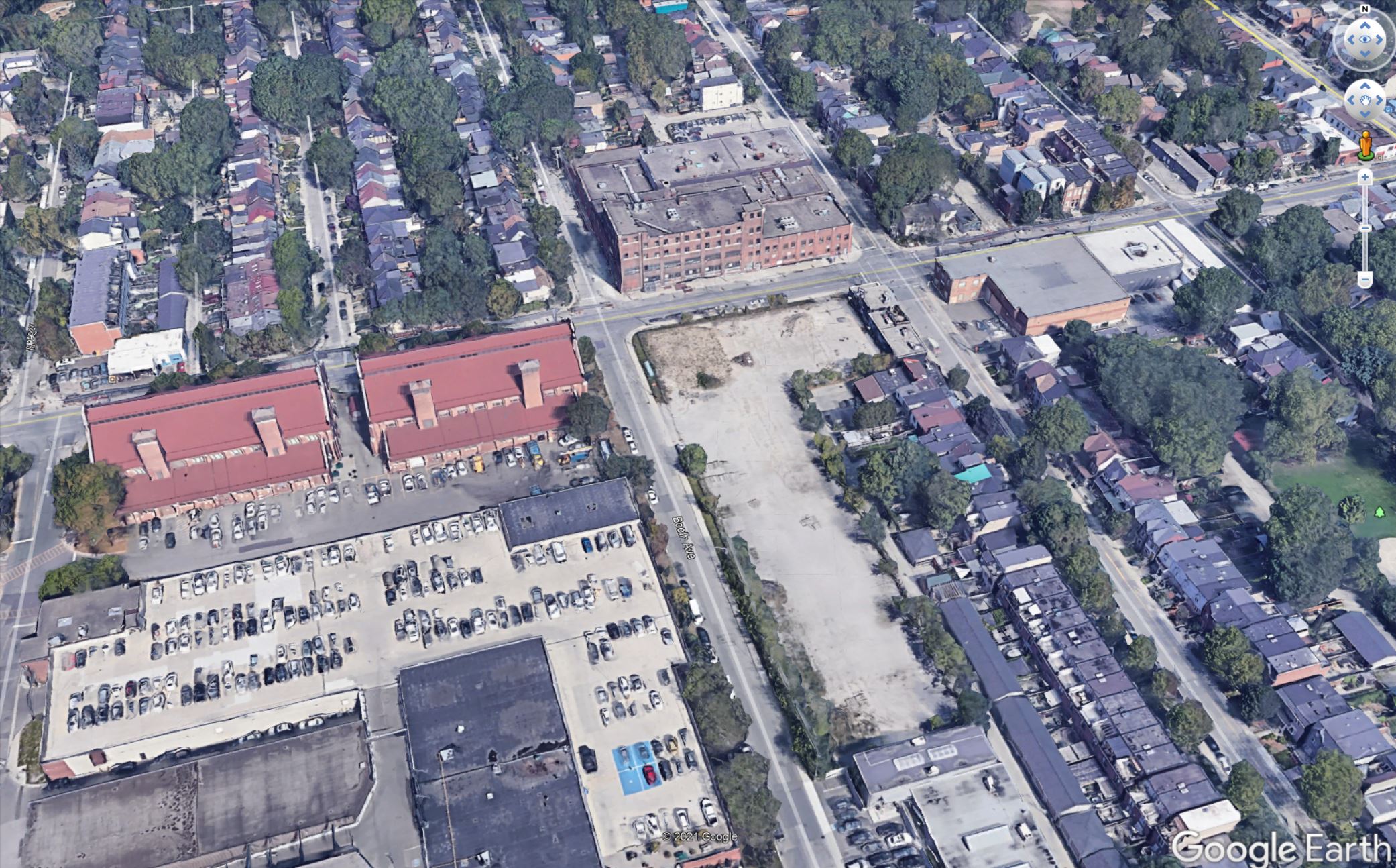
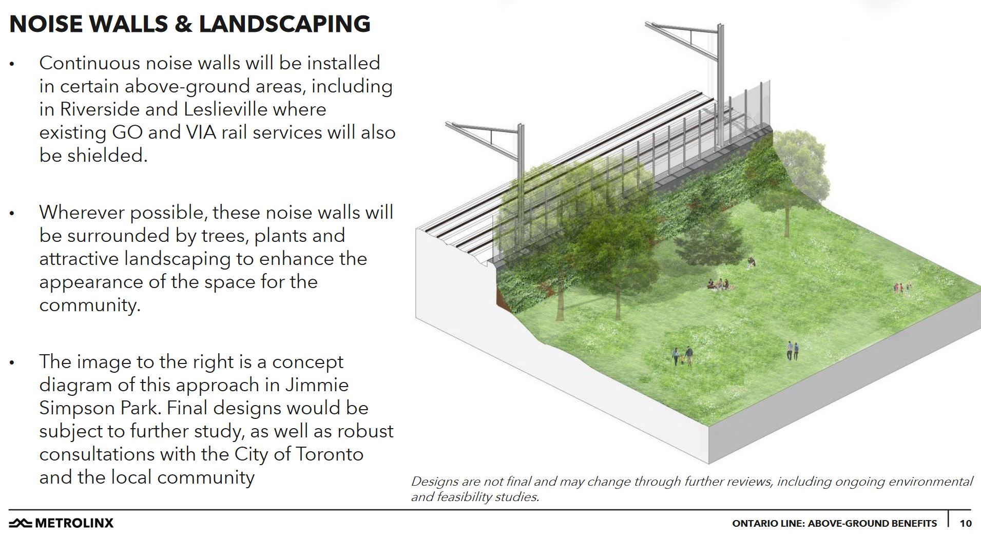
The Ontario Line is under fire in at least two locations, Riverside and Thorncliffe Park, because of intrusions on the community. In Riverside, the debate is over underground vs at grade construction, as well as the proposed alignment, and Metrolinx’ possible misrepresentation of the combined GO Transit and Ontario Line corridor from the Don River to Gerrard. In Thorncliffe Park, the proposed maintenance yard requires the expropriation of a group of offices and shops that form a community centre. A Mosque is also affected, although it plans to move to another building nearby.
Changing the design in either of these areas will almost certainly raise costs, and the project cap will be used to counter any such proposals. Oddly enough, this was not an issue on Eglinton West which is going undergound at a cost of nearly $2 billion so that the good people of Etobicoke do not have to see streetcars in their neighbourhood. That decision is now baked into the project cost, and Metrolinx is on the verge of awarding the tunneling contract.
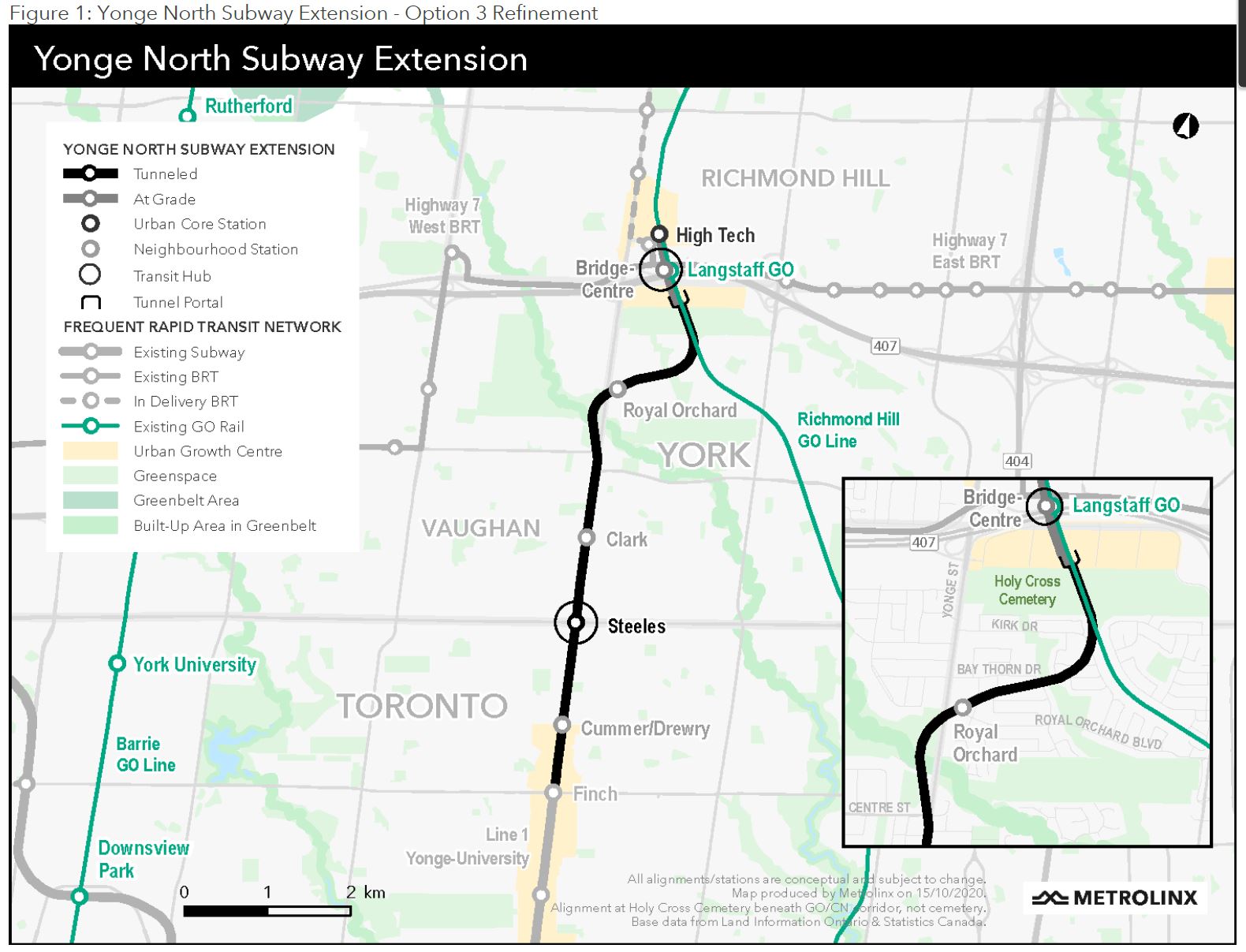
The planned alignment of the Yonge North extension under the Royal Orchard neighbourhood is also under fire, although Metrolinx claims that the line will be so deep it will have no effect on the residential community above. That is an intriguing claim given that the tunnel portal is in the GO rail corridor and the trains will not leap instantly from deep underground to the surface.
The Scarborough decision has long been a fait accompli, but the current announcement commits the feds to a 40 per cent share of the expanded project.
More Streetcars for Toronto
In 2020, the TTC proposed that the streetcar fleet be expanded by 60 cars, and the City signed on to fund 13 of these. The remaining 47 are now funded by contributions from the other governments, a move that will keep Thunder Bay happy with a vehicle order to keep the now-Alstom (formerly Bombardier) plant going. Some work will also go to the Alstom plant in La Pocatière, Québec.
The subway extensions will also need new cars, but unlike the streetcar fleet, there is no open contract to simply be extended. It will be interesting to see how additional cars for Line 1 and a new fleet for Line 2 will be tendered, and what political machinations will bear on the vendor selection.
The expanded streetcar fleet will not all fit in existing facilities at Leslie, Russell and Roncesvalles. The TTC plans to renovate Harvey shops at Hillcrest as a small carhouse serving (at least) the 512 St. Clair route. The existing streetcar maintenance facilities at Hillcrest were designed in the 1920s for standard sized streetcars and could only host a few Flexitys at a time during the early testing and acceptance period.
Now that the full order for more cars has funding, the Hillcrest renovations can proceed.
Left at the Altar
Important projects which might benefit from federal funding are still sitting in limbo including:
- Eglinton East LRT to UTSC and Malvern
- Waterfront East LRT to Broadview
- Line 2 Bloor-Danforth Automatic Train Control and fleet renewal
- New Line 2 maintenance facility west of Kipling Station (Obico yard property)
There is a separate federal program to fund transit, but that is already partly earmarked for electrification of the bus fleet and garage upgrades. How much will be left for other projects remains to be seen.
With all of this new money for Toronto transit, the TTC needs to update its Capital Plan to reflect the current status of project funding and the remaining budget shortfall. We might have billions worth of promises, and even a few celebratory bottles to drink, but there is a long way to go thanks to decades of deferred investment.