
This article compares travel times for the 512 St. Clair streetcar for June 2026 and June 2019. It is part of a series setting out the changes in operating speed of streetcar routes since the introduction of the new Flexity streetcars in the past decade.
Three sets of charts here show the operational behaviour of the route from different points of view:
- Comparisons of travel speeds over segments of the line show broadly how, when and where travel speeds have changed.
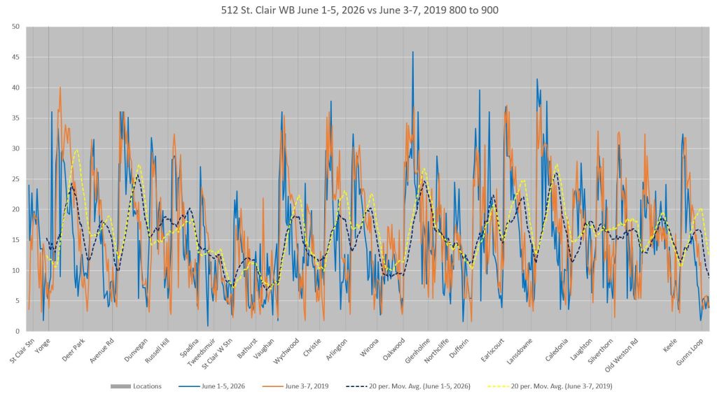
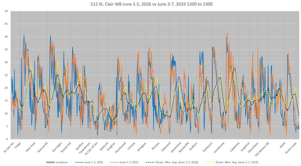
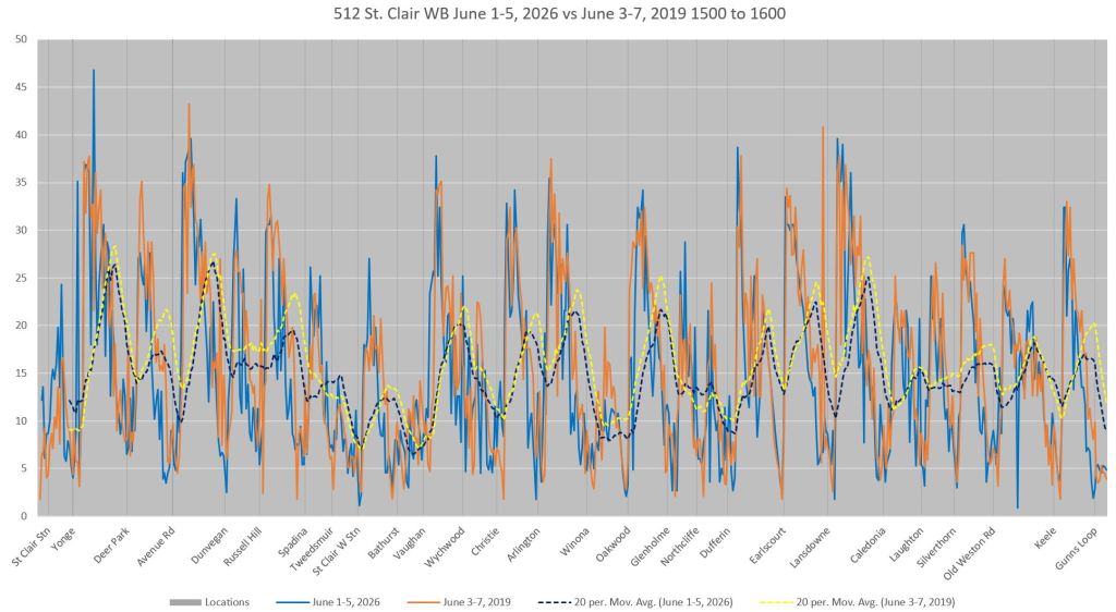
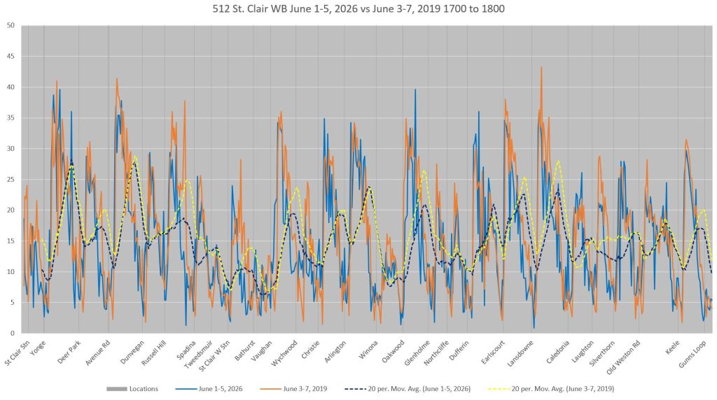
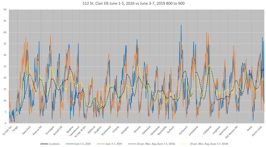
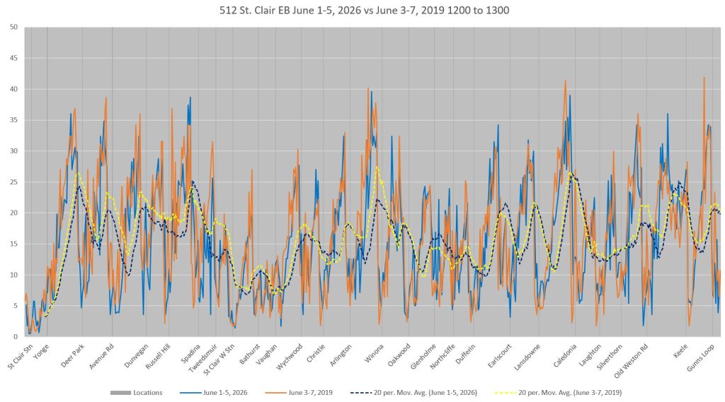
- A fine-grained speed profile of the line compares 2019 and 2026 data showing specific locations of changes, and in particular that speed differences lie across the route.
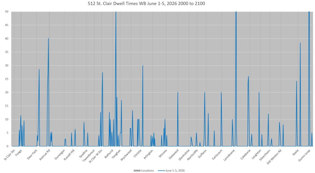
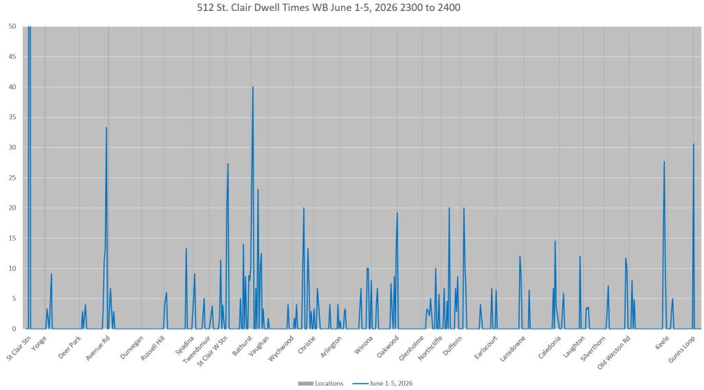
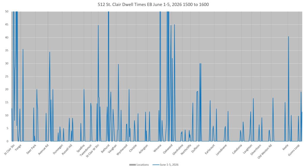
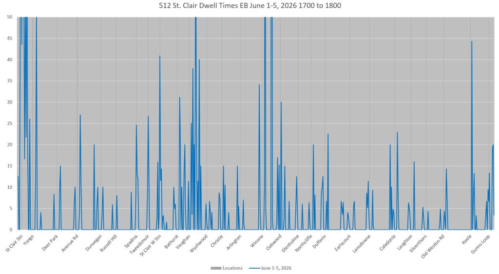
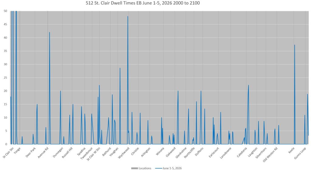
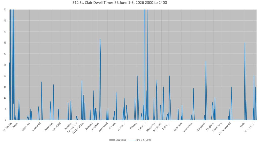
- Charts of dwell times show locations and times where streetcars are held for passenger service and traffic signals. Congestion generally does not play a role because almost all of the route is on reserved lanes.
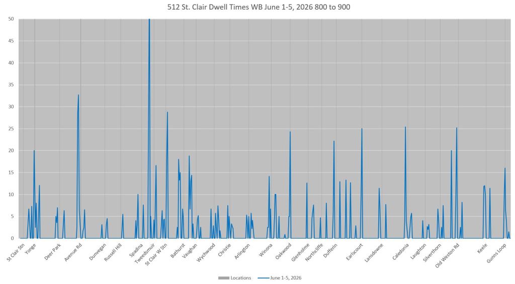
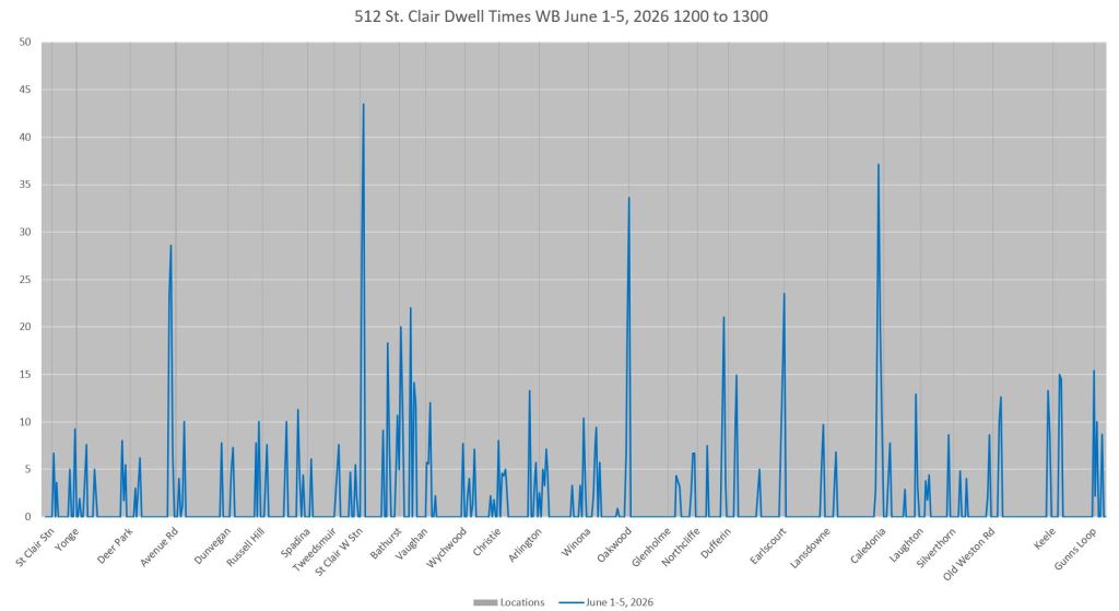
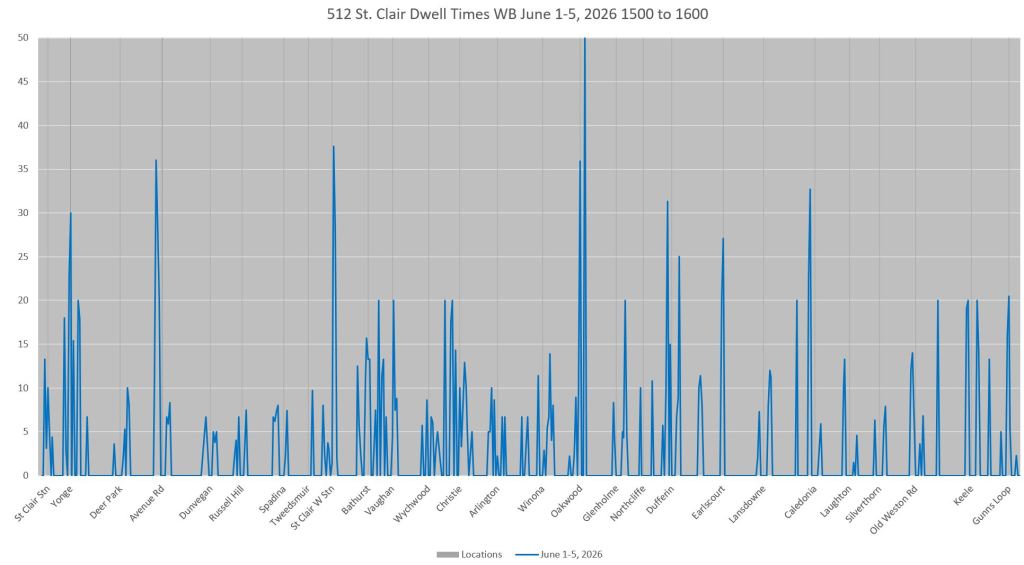
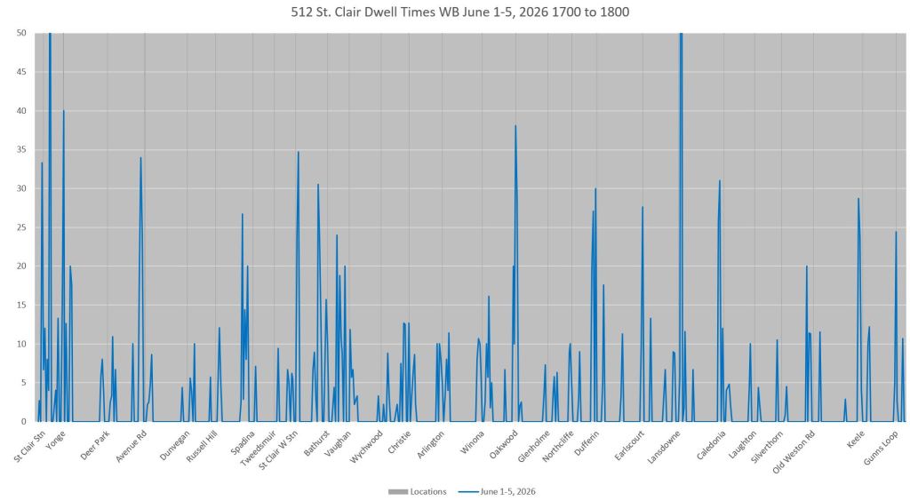
“Double stops” at traffic signals before farside loading islands remain a problem with streetcars not always getting a clear run through intersections. This is often discussed in transit and social media circles, but more work is needed to get true transit priority for streetcars on 512 St. Clair.
St. Clair also has very high terminal recovery times compared to travel time along the route. It is not clear that this time is needed, or if it is a relic of an era when TTC made service run “on time” by padding schedules so that it would never be late.
Service Designs
Note that although St. Clair is part of the six minute network, the service in 2026 is still less frequent than in 2019 by, in some cases, a factor of one third. Travel times are roughly the same today, but some recovery times have increased. It is hard to believe that a relatively short route on private lanes requires recovery time 15-20% of the travel time.
June 2026:

June 2019:

Methodology
For a description of the methodology behind these charts, please refer to the Overview.
Comparative Travel Speed by Route Segment
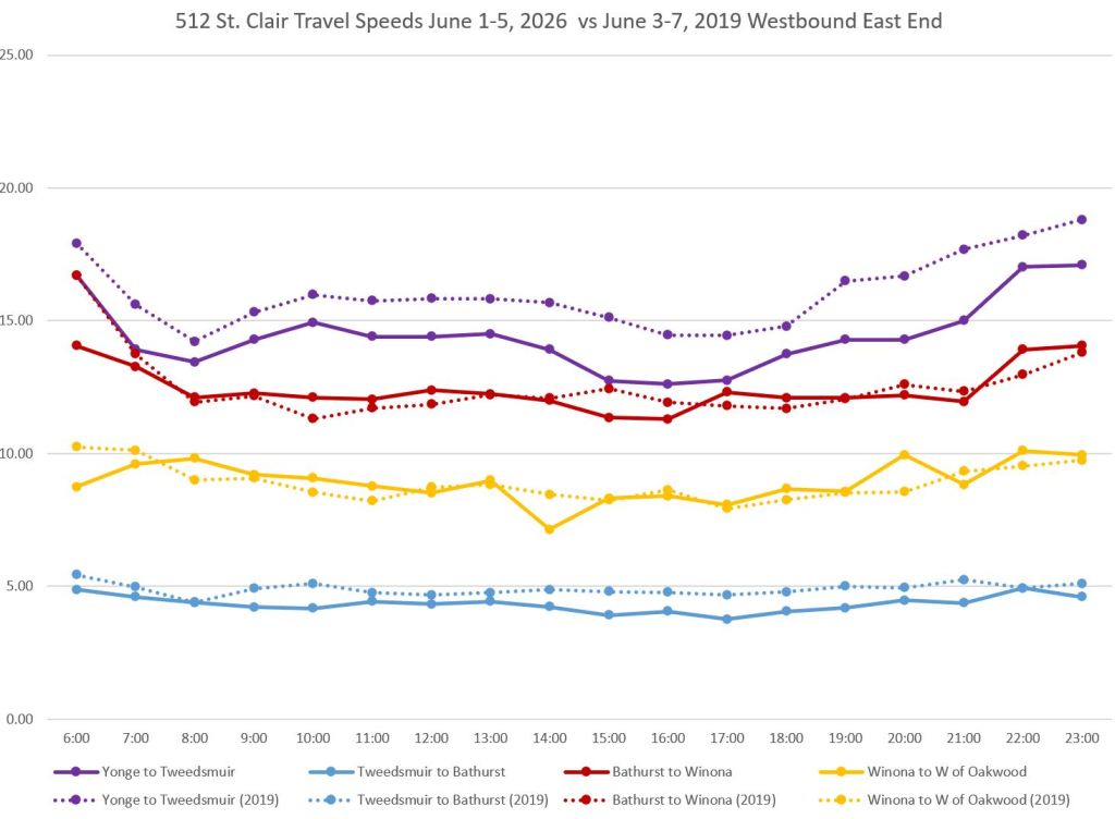
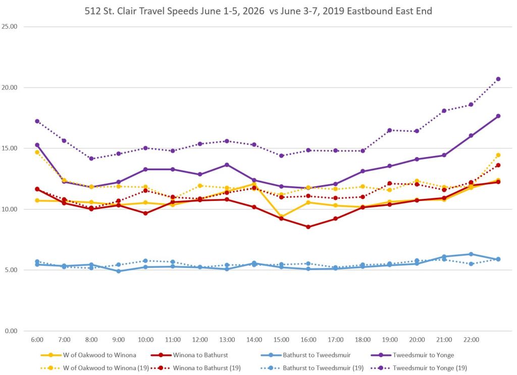
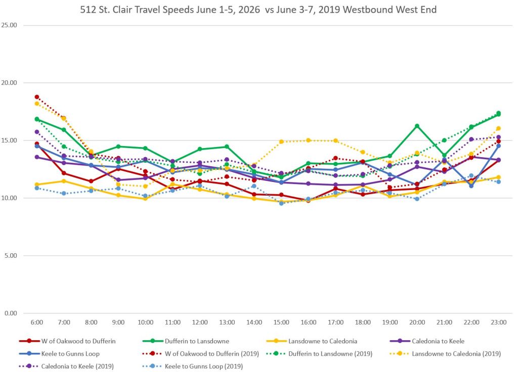
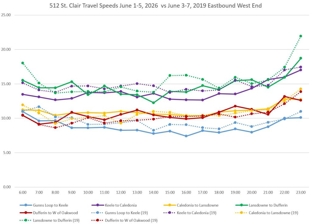
The charts below show travel speeds over sections of the 512 St. Clair route for weekdays in the first week of June 2026 and 2019. Solid lines show the 2026 data, while dotted lines show 2019. In some cases, notably between Tweedsmuir (just east side of St. Clair West Station) and Yonge Street, the 2019 speeds over the day are higher (purple, upper charts). Other segments show smaller differences, and in some cases 2026 matches or beats the 2019 numbers.
Note that the very slow segment from Bathurst to Tweedsmuir (blue, upper charts) includes St. Clair West Station.
Detailed Speed Profiles
Westbound
Slow areas westbound include:
- Through St. Clair West Station and west to Vaughan Road.
- Approaching Oakwood. This area includes slow operation over special work at Robina, east of Oakwood, the eastern leg of Oakwood Loop. The carstop at Oakwood is nearside.
- Approaching Dufferin. There is some debate about how much time would be saved by eliminating the stop at Northcliffe, but whether this will happen is uncertain.
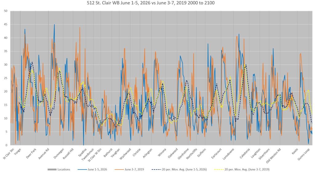
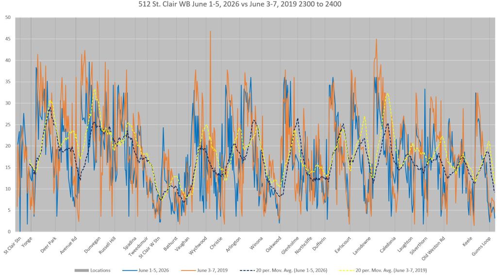
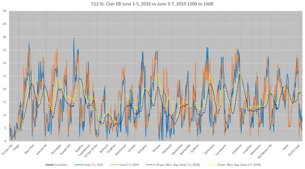
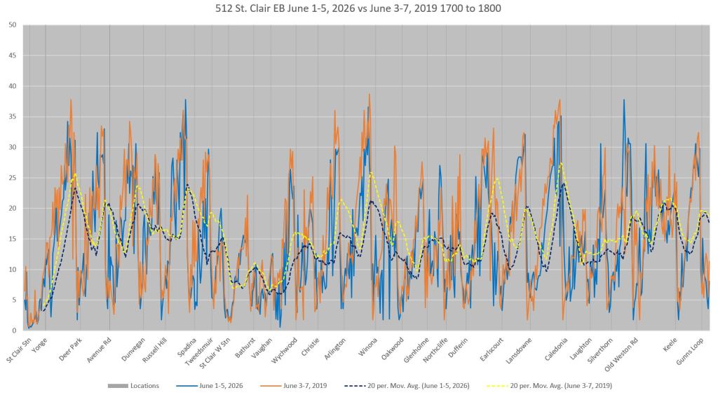
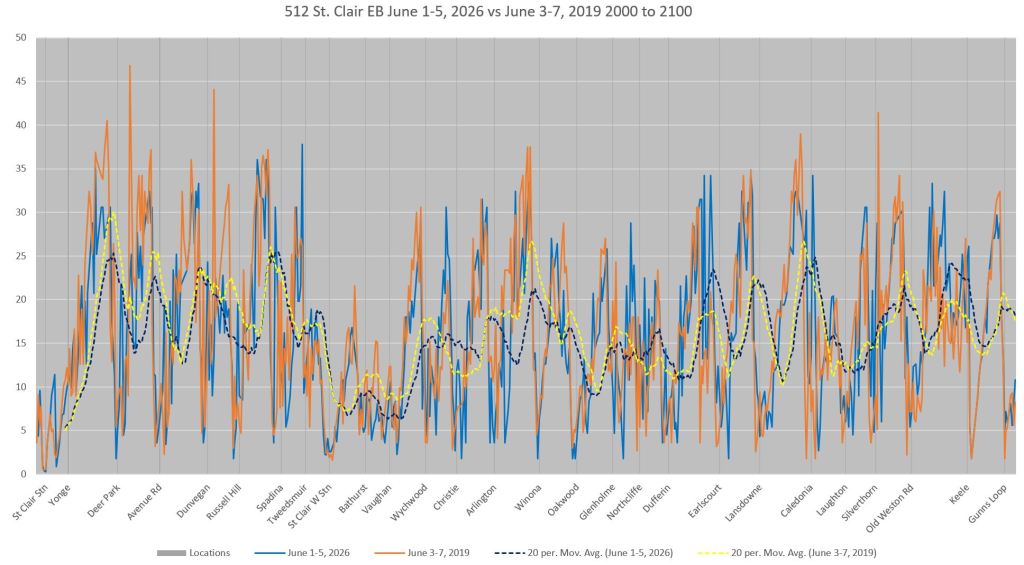
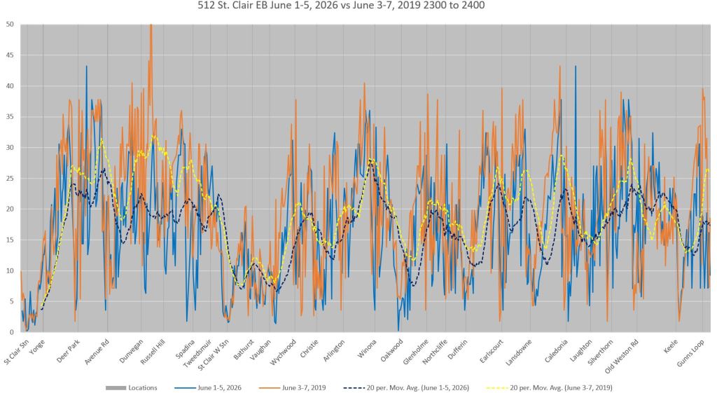
Eastbound
(These charts should be read right-to-left.)
Eastbound service has slow patches similar to westbound at Dufferin, Oakwood and the section from Vaughan eastward through St. Clair Station.
Dwell Times
The dwell time charts show locations where streetcars are stopped more than briefly. At many intersections they highlight the “double stop” problem with dwells both before, to await a green signal, and after, to serve a stop. In several cases, the nearside stop to await a green signal is longer than the farside stop to serve passengers, notably at Avenue Road both ways.
These delays are seen even in late evening data.
In a previous review of 512 St. Clair, the TTC claimed that many problems with transit priority and detection of streetcars had been fixed during the last major shutdown for construction. While the detectors might be working, it is clear that some traffic signals are not programmed to favour the streetcars.
At many locations, there is evidence of queuing before stops even though this line operates in its own lanes. This pattern is commonly seen on mixed traffic routes, but here it suggests bunched service except for the few stops shared with overlapping bus routes near St. Clair West Station.
Westbound
Eastbound
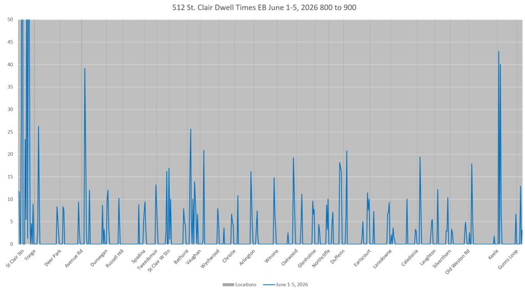
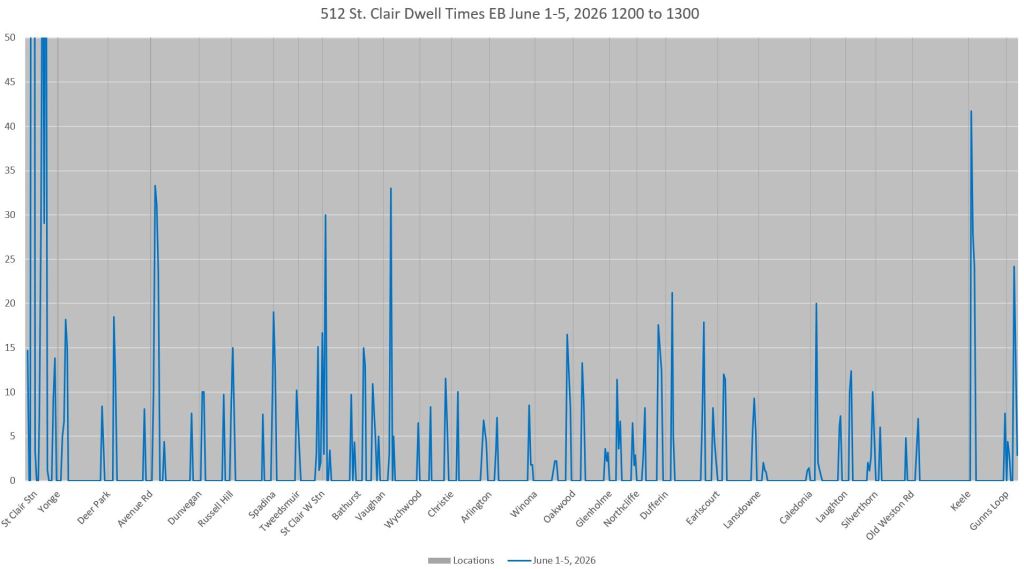


The disrupted segment from Vaughan Road to St Clair West Station has a whole mess of multiple bus and streetcar routes, intersecting tracks at two streets to crawl over, and busy intersections with advanced greens. BUT it also is a place where the operators “play games” with the schedule. I think operators love to be ahead of schedule because they can get ahead of the arrival of customers to make their life easier by having fewer humans do deal with. If so, they need to disguise their early arrival at the station. So it is, in that segment they slow down to a creep to intentionally catch red-lights. Been there; seen that many times.
LikeLike