Joint Metrolinx, City and TTC Consultation on Transit Studies (Updated June 21, 2015)

Updated June 21, 2015 at 12:45 am: SmartTrack alignment option 1C which was included in the presentation deck, but not in the individual illustrations on the project website, has been added to the consolidated set.

Updated June 12, 2015 at 6:30 am: Details of SmartTrack and Relief Line alignment options added.

The City of Toronto, Metrolinx and the TTC will conduct a series of eight meetings at locations around Toronto over coming weeks to present current information on studies now in progress regarding GO’s Regional Express Rail (RER) plan, SmartTrack, the Scarborough Subway Extension (SSE) and the Relief Line (aka “DRL”). Some of these meetings will focus on specific projects (noted below), while others are general overviews.

  • Sat. June 13 9:30am: Burnhamthorpe Collegiate Institute, 500 The East Mall
  • Mon. June 15 6:30 pm: Estonian House, 958 Broadview Avenue (Relief Line)
  • Wed. June 17 6:30 pm: Spring Garden Church, 112 Spring Garden Avenue
  • Thurs. June 18 6:30 pm: Archbishop Romero Catholic SS, 99 Humber Boulevard South (SmartTrack)
  • Sat. June 20 9:30 am: Hyatt Regency Hotel, 370 King Street West
  • Mon. June 22 6:30 pm: Winston Churchill Collegiate Institute, 2239 Lawrence Avenue East
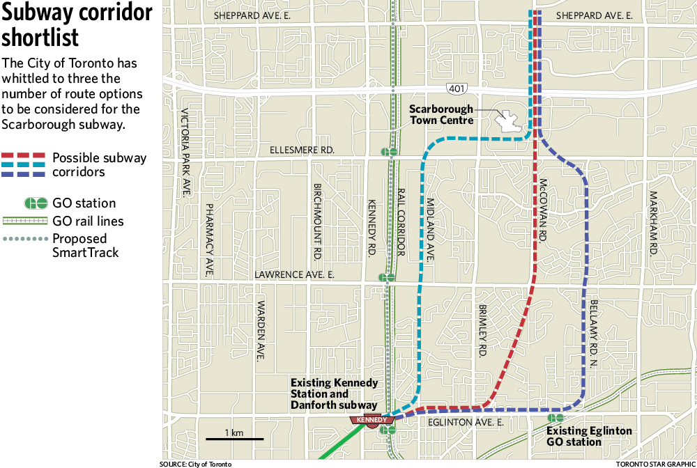
  • Wed. June 24 6:30 pm: Scarborough Civic Centre, 150 Borough Drive (SSE)
  • Thurs. June 25 6:30pm: Riverdale Collegiate Institute, 1094 Gerrard Street East (Relief Line)

Consultation in Mississauga, Peel, Markham and York Region will occur in September according to the City’s press release.

Recommendations will be presented by TTC and City staff to the TTC Board and Council in Fall 2015 on SmartTrack, the SSE and the Relief Line.

Update June 12:

SmartTrack

The presentation boards and alignment options for the western leg of SmartTrack are now available online. For convenience, I have collected the illustrations in one file [PDF 2MB].

Broadly the study is considering three alignment groups for the link between Mount Dennis and the Mississauga Airport Corporate Centre:

  • A direct connection via Eglinton from the Kitchener rail corridor
  • A separate heavy rail corridor via Eglinton from Mount Dennis
  • A direct connection south from the Kitchener rail corridor through the airport

The “base case” for the study is the already-approved second phase of the Crosstown LRT.

The options include:

  • 1: Direct links with the SmartTrack alignment:
    • 1A: Swinging east of the KW rail corridor south of Eglinton, and then turning west to make a direct connection with the Crosstown line.
    • 1B: Turning west from the KW rail corridor south of Eglinton. This is the original SmartTrack proposal.
    • 1C: Continuing north of Eglinton, and then veering back south through a vaguely defined area west of Weston Road [illustration added June 21]
  • 3A: A separate line west from Mount Dennis.
  • 2: Links north via the rail corridor and then south into the airport lands:
    • 2A: To a point beyond the UPX airport spur, then south through the airport. The “Airport” station would be a connection to the UPX at Airport Road.
    • 2B: The same alignment as 2A at the north end, but following Dixon Road and Carlingview south to 427/401.
    • 2C: To a point east of the UPX spur with a station at the east side of the airport, then south via Carlingview as in 2B.

Some alignments require tight turns and tunneling will be needed for all of them contrary to the original claims that SmartTrack would be a “surface subway”. This will also force the issue of electrification without which a tunnel alignment is impossible, but Metrolinx plans now claim that the first electric operations will not begin until 2023.

The option 2 alignments will face technical challenges including curve radii depending on the exact details of the alignment and the equipment chosen for the route.

Headways for all option 1 and 2 alignments will be constrained by the need to share trackage with the UPX operation.

Relief Line

Four corridor options are under consideration. At its northern end, the corridor would start at either Broadview or Pape Station, and through the core area, the line would follow either Queen or King/Wellington. I have collected the four maps together in one file for convenience.

Detailed discussions of the pros and cons of these options are on the respective pages of the project site. The Pape alignment has clear advantages over Broadview, and a Wellington alignment through the core has advantages over King or Queen.

The Gardiner, SmartTrack and the Scarborough Subway

Three major projects face approvals at Toronto Council and Queen’s Park in coming months.

  • Should we replace the Gardiner Expressway with an at-grade boulevard between Jarvis and the Don River?
  • Should “SmartTrack”, John Tory’s signature campaign plank, form a U-shaped line from Markham to Pearson Airport providing both regional and local service in parallel with GO Transit?
  • Should the Bloor-Danforth subway be extended through Scarborough in place of the once-proposed LRT network, via which route and at what cost?

None of these is a simple problem, and they are linked by a combination of forces: polarized political views of what Toronto’s future transportation network should look like, very substantial present and future capital and operating costs, and competing claims of transportation planning models regarding the behaviour of a new network.

On the political front, Mayor Tory is playing for a trifecta against considerable odds. Winning on all three would cement his influence at Council, but it is far from clear that he will win on any of them. Council is split on the expressway options, SmartTrack has already sprouted an alternative western alignment, and the Scarborough Subway fights for its life with alternative route proposals and the threat of demand canibalized by the Mayor’s own SmartTrack plans.

Continue reading

Scarborough Subway Update: May 27, 2015

Updated May 30, 2015: The staff presentation is now available online. Some illustrations from it have been included in the article below.

At its May 27, 2015, meeting, the TTC Board received a presentation from Rick Thompson, the Chief Project Manager for the Scarborough Subway Extension (SSE). This presentation is not yet online.

During the presentation, Thompson noted that the process of winnowing down nine alternative routes for the SSE was nearly complete, and that a report on the three short-listed options would be issued fairly soon.

The original nine proposals included two major groups. The first would see the north end of the line continue east from STC on alignments similar to the proposed Scarborough LRT crossing Sheppard at either Markham Road or Progress. Three routes were proposed to reach the existing SRT corridor:

  • Via the SRT as currently constructed.
  • Via Eglinton and Midland, then swinging back into the SRT right-of-way north of Eglinton (this would avoid reconstruction of Kennedy Station on a north-south alignment).
  • Via Eglinton and Midland, joining into the SRT alignment near the existing Midland Station.

The second group takes a north-south alignment through or past STC and all arrive at Sheppard and McCowan as their terminus:

  • A Midland/McCowan option would swing into the Gatineau hydro corridor south of Lawrence to link northeast to McCowan and then follow the McCowan route north.
  • A Brimley option would travel east on Eglinton, north on Brimley and then swing northeast through STC to McCowan.
  • A McCowan option would follow Eglinton to Brimley, then swing north via Danforth Road to McCowan. This was the original proposal approved by Council.
  • A Bellamy option would follow Eglinton to Bellamy, turn north, and then swing back to the northwest to reach the McCowan/STC station.
  • A Markham Road option would follow Eglinton to Markham Road (although the exact alignment east of Bellamy is unclear), then turn north and eventually back west to McCowan. This is the most roundabout of the possible routes.

SSEOptions201505

Events overtook the plans, and a report on the shortlisted options that had gone privately to Councillors made its way into the media. The Star’s Jennifer Pagliaro reported that the three remaing options were the original McCowan alignment, the Bellamy alignment and the Midland route running straight north to meet the SRT corridor.

ci-scarborough-subway-routes-shortlist-web

[Toronto Star, from City of Toronto]

Continue reading

TTC 2015-2024 Capital Budget: System Expansion Projects

The TTC’s Capital Budget generates much debate over a few items, but there are many, many projects at the detailed level. Understanding those details puts the debate over transit spending, operations and expansion in a better context. This and following articles will look under the covers of the Capital Budget. I will start with the expansion projects because these have seen so much debate, but will turn to the more mundane parts of the budget that keep the wheels turning.

The projects discussed here include:

  • The Toronto York Spadina Subway Extension (TYSSE) to Vaughan Metropolitan Centre
  • The Scarborough Subway Extension (SSE)
  • Various Waterfront proposals

Neither the Downtown Relief Line (DRL) nor the Yonge extension north to Richmond Hill is included because these are not yet official projects.

Continue reading

TTC 2015 Fleet Plans (Updated)

Updated March 2, 2015 at 9:20 am: This article has been extended with additional illustrations and information from the detailed TTC Capital Budget. The original version was published on January 28, 2015.

Within the TTC’s 2015 Capital Budget, the Fleet Plans give an indication of current thinking on the evolution of TTC service. Now that Toronto appears to have a pro-transit administration at City Hall, the plans are somewhat out of sync with a revived interest beyond “subways, subways, subways”. The details in the plans need review, and this will affect planning in future budgets.

Some policy decisions are evident within the fleet plans, although these have not yet surfaced in public discussions.

Continue reading

A Few Questions About Scarborough

Toronto Council’s agenda for today, February 10, 2015, contains a series of “Administrative Inquiries” by Councillor Josh Matlow regarding various aspects of transit plans for Scarborough. The City Manager’s response appeared late yesterday, but it was not exactly packed with revelations.

In theory, the inquiry process provides a way for questions to flow directly from a Councillor to City staff bypassing the usual mechanism of committee reports where administration majorities might strangle debate. In practice, the information released might or might not fully address the question.

Mayor Tory’s position is quite clear: the subway debate is over, and Matlow’s questions are simply attempts to reopen the question on matters that are already known and decided. Would that it were so simple. Subway champions should pause in their dismissal of Matlow’s position because the report shows how much we don’t know, or at least are not being told, about the subway project.

Continue reading

Where Might The Scarborough Subway Go?

The City of Toronto will hold its first public consultations on the proposed Scarborough Subway Extension (SSE) starting on the coming weekend:

Date: Saturday, January 31, 2015
Time: 10:00 a.m. – 12:00 p.m.
Location: Jean Vanier Catholic
Secondary School, 959 Midland
Avenue, Scarborough

Date: Monday, February 2, 2015
Time: 7:00 p.m. – 9:00 p.m.
Location: Scarborough Civic
Centre, 150 Borough Drive,
Scarborough

The primary function of initial meetings such as these is to make sure that what the staff proposes to do actually meets public expectations. In the old days of traditional Environmental Assessments, this was the most tedious part — establishing the Terms of Reference — in effect a study to define a study. That’s no longer part of the official scheme, but some prep work is required to validate the work plan. For the SSE, this is complicated by the desire to get everything done quickly and in parallel with other related studies.

When the SSE was approved by Council as an alternative to the LRT plan then on the table (and still, officially, the signed deal with Queen’s Park), the subway was the only game in town. Talk of significant improvements to GO Transit service in Markham, let alone frequent “SmartTrack” service at TTC fares in the Stouffville GO corridor, had not yet been added to the conversation.

In some ways, the study now getting underway reflects that isolated view of the project — so typical of much rapid transit planning — in that the focus is on one project. However, a parallel study by Metrolinx, the City and TTC will review a wider range of options including how the presence of GO corridor services might affect demand and travel patterns for the SSE. (See Planning for SmartTrack) Necessarily these studies will interact because the selection of a route and stations for the SSE will interact with plans for other rapid transit services.

Continue reading

Where Is The Centre of Scarborough?

Everyone knows that the Scarborough Subway will run east from Kennedy Station, veer north at Danforth Road, and then go straight up McCowan to Sheppard. Right?

At Toronto’s Executive Committee today (Jan. 22), a major item of discussion was the study plan for SmartTrack. As previously reported, this will include a review of the effect of SmartTrack and the companion Metrolinx RER plans on other projects including the Yonge Relief Study and the Scarborough Subway.

As things turn out, there is now a worry that SmartTrack will draw so much riding from the nearby subway line that it will no longer be viable. Whatever can we do?

The answer, believe it or not, is to extend the study area further east looking for a new home for the subway far enough from SmartTrack that the subway has a chance of surviving on its own. Markham Road, 1.7km further east, could raise the attractiveness of the subway to some parts of Scarborough, but it would also move the line well away from Scarborough Town Centre and development plans for the lands around STC.

With an extra roughly 2km of line to reach Markham Road, the project may never reach across the 401 to Sheppard Avenue unless a very generous angel adds to the City’s share of the project cost.

Does this make sense? Yet another route would be included in the subway study in the hope that it will eke out enough ridership if it lies further east. What does this say about any claims the McCowan route is best because of the areas it serves?

This is what passes for planning in Scarborough, and it shows that the subway advocates are far from certain that their project has lasting, solid support.

CPR Obico Yard: A chance for TTC Expansion?

According to the Globe and Mail, the CPR plans to redevelop surplus lands in many cities. Among the land that is up for grabs is the Obico Yard near Kipling Station in Etobicoke.

Why does the TTC need more yard capacity?

For starters, they have more trains than will fit within existing yards and the problem will only get worse with the construction of any new lines such as the Scarborough extension or the Downtown Relief Line. The yard at Keele Station has been pressed back into service to hold the overflow from Greenwood Yard that was triggered, in turn, by the T1 car fleet at Wilson Yard being pushed out by the new TR fleet.

The Scarborough project includes budget room for a new yard, but exactly where the TTC would put this in Scarborough is a bit of a mystery.

A west end yard on the BD line would allow service to be split between both ends of the line, and it would free up space at Greenwood. The property is already a railway yard, and it sits in the middle of an industrial area.

Toronto talks a lot about preserving industrial lands, but if this property turns into a new subdivision, this will be a major failure by the TTC (or GO Transit) to grab an ideal spot for expanded system capacity.

Planning for SmartTrack

At its meeting of January 22, 2015, Toronto’s Executive Committee will consider a report (SmartTrack Work Plan 2015-2016) recommending a work plan for the study of Mayor Tory’s SmartTrack proposal together with other related transit projects. This is intended to dovetail with Metrolinx’ work on their Regional Express Rail (RER) network, and will have spillover effects on studies of both the Downtown Relief Line (DRL) and the Scarborough Subway Extension.

The most important aspect of this report is that, at long last, a study is reviewing transit options for Toronto on a network basis rather than one line at a time. Factors such as alternative land use schemes, fare structures and service levels will be considered to determine which future scenarios best support investment in transit. Rather than starting with a “solution”, the studies are intended to evaluate alternatives.

If this outlook actually survives, and the studies are not gerrymandered before they can properly evaluate all strategies, then the process will be worthwhile and set the stage for decisions on what might actually be built. The challenge will be to avoid a scenario where every pet project on the map is untouchable rather than making the best of the network as a whole. The term “best” will be open to much debate.

Continue reading