TTC (Re)Announces Ten Minute Network

On June 15, TTC Chair Josh Colle and Deputy CEO Chris Upfold held a press conference at Bathurst Station to announce the “Ten Minute Network”, one more step in restoring transit’s lustre after the Ford/Stintz regime of cutbacks.

The announcement trumpeted the change for more than it actually represents:

The improvements include all four subway lines, 10 streetcar routes and 37 bus routes and will be implemented through the end of 2015 and into 2016.

Of course the subway lines already run at better than a 10 minute headway, as do most streetcar lines most of the time. Colle talked about how people would not be waiting as long for their bus. Technically, that is true, provided that their bus is one that now runs less frequently. Changes are planned for subway services, but they are not included in this package (I suspect we will see those in the 2016 budget proposals).

For convenience, I have consolidated all of the current service levels (May 10, 2015 schedules) for the affected routes into a chart.

TenMinuteNet201506

The routes are colour coded to indicate their current status:

  • Green indicates a route that already has service every 10 minutes or better
  • Red flags a change that was implemented in the May 10, 2015 schedules
  • Blue flags a change that will be implemented in the June 21, 2015 schedules
  • Purple flags a route and time period where the service has not yet been improved to the 10 minute standard

Where times are shown in black, they were already at 10′ or better before May 10, are are not affected by the announcement. A considerable amount of service already operates at better than 10′ headways, or will by June 21.

Of particular note is the inclusion of 501 Queen from Neville to Long Branch in the list. Riders in southern Etobicoke will finally get “frequent” service. Moreover, the TTC plans to revise scheduled running times so that streetcars do not have to short turn as often just to stay on time.

The list of routes includes a note that peak period constraints on fleet size will prevent improvements on 501 Queen, 65 Parliament and 96 Wilson until there are more vehicles. This may be true for peak periods, but nothing prevents the TTC from adding off-peak service immediately.

The schedules going into effect on June 21 will be used through the summer except for the Pan Am Games period in July. Therefore, the next “new” schedules will not appear until September.


Joint Metrolinx, City and TTC Consultation on Transit Studies (Updated June 21, 2015)

Updated June 21, 2015 at 12:45 am: SmartTrack alignment option 1C which was included in the presentation deck, but not in the individual illustrations on the project website, has been added to the consolidated set.

Updated June 12, 2015 at 6:30 am: Details of SmartTrack and Relief Line alignment options added.

The City of Toronto, Metrolinx and the TTC will conduct a series of eight meetings at locations around Toronto over coming weeks to present current information on studies now in progress regarding GO’s Regional Express Rail (RER) plan, SmartTrack, the Scarborough Subway Extension (SSE) and the Relief Line (aka “DRL”). Some of these meetings will focus on specific projects (noted below), while others are general overviews.

  • Sat. June 13 9:30am: Burnhamthorpe Collegiate Institute, 500 The East Mall
  • Mon. June 15 6:30 pm: Estonian House, 958 Broadview Avenue (Relief Line)
  • Wed. June 17 6:30 pm: Spring Garden Church, 112 Spring Garden Avenue
  • Thurs. June 18 6:30 pm: Archbishop Romero Catholic SS, 99 Humber Boulevard South (SmartTrack)
  • Sat. June 20 9:30 am: Hyatt Regency Hotel, 370 King Street West
  • Mon. June 22 6:30 pm: Winston Churchill Collegiate Institute, 2239 Lawrence Avenue East
  • Wed. June 24 6:30 pm: Scarborough Civic Centre, 150 Borough Drive (SSE)
  • Thurs. June 25 6:30pm: Riverdale Collegiate Institute, 1094 Gerrard Street East (Relief Line)

Consultation in Mississauga, Peel, Markham and York Region will occur in September according to the City’s press release.

Recommendations will be presented by TTC and City staff to the TTC Board and Council in Fall 2015 on SmartTrack, the SSE and the Relief Line.

Update June 12:

SmartTrack

The presentation boards and alignment options for the western leg of SmartTrack are now available online. For convenience, I have collected the illustrations in one file [PDF 2MB].

Broadly the study is considering three alignment groups for the link between Mount Dennis and the Mississauga Airport Corporate Centre:

  • A direct connection via Eglinton from the Kitchener rail corridor
  • A separate heavy rail corridor via Eglinton from Mount Dennis
  • A direct connection south from the Kitchener rail corridor through the airport

The “base case” for the study is the already-approved second phase of the Crosstown LRT.

The options include:

  • 1: Direct links with the SmartTrack alignment:
    • 1A: Swinging east of the KW rail corridor south of Eglinton, and then turning west to make a direct connection with the Crosstown line.
    • 1B: Turning west from the KW rail corridor south of Eglinton. This is the original SmartTrack proposal.
    • 1C: Continuing north of Eglinton, and then veering back south through a vaguely defined area west of Weston Road [illustration added June 21]
  • 3A: A separate line west from Mount Dennis.
  • 2: Links north via the rail corridor and then south into the airport lands:
    • 2A: To a point beyond the UPX airport spur, then south through the airport. The “Airport” station would be a connection to the UPX at Airport Road.
    • 2B: The same alignment as 2A at the north end, but following Dixon Road and Carlingview south to 427/401.
    • 2C: To a point east of the UPX spur with a station at the east side of the airport, then south via Carlingview as in 2B.

Some alignments require tight turns and tunneling will be needed for all of them contrary to the original claims that SmartTrack would be a “surface subway”. This will also force the issue of electrification without which a tunnel alignment is impossible, but Metrolinx plans now claim that the first electric operations will not begin until 2023.

The option 2 alignments will face technical challenges including curve radii depending on the exact details of the alignment and the equipment chosen for the route.

Headways for all option 1 and 2 alignments will be constrained by the need to share trackage with the UPX operation.

Relief Line

Four corridor options are under consideration. At its northern end, the corridor would start at either Broadview or Pape Station, and through the core area, the line would follow either Queen or King/Wellington. I have collected the four maps together in one file for convenience.

Detailed discussions of the pros and cons of these options are on the respective pages of the project site. The Pape alignment has clear advantages over Broadview, and a Wellington alignment through the core has advantages over King or Queen.

Toronto To Propose Peak-Hour Extensions on Queen, Dundas, Carlton/College

The City of Toronto will hold three public meetings regarding proposed changes in rush hour traffic restrictions on Queen, Dundas and Carlton/College between Parliament and Roncesvalles.

  • Wed. June 17 at 6:30 pm: Mary McCormick Community Centre, 66 Sheridan Avenue
  • Thurs. June 25 at 6:00 pm: Scadding Court Community Centre, 707 Dundas Street West
  • Mon. June 29 at 6:00 pm: City Hall, Committee Room 2

Work underway by City Transportation Services and the TTC includes:

The project team is currently:

  • Analyzing GPS-based data for the streetcar routes along Dundas Street, College/Carlton Streets, and Queen Street West
  • Looking at how existing peak-hour restrictions function along the routes
  • Finding opportunities to improve streetcar travel times and reliability. For example, where streetcar travel times increase sharply after current restrictions end (e.g. 6pm), the project team is considering extending the peak period by a half-hour or hour on each end to improve the flow of transit, general traffic, and cyclists
  • In a few cases, where no clear benefit is observed from an existing extension, peak hours are being reduced

Additional measures to improve transit operations, in various stages of implementation, include:

  • Re-timing signals to give more green time to the priority direction
  • Active Transit Signal Priority (extended green or shortened red when transit vehicles are detected and meet certain requirements)
  • All-door boarding / Proof of Payment (POP)
  • Greater enforcement of restrictions

[From the “Overview” tab]

Disclosure: I have acted as a consultant to this project in the analysis of TTC vehicle tracking data.

TTC Board Meeting Wrapup: May 27, 2015

The TTC Board met on May 27, 2015 with an unusually rich agenda that took the public session straight through from 1:00 to 7:30pm, except for a break of roughly half an hour to discuss some items in camera. Rather than the relentlessly cheery, swift, but vapid meetings of the ancien régime, this one had some substance.

Reports on the Scarborough Subway, and on the surface route improvements are discussed in separate articles.

This article deals with:

  • TTC Governance
  • TTC and City Joint Transportation Initiatives
  • Draft Financial Statements
  • CEO’s Report

Continue reading

The Gardiner, SmartTrack and the Scarborough Subway

Three major projects face approvals at Toronto Council and Queen’s Park in coming months.

  • Should we replace the Gardiner Expressway with an at-grade boulevard between Jarvis and the Don River?
  • Should “SmartTrack”, John Tory’s signature campaign plank, form a U-shaped line from Markham to Pearson Airport providing both regional and local service in parallel with GO Transit?
  • Should the Bloor-Danforth subway be extended through Scarborough in place of the once-proposed LRT network, via which route and at what cost?

None of these is a simple problem, and they are linked by a combination of forces: polarized political views of what Toronto’s future transportation network should look like, very substantial present and future capital and operating costs, and competing claims of transportation planning models regarding the behaviour of a new network.

On the political front, Mayor Tory is playing for a trifecta against considerable odds. Winning on all three would cement his influence at Council, but it is far from clear that he will win on any of them. Council is split on the expressway options, SmartTrack has already sprouted an alternative western alignment, and the Scarborough Subway fights for its life with alternative route proposals and the threat of demand canibalized by the Mayor’s own SmartTrack plans.

Continue reading

UPX Was Never To Break Even

With all the hoopla surrounding the launch of service on the Union-Pearson Express (aka UPX or UP Express), it was refreshing to learn today from no less than the CEO of Metrolinx, Bruce McCuaig, that the line will never cover its costs.

Cast your mind back to the days of Prime Minister Chrétien and his Transport Minister, David Collonette (1997-2003). They had a dream of an express train from Union Station to Pearson Airport, a service that would be built, owned and operated at no cost to the government through the magic of private enterprise. SNC Lavalin was to be the lucky proprietor.

Things didn’t quite work out. SNC Lavalin discovered that the cost recovery for “Blue 22” as it was called in the early days simply didn’t pan out, and they looked for government support. When the Tories came to power, Ottawa’s love for this project waned, and they dumped it … right into the willing lap of Dalton McGuinty who embraced the scheme as a way for Ontario to show the world what we’re made of. Don’t be the last city without an air rail link! The matter was especially crucial as part of the Pan Am Games bid — there would be an express train to the airport.

Alas, the numbers still didn’t work, and SNC Lavalin looked to Queen’s Park for financial support. McGuinty showed them the door, and that might have been the end of things but for the usual Ontario hubris. The project became a public sector job 100%, but there was still the sense that it wouldn’t be a burden on the taxpayer.

On Friday, June 5, 2015, the Star’s Tess Kalinowski had an online Q&A with Bruce McCuaig, and it was quite revealing.

When will the line be electrified?

“The recent provincial budget set aside funding for Regional Express Rail, which includes electrification of the corridors, including UPX. We are folding the UPX electrification into the electrification of the Kitchener corridor as far as Bramalea, and we expect electrification to start being operational on five of the lines in 2023.”

There was a time when electrification was promised for only a few years after UPX began operation. Clearly, this is not going to happen even on a small scale for 8 years, let alone a full buildout. Whether there will even be a government left in office willing to undertake this project remains to be seen.

Back in September 2014, McCuaig claimed that the government’s promised electrification within 10 years was possible. Hmmm. Maybe a few kilometers here and there, but certainly not the full buildout if they’re only going to start in 2023. After a burst of election fever and enthusiasm for electrified GO services, Queen’s Park is getting cool, if not cold feet.

What about additional stations?

“We are building in plans for a new GO station and UPX station into the construction contract for the Eglinton Crosstown LRT. The Crosstown phase 1 ends at Mount Dennis and I think it would be a great place to have an interchange to give people more choice. At Woodbine, we have done what transit planners call “protect” for a potential future station.

“More stations connected in to the subway (like Dundas West/Bloor) and a future location at Mount Dennis means you can access the service at a lower cost. The trip from Dundas West/Bloor to the airport will have a fare of $15.20 if you use your PRESTO card”

It’s nice to know that Metrolinx still implies that the Crosstown will have a “phase 2”, although the almost certainly lower fare on this local transit service would make one wonder why one would choose to transfer off of the Crosstown and onto UPX, especially at a premium fare. As for the fare from Dundas West, it might just be a tolerable alternative to the 192 Airport Rocket from Kipling Station once Metrolinx builds a convenient link from the UPX station to the subway. The current arrangement is not exactly a “first class” link the fare would imply.

How many riders will UPX need to break even, and will it pay off its capital costs?

We plan to have the fare box for UPX cover its operating costs within three to five years. As you would expect, it will take a few years to build the ridership, just like any other system. We are not expecting fares to pay back the capital costs at this time. The province has invested the $456 million in the capital and it would be unusual in a North American context to expect customers to pay back the capital cost through their fares. I don’t know off the top of my head how many riders per day will be needed for cost recovery, but we do expect that level of ridership by year three to five.

So let’s get this straight: what started out as a sure thing for the private sector will take maybe three years just to reach a break-even state on operating costs. This also happens to be the period by which Metrolinx expects ridership to stabilize, and one wonders just how much room for growth in demand and revenue there will be beyond that. As for capital costs, oh we could never expect passengers to pay those. No wonder SNC Lavalin wanted a subsidy.

By the way, remember that phrase the next time someone tries to slip capital-from-current spending into an operating budget as John Tory did this year with the TTC’s bus purchase.

What we don’t know is the amount of subsidy the UPX will divert from other transit needs within GO or other transit systems. There will inevitably be pressure to bring fares on UPX down, especially if service in the corridor is combined with a route like SmartTrack. Then there is the small matter that UPX is a separate division complete with its own president. This is rather like having a President of the Scarborough RT except that Line 3 carries nearly 40,000 riders a day, more than UPX can physically handle if it were packed from 6am to midnight.

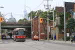
I will be magnanimous. Get the line open. Enjoy Balzac’s coffee in the station. Thrill to the glorious view of Toronto’s former industrial might along the rail corridor. Impress the hell out of those Pan Am visitors (although of course the officials and athletes have limos and buses and reserved lanes on expressways for their delicate sensibilities).

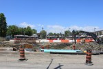
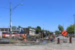
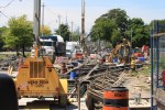
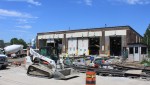
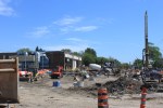
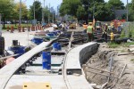
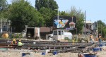
Once the games are over, let’s get serious about the money we have invested in the Weston/Georgetown corridor and figure out how to run an actual transit service that caters to more than the well-off who can afford to pay extra for a fast ride downtown.


504 King Cars Returning to King Street (Updated)

After a long absence courtesy of a shutdown of the King Street branch of the Queen/Don Bridge, streetcars will return to King east from Parliament to the Don on Friday, June 5. This will put the 504 King and 503 Kingston Road Tripper cars back on a route they have not seen since mid-2013.

Construction under the Don Bridge of infrastructure to support the development of West Don Lands undermined the bridge foundations which, as it turns out, are wooden piers. Infrastructure Ontario, the agency in charge of the overall project to build the Atheletes’ Village in the WDL, has claimed that King Street would reopen at several possible dates going back to fall 2014.

This will also mark the first streetcar traffic over the new intersection at Sumach Street that leads south to Cherry Street, the WDL and the Distillery District. That line is expected to begin service in Spring 2016 when new residents start moving in to the neighbourhood. The TTC has not yet announced what route structure will be used to serve Cherry south to the loop at the rail corridor (just north of the old Cherry Street Tower).

A comment left by a reader in another thread adds a few details:

503/504 service will be restored on King St. East between Parliament St. and Queen St. East at 5 AM June 05 2015. The city and its contractor (Aecon) have completed repairs and the TTC has replaced the trolley wire. Test streetcars have already been conducted with good results. The TTC will be posting at stops and on web site of changes, as well as having alternate duties employees at the affected Queen St. East stops to advise customers of the restoration of service. (nfitz will be very happy)

Updated June 5, 2015 With Photos

The century-old housing that provided a backdrop for diverting King cars on Parliament will soon disappear under yet more new condominiums.

Meanwhile, down on King, the landscape has changed a lot since the 504 last plied these rails. The black building is a new condo while the brown one across the street, with a Tim Horton’s that has been busy from the day it opened, is a new Toronto Community Housing building.

At Sumach, the new intersection leads south to track on Cherry that will be activated in Spring 2016 when new condo residents move in to what is now the Pan Am Games Athletes’ Village.

Queens Quay Two Way Traffic Begins

On Monday, June 1, the transition to the “new” two-way operation of Queens Quay started with conversion of the traffic signals at Bay Street to their new configuration. This work will progress westward with one intersection a day until June 10.

The new traffic controllers are supposed to have much more sophisticated transit priority provisions than are used elsewhere in Toronto, and their ability to speed up operations on the streetcar right-of-way will be interesting to watch. I have already requested vehicle tracking data for May 2015 as “before” information, and the June 2015 data, when it comes, will show the degree to which the new signals actually perform as claimed.

(Existing signals have no transit priority at all. They merely cycle through a standard program which does more to hinder transit vehicles than to help them.)

Work on the overall Queens Quay project is nearing completion in many areas, although visitors may be forgiven for doubting this given the ever-present and shifting construction barriers. The weekly construction notice gives details of the work as it progresses.

Russell Carhouse: Eastern Avenue Reconstruction (Updated November 20, 2015)

Updated Noveber 20, 2015 at 3:00 pm: Track construction at Russell Carhouse is now complete and overhead installation is in progress.

Updated July 28, 2015 at 12:20 pm: Photos of construction work in progress.

Updated July 3, 2015 at 5:40 pm: Photos of construction work in progress.

Updated June 24, 2015 at 5:00 pm: Photos of construction work in progress.

Updated June 6, 2015 at 10:00 am: Photos of Eastern Avenue construction from 1928 provided by John F. Bromley from his collection have been added to this article.

The ladder track at the south end of Russell Carhouse is being completely regraded and replaced in a project that will consume a few months. This is a joint project with the City of Toronto who are replacing a storm sewer that runs along the northern side of Eastern Avenue.

The track will not only be replaced, but it will be separated from a new sidewalk, and the track elevation will be changed to reduce the effect of turning and climbing at the same time into the tracks at the carhouse.

Eastern Avenue will be one lane each way in the new configuration. Because parking is allowed in curb lanes east and west of this area, a two-lane road is all that is needed to handle typical traffic volumes.

EasternAveDesign201506

[Image from the City of Toronto Construction Notice]

Removal of the existing track is, as of June 2, complete. Carhouse operations are more complex than usual with cars having to back into their storage and maintenance locations. Originally, the TTC would have had Leslie Barns at least partly available for storage, but that site and its access track are still under construction.

The original ladder track on Eastern Avenue was further south. The change is visible in these construction photos from 1928 provided by John F. Bromley from his collection.

Updated June 24: Construction work in progress

Updated July 3: Construction work in progress

Updated July 28: Construction work in progress

Updated November 20: Overhead installation in progress

Scarborough Subway Update: May 27, 2015

Updated May 30, 2015: The staff presentation is now available online. Some illustrations from it have been included in the article below.

At its May 27, 2015, meeting, the TTC Board received a presentation from Rick Thompson, the Chief Project Manager for the Scarborough Subway Extension (SSE). This presentation is not yet online.

During the presentation, Thompson noted that the process of winnowing down nine alternative routes for the SSE was nearly complete, and that a report on the three short-listed options would be issued fairly soon.

The original nine proposals included two major groups. The first would see the north end of the line continue east from STC on alignments similar to the proposed Scarborough LRT crossing Sheppard at either Markham Road or Progress. Three routes were proposed to reach the existing SRT corridor:

  • Via the SRT as currently constructed.
  • Via Eglinton and Midland, then swinging back into the SRT right-of-way north of Eglinton (this would avoid reconstruction of Kennedy Station on a north-south alignment).
  • Via Eglinton and Midland, joining into the SRT alignment near the existing Midland Station.

The second group takes a north-south alignment through or past STC and all arrive at Sheppard and McCowan as their terminus:

  • A Midland/McCowan option would swing into the Gatineau hydro corridor south of Lawrence to link northeast to McCowan and then follow the McCowan route north.
  • A Brimley option would travel east on Eglinton, north on Brimley and then swing northeast through STC to McCowan.
  • A McCowan option would follow Eglinton to Brimley, then swing north via Danforth Road to McCowan. This was the original proposal approved by Council.
  • A Bellamy option would follow Eglinton to Bellamy, turn north, and then swing back to the northwest to reach the McCowan/STC station.
  • A Markham Road option would follow Eglinton to Markham Road (although the exact alignment east of Bellamy is unclear), then turn north and eventually back west to McCowan. This is the most roundabout of the possible routes.

SSEOptions201505

Events overtook the plans, and a report on the shortlisted options that had gone privately to Councillors made its way into the media. The Star’s Jennifer Pagliaro reported that the three remaing options were the original McCowan alignment, the Bellamy alignment and the Midland route running straight north to meet the SRT corridor.

ci-scarborough-subway-routes-shortlist-web

[Toronto Star, from City of Toronto]

Continue reading