
This is the third article in a series about the anticipated effects of construction through downtown of the Ontario Line. Because the stations at King/Bathurst and Queen/Spadina are similar in their construction technique, I have grouped them together.
Two of the four corners at each intersection will be used for excavations down to the tunnels which will exist by the time station construction begins. The plan is to avoid road closures that would disrupt transit service, not to mention capacity on the road network.
This may sound good in theory, but transit service will suffer from new pinch points in the road network, and pedestrians will attempt to make connections between transit routes walking along roadways adjacent to construction zones. Although there are no formal cycling lanes on streets at either station, a substantial volume of cycling traffic now uses curb lane space that will disappear.
In both cases, construction is planned to run from July 2022 until mid-to-late 2029.
- July 2022 to June 2023: Setup, utility relocation and enabling works
- July 2023 to March 2026: Excavation
- March 2026 to September 2027: Below grade concrete work
- Fall 2026 to Fall 2027: Exterior station work
- June 2027 to September 2028: Interior station work
- March 2028 to March 2029: Station fit out and testing
There is no plan to selectively re-open parts of the street once the major works of excavation and concrete pours are out of the way.
An obvious issue for the long term is that no sooner will subway construction decamp from these sites, but new building construction will move in. The loss of sidewalks and road space could continue well into the 2030s.
When I asked the City of Toronto about this, they understandably have no information on the time frame or effects of potential developments of these “Transit Oriented Community” sites to be developed by Infrastructure Ontario.
[…] although these sites have been flagged as TOC’s we don’t currently have any details around these and their construction impacts. If lane closures are required for their construction then reports will need to come forward to City Council at the appropriate time which will spell out the occupations required and impacts.
Ashley Curtis, Director Transportation Planning & Capital Program. Dec. 2, 2021.
King/Bathurst Station
At King and Bathurst, the Ontario Line passes diagonally under the east side of the intersection.
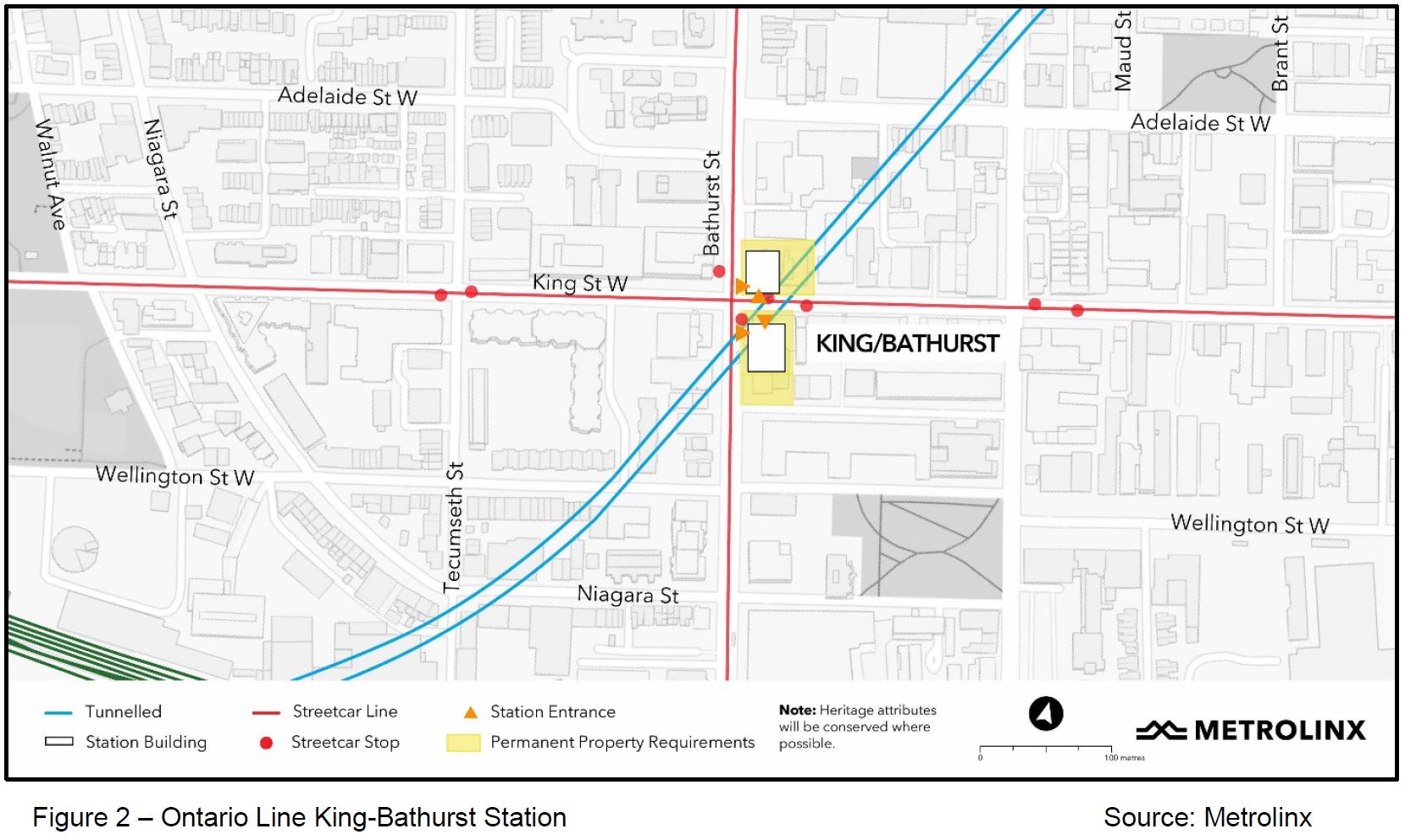
The excavation sites at King Bathurst now contain older buildings whose facades will be retained for incorporation in future development.
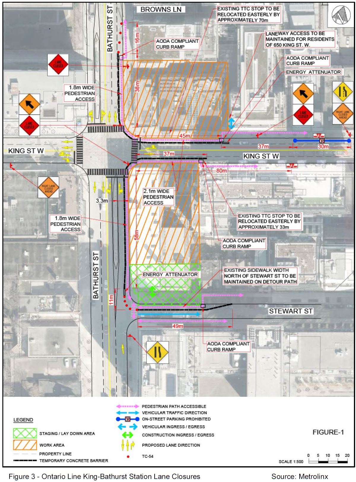
Pedestrian paths will be maintained on the affected corners by taking over the curb lane as shown with the dotted pink lines and black borders in the diagrams.
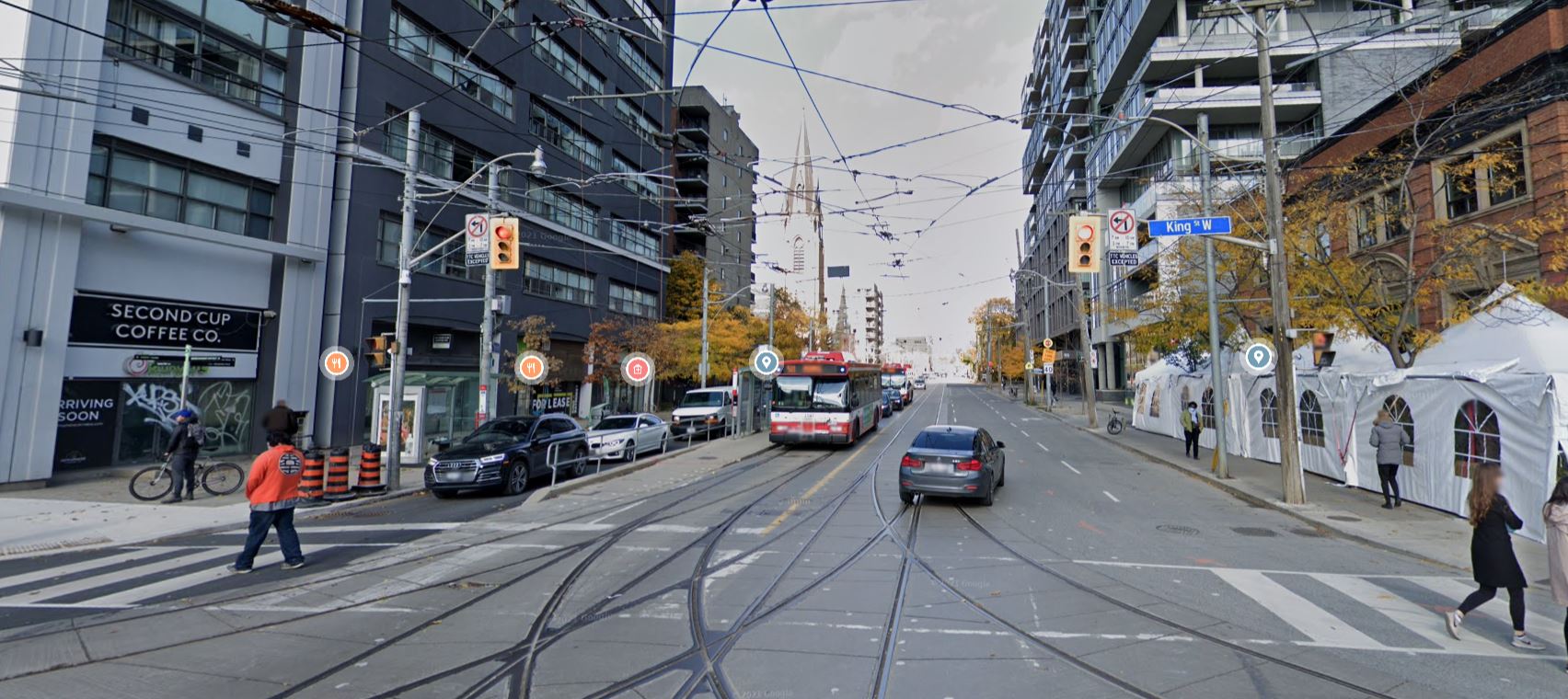
Transit stops on King will be moved considerably east of the intersection, and this will make transfer connections between King and Bathurst streetcars much less convenient. Shifting them to the west side of the intersection would be simpler for pedestrians and keep them out of the construction zone, but at the cost of inconvenience to motorists.
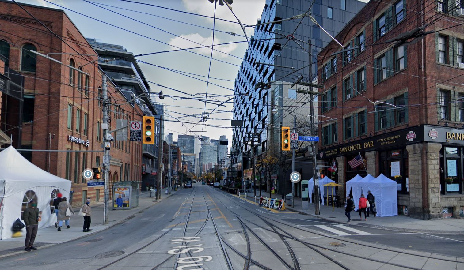
Here is the view eastbound on King from Bathurst. Both the north and south sidewalks will be occupied for construction, and the transit stops will move 80m further east with access via walkways in what are now the curb lanes.
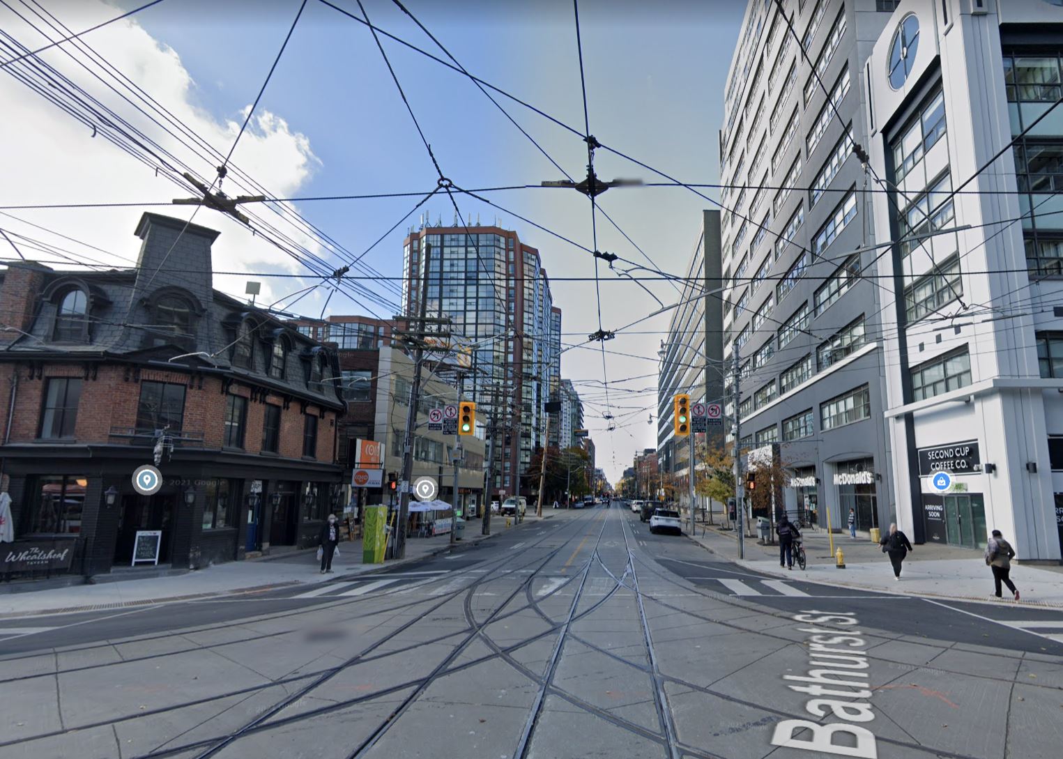
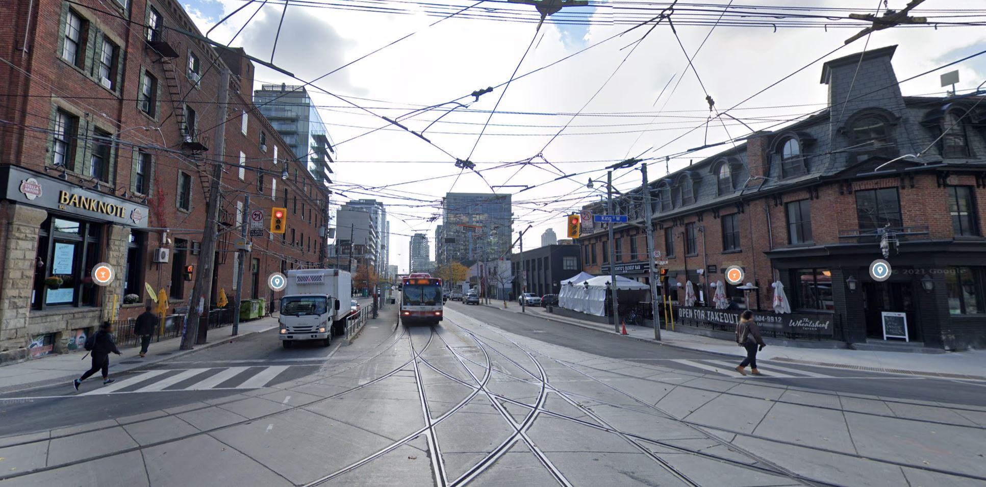
Here is the view looking west. This side of the intersection will not be affected by construction. With luck, The Wheat Sheaf tavern will survive. It would make a nice name for the future station, but not as a memorial.
North-south traffic and pedestrians will be constrained by the loss of the east curb lane and sidewalks. Transit stops in both directions have safety islands and these will not move.
The northbound curb lane will become the pedestrian sidewalk from King to roughly the south end of the newer building on the right of the photo.
To the south, pedestrians will be shifted into the east curb lane for the entire block between King and Stewart Streets.
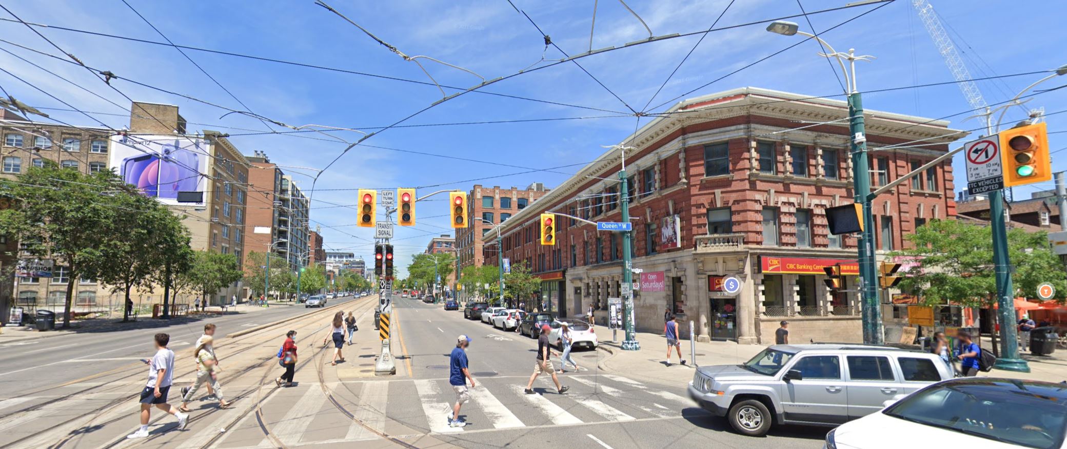
Queen/Spadina Station
The Ontario Line swings under Queen Street west of Spadina and the Queen/Spadina Station will lie east-west under the intersection.
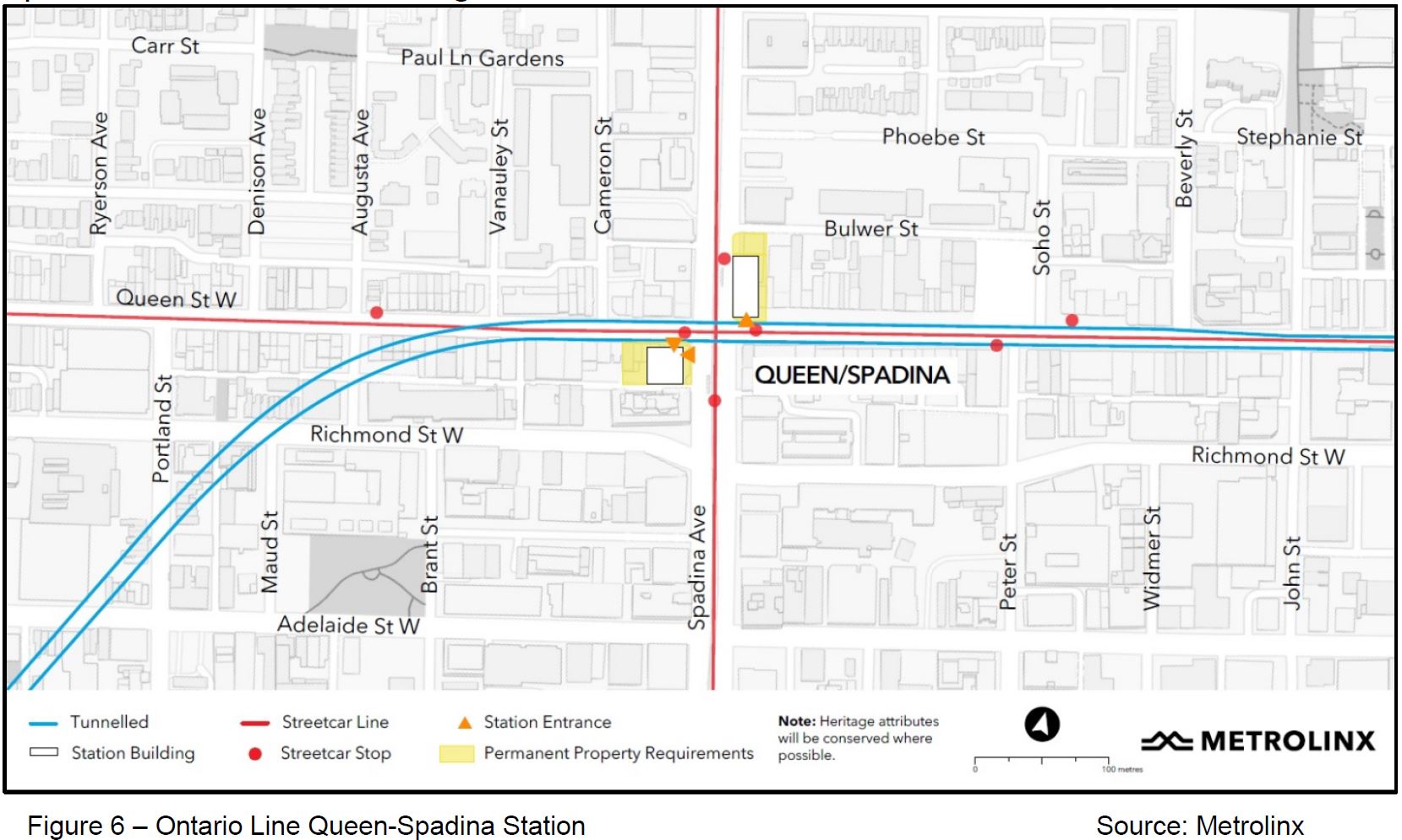
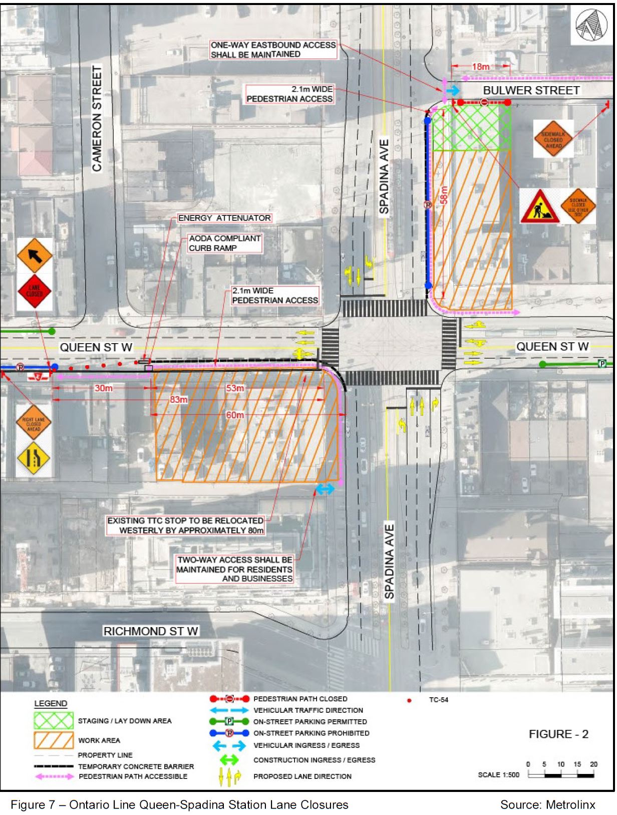
Excavations that will become the new entrances will be on the northeast and southwest corners. Pedestrians will be shifted from the sidewalks into the curb lane on the east side of Spadina from Queen north to Bulwer, and on the south side of Queen from Spadina west to Cameron Street.
Although the northeast corner is a construction site, the wide sidewalk will allow pedestrians to remain without shifting them onto the roadway.
Three of the four transit stops here have safety islands, and they will remain as is. The eastbound stop will be moved west 83m to Cameron Street.
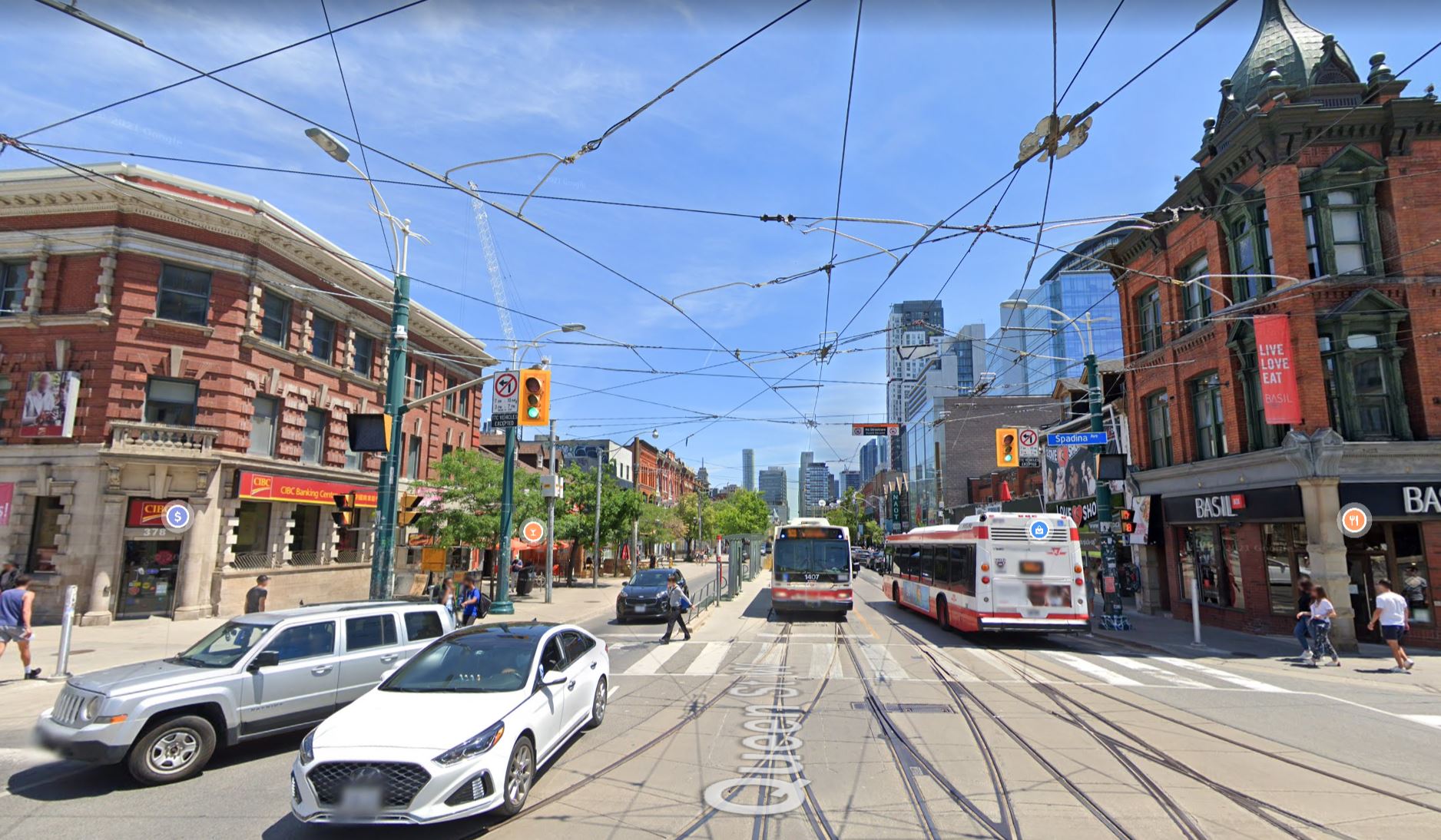
This is the view looking north from Queen on Spadina. The facade of the bank on the northeast corner will be retained as part of the new station entrance and future development. The area now occupied by parked cars on the east side of the street will become the temporary pedestrian walkway.
This view east on Queen from Spadina shows the wide north sidewalk. The construction site will encroach on the sidewalk, but will not completely engulf it.
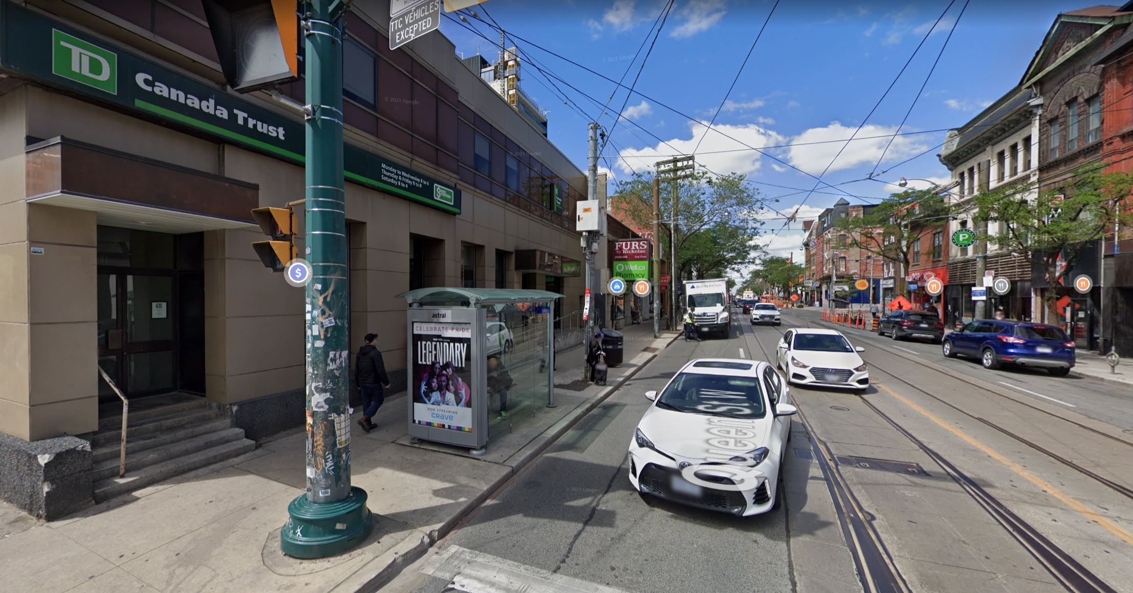
This view west on Queen from Spadina shows the area where the new station entrance will be built. None of the buildings in this site will be retained.
Pedestrians will be shifted into the existing curb lane here, and the transit stop will be moved one block west to Cameron Street (behind the white cube van parked in the background).
In the next article, I will turn to Moss Park and Corktown Stations.

But… but… but… what about the tunnel from Fort York to the Wheat Sheaf Tavern? lol
P.S. Name the King-Bathurst Station the “Wheat Sheaf Station”.
Steve: I mention that station name in my article, but hope that the tavern is still there in a decade, and the station isn’t just a large memorial.
LikeLike
Still hoping for “Queen and Spadina McDonald’s Station” station name sponsored by the private sector
(Not least because that’s all that’s likely to be left of interest at the intersection by the time construction+TOC is done)
LikeLike
They should look at adding an island to the eastbound stop at Queen & Spadina. Given all the properties they’re taking on the south side it looks like there’s enough room to push the sidewalk further south to facilitate this.
Steve: Maybe eventually, although there would remain a problem with alignment of the shifted eastbound curb lane and its mate on the east side of the intersection.
LikeLike
Sure, but the same thing happens with the westbound stop where there is an island.
LikeLike