Front Street Extension: Going, Going …

This morning, the Planning and Growth Management Committee adopted a report recommending that the Front Street Extension be removed from Toronto’s Official Plan.

Soon, soon, the FSE will be officially dead.

Now if we can only get a sensible look at the Waterfront West LRT line rather than the piecemeal approach of past years.

For the record, I do not agree with schemes to bring transit into downtown via Front Street because this will run into severe problems in front of Union Station where current plans call for considerable increase in pedestrian space.

GO Transit’s Relief Line: The 1986 Study

This post continues a series looking at old proposals for ways to get commuters into downtown Toronto.  This isn’t a new problem, and as we have already seen, the TTC and Metro Planning were contemplating various alternatives four decades ago.

In response to the proposed Downtown Relief Line and other subway schemes, GO Transit commissioned a study of the possibilities for GO Rail service.  This study recommended frequent, all-day service between Halwest (the point where the York Subdivision, CN’s Toronto bypass, meets the line to Brampton) to Doncaster (the point where the CN Bala Subdivision, used by the Richmond Hill train, crosses the York Sub).

As is quite evident from any GO timetable, this didn’t get built.  One reason was that interest in the DRL waned as the political dynamic and planning focus turned away from downtown to the so-called “centres” that would grow within Toronto’s suburbs.  Travel into downtown continued to grow, and the GO Lake Shore service handled much of the transit-based increase.

A few points worth noting:

  • The option of using the connecting track from the CN to the CP between Oriole and Leaside was considered to be the superior route, although it had its problems including a potential conflict with the proposed Leslie Street extension.
  • For reasons that are not explained, the equipment cost for the most limited of services is higher than for all-day service.  In general, I would treat the cost estimates with some suspicion because (a) they are two decades old and (b) ancilliary costs such as connections to the TTC at Dundas West don’t appear to be included.
  • The inclusion of a cost comparison between subway and GO construction was clearly intended to plump for GO as the much cheaper alternative.  However, the study does not address the variation in origins and destinations that requires both local and express services in any corridor as discussed here previously.
  • There are no demand projections, only a feasibility study of what service could be operated.

Richmond Hill Georgetown Study June 1986

Figure II: Richmond Hill Line

Figure III: Georgetown Line

Is There Hope For Transit In 2009?

The new year brings a dark economic climate, worries about job losses, falling revenues for all governments and a pervasive sense that we have not yet seen the worst.  Whether this is media disaster-mongering, a realistic view of the future, or something in between remains to be seen.

What is quite clear is that an economic model that underpinned the past decades has run its course.  Can the same level of activity — jobs, travel, government investment — be sustained into 2009 and the next decade?

Transit is only a small part of this, and yet decisions made about transit funding have long-lasting effects.  Through my “career” as a transit activist, I have seen the boom-and-bust cycles of funding and watched as grand schemes for transit investment disintegrate when the economy falters and governments lose interest.  Too often, transit was something everyone wanted to champion, but nobody wanted to pay for.

A major problem throughout the North American transit industry, not just in Toronto, is that transit capital spending is viewed as an economic stimulus, a job creation (or preservation) mechanism, not as an essential part of what makes urban economies work.  The dominance of auto travel (and the lack of transit alternatives) puts transit down many voters’ priority lists.  People are comfortable in their cars which, for all their problems and costs, work.  The same cannot said for transit.  You cannot get to work on a press release.

The long lead times for transit projects bring a typical cycle:

  • Governments with money to spend start to think about investing in transit.
  • Plan, Plan, Plan.  Much work for consultants and facilitators (less so with the new streamlined approval process).
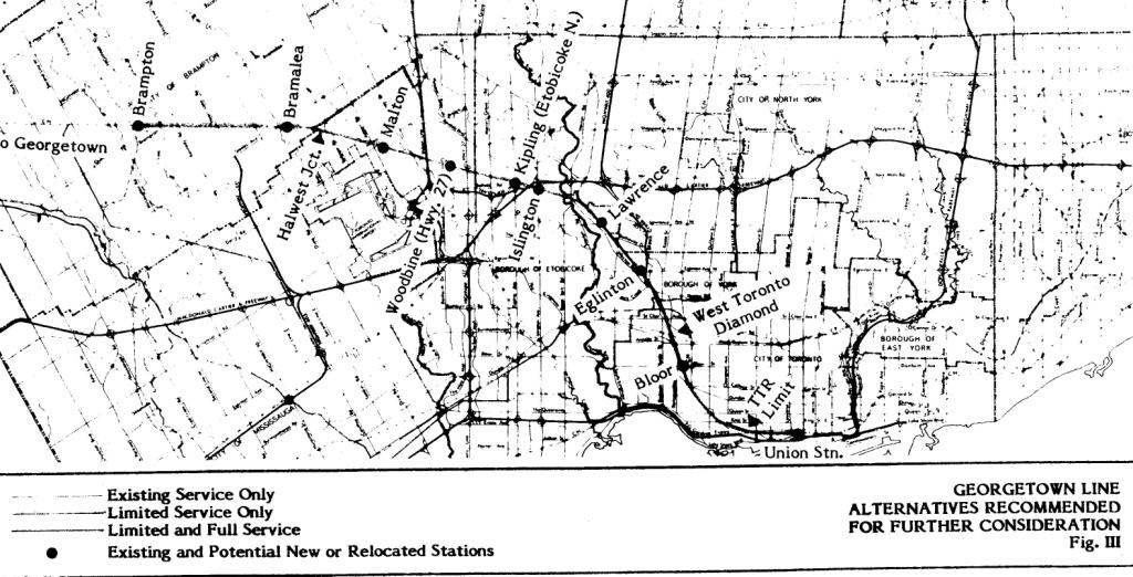
  • Finally a map, and a few lines that get into detailed design.
  • Ooops!  A recession.

We are a bit better at it this time around.  We have many plans in the hopper and we haven’t (yet) stopped everything in its tracks waiting for the next boom.  The root problem is that transit is not something we spend on regularly, but only when we can drum up a few billion for someone’s pet project.

Where does this leave us for 2009? Continue reading

Where Would a Queen Subway Go?

This post is intended to continue the thread of historical background to the problem of threading a Downtown Relief Line from the Danforth Subway into downtown Toronto.  It is not intended to endorse a specific alignment, but to show the sort of problems that existed 40 years ago and which remain today.

Back in June 1968, the TTC considered a report about an interim Queen Street streetcar subway and a later subway line.  (The linked version of this report has been scanned as text and formatted by me rather than leaving it as page images, but the content is identical.) This contains a number of observations of interest.

  • At this point, the alignment from Queen north was designed to connect with Greenwood Yard as a full subway.  This would be changed many years later to a Pape alignment south to Eastern for a possible ICTS/RT yard.
  • An interim arrangement with a streetcar subway from roughly Sherbourne to Spadina was examined, but it was thought that in the long term, the demand in the Queen and King Street corridors would exceed the capability of streetcar operations.  In hindsight, this is a rather large case of overestimation of future demand.
  • Construction of the Sherbourne Portal would be possible because the buildings on the north side of Queen had recently been demolished to make way for Moss Park.
  • Conversion of a streetcar subway to a full high-platform rapid transit line was considered to be difficult.
  • An alignment south of Queen Street was considered impractical because of the buildings that would have to be underpinned or demolished.
  • An alignment directly under Queen Street would probably require cut-and-cover construction with associated disruption due to soil conditions.  The possibility of more advanced tunneling methods is mentioned.
  • Widening Queen Street is considered an option because, in the good old days, tearing down buildings was the thing to do.  This would not play out quite so favourably as an option today.  The buildings are part of a vital streetscape.
  • An alignment behind the north side properties was considered, although it would still involve considerable building acquisition and demolition.
  • A study by the Metro Planning Department suggested that in the west, the line might travel northwest via the CN corridor to the vicinity of Islington Avenue.
  • The projected cost of the line is in the range of $25-million per mile, or $16-million per km.
  • The report confirms that structural provision exists at Osgoode Station for an east-west subway line.

I have also included here a scan of a drawing showing a possible alignment from Donlands Station south and west to the Broadview (this is labelled “north alignment”, but this portion is substantially the same for all variants).

donlandslegcSeveral points are worth noting from this drawing.

  • The tunnel would pass under Eastern High School and through an existing residential neighbourhood.
  • The alignment would require the demolition of a large number of vintage buildings along Queen Street.
  • The curve south to west begins at Dundas and Alton and ends at Queen and Jones.  This gives an indication of the swath that any subway curve will cut through a neighbourhood, and I commend this to those readers who propose lines with hairpin turns.
  • A curve from Pape onto the rail corridor would be less severe, although not without impacts, because it would not be a full 90 degree turn.  (Pape is the north-south street just to the right of the obscured part of the street grid at the top of the page.)

As I said at the outset, I am publishing this to provide context for the discussion on this site.  The planned construction of the Richmond Hill subway extension and the demand it will add to the Yonge line has side-effects that must be addressed.  None of the options is simple, but we need to understand what they all are and how elements of them might be chosen or omitted from the solution.

Where Would a Don Mills Subway Go?

There has been a lot of discussion here about potential alignments for the eastern leg of a downtown relief line.  On occasion I have mentioned a route rather different from the commonly discussed one via Pape, the Leaside Bridge and Overlea, and I am sure this has caused some confusion.

One advantage of having been at this transit advocacy business for a long time is that I have a long memory and archives to match.  For your delectation, here is a proposed route from Don Mills and Eglinton to downtown.  It is a TTC Subway Construction Department drawing dated December 12, 1973.

donmillsalignmentdec73c

A few things worth noting about this drawing:

The route north from Danforth is via Donlands, not Pape.  This provides access to Greenwood yard via the connection shown.  It also aligns the route further east to simplify the valley crossing north of O’Connor.

The route passes through the middle of Thorncliffe Park and proceeds north to Eglinton.  This is more or less the sort of alignment I have been talking about for the east leg of a DRL (or, for that matter, for the Don Mills LRT if it came south of Eglinton).

Two alternative alignments from the CNR line to Queen are shown.  One goes straight south while the other runs along the rail corridor.  Going west along Queen brings its own problems, and these were discussed in an earlier, 1968 report that I will present in a separate post.  (Please don’t clutter up the comments thread here with questions about that part of the alignment.  You will get your chance.)

I present this information mainly so that people can see that the idea of a subway to Eglinton and Don Mills is hardly new, and it’s not even mine — I simply resurrected an old TTC concept.  When we discuss transit plans, it is useful to know some of the history.

Buses on Streetcar Routes?

The CBC this morning carried an item reporting that the TTC would begin running buses on streetcar routes to relieve crowding.  Chair Adam Giambrone was quoted as saying that cars don’t get out of the yard due to “safety” problems such as dashboard heaters failing and causing windows to fog up.

Sigh.  That’s this week’s excuse.  Things are getting bad when the best that Giambrone can trot out is that chestnut “safety” that is a catch-all excuse in the same league as “congestion” and “TTC culture”.  The real problem is that the TTC has been hiding reliability problems with the streetcar fleet for years, and needed service improvements don’t show up because they don’t have enough working cars.  The problem has been masked because at least one carline has been under construction for most of the last five years.

Next week, a new schedule comes into play on Queen with less, yes less service than today.  The reason?  The operators need even more layover time (strangely only on weekday schedules but not in the evening), and the TTC comes up with this by stretching the headways.

Management’s refusal to undertake a restructuring of the line, to break it into separate components that don’t have an immense round trip and a corresponding need for layovers, is getting quite trying.  The use of relief crews at Russell Division works in the east end because the carhouse is near the end of the line, but a completely different scheme is needed in the west for Long Branch bound cars.

If we are going to start busing streetcar lines, then let’s stop running inadequate service to handle the demand on the routes.  Stop telling us about average loads that are within standards when news reports include clips of people complaining about huge gaps and crowded cars.

Thanks to inaction on streetcar reliability, riders will have to put up with ongoing problems for three years until the new fleet begins to arrive.  Even that is dependent on funding, and I am not convinced that the streetcar fleet will survive the many demands for new money in Ottawa and Queen’s Park.  Is this the beginning of the end?  A fate like the trolleybus network that was allowed to deteriorate beyond the point of no return?

Service Changes for January 2009 (Updated)

Updated December 29:  The January 2009 Service Summary is now available online.

January 2009 brings a small number of service changes notably on the streetcar system.  Many of these address overcrowding problems during the off-peak (there are no spare cars for peak period requirements).

Of particular interest are the changes on 501 Queen.

The weekday schedules will be adjusted by adding running time and stretching the headways during both peak periods and midday.  The alleged purpose of this change is to improve trip reliability.  Whether this will simply mean that even longer layovers will be available at both ends of the line remains to be seen.

Given the length of the Queen route, the TTC needs to move away from laying over cars to laying over operators by way of scheduled breaks at Russell and Roncesvalles carhouses.  Ad hoc changes to line management are in place at Russell, but still not at Roncesvalles.

I have requested the CIS data for December 2008 and January 2009 for Queen (and related routes) in order to investigate whether there has been any improvement due to recent and pending schedule changes. 

Meanwhile, the service improvements on Saturday and Sunday address crowding that shows up even on the averages, never mind when the service is erratic.  It wasn’t your imagination, there just were not enough cars on the line for the demand.

Where Is The Wellesley Bus?

Over the past week, two people have commented to me about trying to use the 94 Wellesley bus and just giving up.  Among the complaints I have heard are:

  • The printed timetables are completely meaningless.
  • Gaps of over half an hour in the peak period occur.

This is quite different from the rosy view the TTC system had in the wake of November’s service improvements.  Looking at the Scheduled Service Summary I see that the headways are supposed to be:

  • AM Peak:  12′ between Ossington  and Wellesley Stations, 6′ east to Castle Frank
  • Midday:  10′
  • PM Peak:  16′ between Ossington and Wellesley Stations, 8′ east to Castle Frank
  • Early evening:  13′
  • Late evening every day:  15′
  • Saturday early morning:  17′
  • Saturday afternoon:  12′
  • Weekend early evening:  16’40”
  • Sunday daytime:  18′

What is ironic here is that the PM peak service west of Yonge is worse than it is during most other operating periods.  On top of this, if a bus is missing or short turned, a gap of over half an hour results.

I know it’s a lot to expect that there are hundreds (tens?) of Wellesley bus riders reading this blog, but if you have some service horror stories of this or other routes, please let me know.  We need to ensure that the TTC is actually operating its services properly, and not just the ones that had recent improvements.

A Question of Station Capacity (Update 1)

Update 1:  December 28, 5:15 pm:

I have received a note pointing out that a second entrance program is in progress for various stations regardless of the building code requirement for a “trigger” condition (the addition of substantial load to the demand in the station).

The reports in question are from 2004 and 2005.  The 2005 report deals with College, Wellesley, Museum and Castle Frank.  The work at Castle Frank is underway now.  Museum was to get a second exit through the vent shaft at the south end of the station, but this work was put on hold because it was to be funded as part of the condo project on the Planetarium site that was cancalled.

Original post follows with amendments:

“James” sent in a comment in the Richmond Hill subway thread that deserves to start a discussion of its own.

Steve,

Perhaps this comment belongs back in your thread on Bloor-Yonge renovations….

But since that seems to be the dominant line of discussion here….

Your arguments are persuasive on the need to build a DRL (something I already supported); but further, to build it prior to either a major Yonge line extension, or a massive Bloor-Yonge overhaul.

However, I think everyone can accept that Bloor-Yonge, as it is today, requires more space, and improved passenger flows just to cope with existing traffic; and it will likely need that even if a DRL is built. Though, one hopes a less drastic solution might be feasible.

Which brings me to the Steve question of the day. Given the need for capacity/flow improvements and for the renovation for aesthetic and state-of-good-repair reasons of the Yonge portion of Bloor-Yonge…. What if any improvements could the TTC make to this station that would be of moderate expense, and less disruption, in the immediate future?

This post deals primarily with the south end of the Yonge line, but the topic is a generic one for both existing and future stations:  providing the ability for passengers to move around within the stations.  Stations exist to move people, not just trains. Continue reading

Richmond Hill or Bust? The Yonge Subway Extension (Part 3)

Posts in this thread have examined the general design proposed for the Richmond Hill subway and the many demand estimates for this line.  Now I will turn to the impact of this line on the larger network.

As many have pointed out in comments to the previous items, the Spadina/VCC extension was supposed to offload the Yonge subway.  We now know, according to the TTC’s estimates, that the effect will be a reduction of less than 10% of the existing demand southbound at the peak point, Wellesley Station.  Meanwhile, the availability of a competing subway line in the established Yonge Street corridor will attract many more riders.

The TTC manages a rabbit-in-the-hat trick by claiming that demand relative to capacity on the subway in 2017 will be the same as it is today thanks to Spadina diversion and more commodious trains.  That’s a very big, very fat rabbit, and I suspect it’s more of a canard.

Development will continue in York Region, and if anything the availability of frequent transit service, both on GO and on the TTC, will offset any effect that long-term increases in energy costs and commuting might have on travel demand and the decision to live far out of the core area.  Demand will grow on the subway both from the 905 and from within the 416. Continue reading