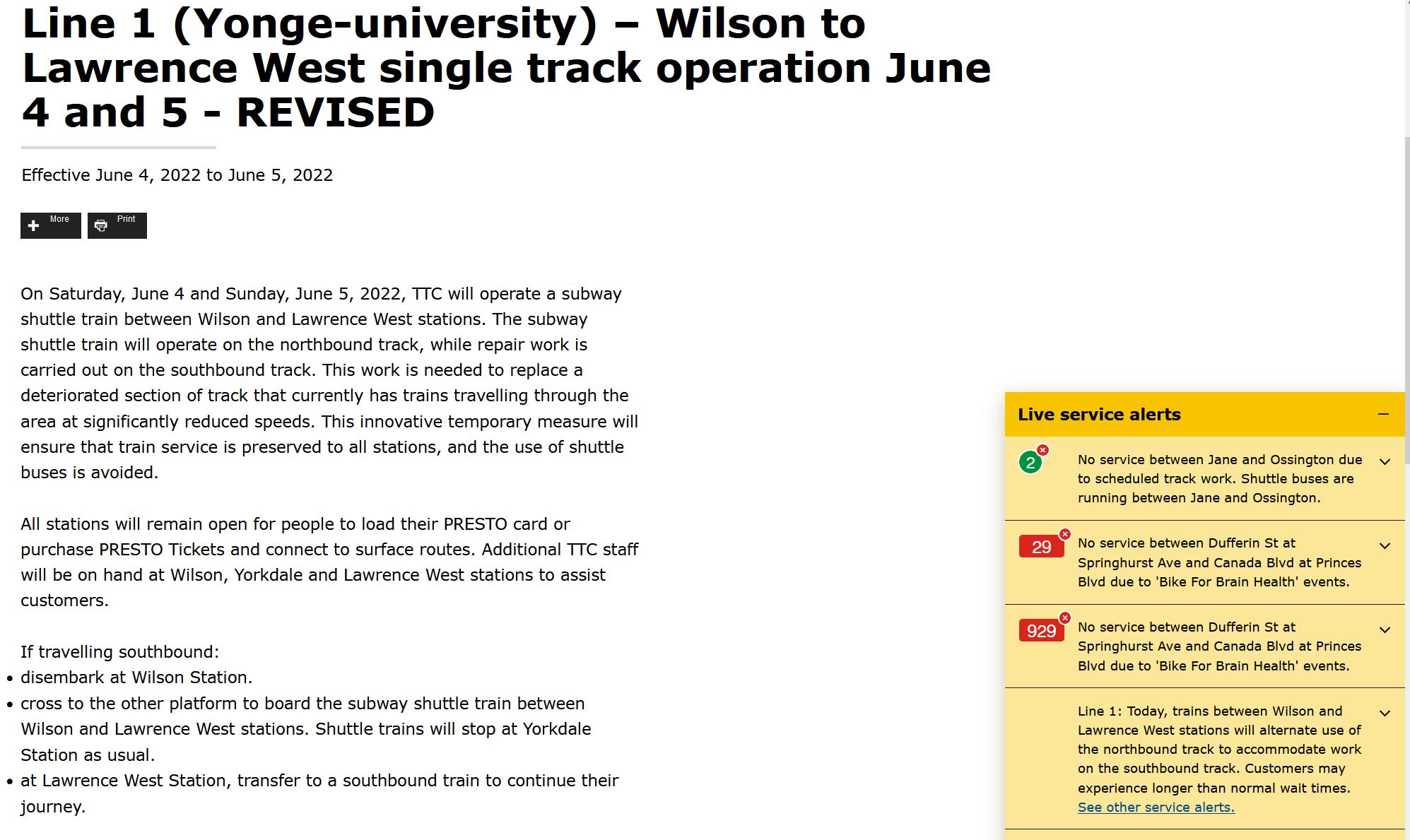
The TTC had planned a shutdown of subway service on Line 1 Yonge-University-Spadina to permit track repairs between Wilson and Lawrence West Stations. This plan has changed to replace the usual bus shuttle with a subway shuttle because track work will only occur on the southbound side.
Subway trains will operate between Vaughan and Wilson Stations terminating on the southbound platform at Wilson. They will return northbound via a crossover north of the station.
A subway shuttle will operate between Wilson and Lawrence West Stations running on the northbound rail in each direction. The train will stop at Yorkdale Station.
Service northbound to Lawrence West Station will cross over via the centre track north of Glencairn Station and terminate on the southbound platform at Lawrence West.
Passengers travelling through the affected area will make across-the-platform transfers at Wilson and at Lawrence West Stations.
There has been great confusion about just what service the TTC is operating and whether there would be a subway shuttle, or simply alternating use of a single track by through service in each direction.
It is actually possible to see both versions of the TTC’s message at the same time. The main text below is the still-active notice of shuttle operation. However, a popup in the corner of the screen displays live service alerts, and this tells a different story.
The TTC has a big problem with contradictory service notices in various parts of its site because they originate from and are maintained by different groups.
On Saturday, May 28, 2022, between 10am and 5pm, the TTC will open the lower level of Bay Station as part of Toronto’s Doors Open event.
May 28, 2022: Updated with photos from the event.
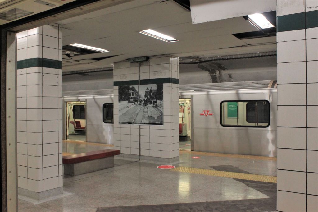
Bay Station is an inverted version of St. George Station with the Bloor line on the upper level (the currently active station) and the University line on the lower level. Tracks connect to Lower Bay from the junctions north of Museum Station and at the west end of Yonge Station. These are regularly used for equipment moves between the two lines as well as by work trains.
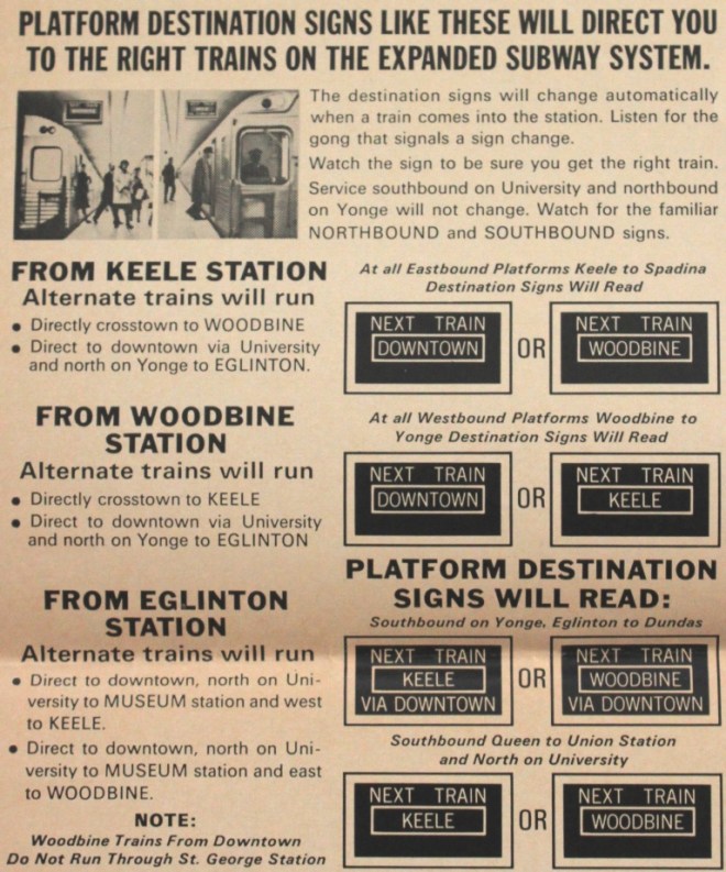
This station has rarely been seen by the train-riding public except for a few construction-related subway diversions. It operated in revenue service for the first six months of the Bloor-Danforth subway during the trial of an integrated service on the Yonge-University and Bloor-Danforth lines. When that ended in September 1966, the station took on various uses including storage, training, testing of platform treatments for wayfinding, and movie shoots.
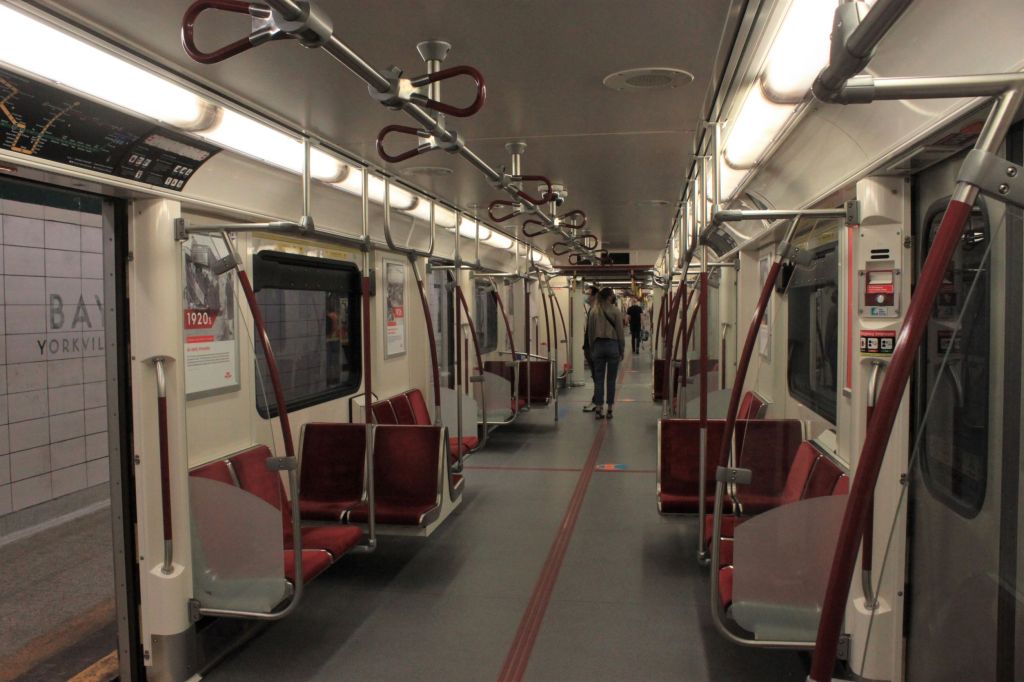
During the event, trains will be parked on the platforms, and there will be displays from the TTC’s centennial book A Century of Moving Toronto.
Access is only by stairway.
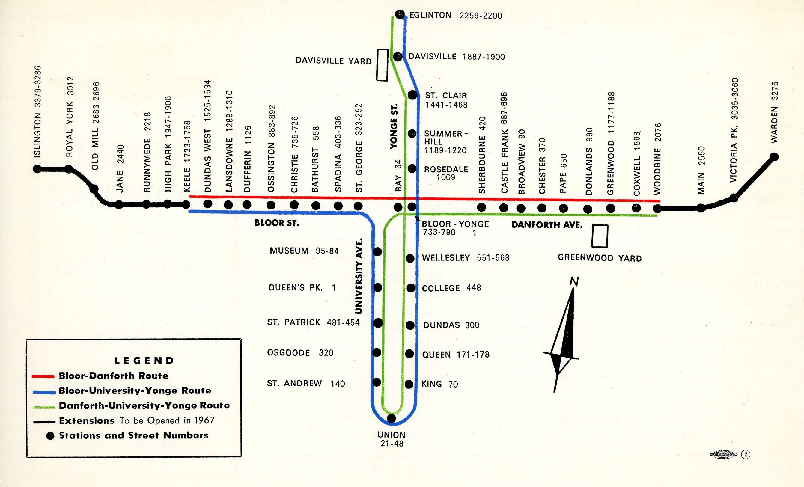
Route Map for Integrated Subway Service 1966
Here is a selection of photos from the event.
Lower Bay Station is taller than most because of the alignment of the tunnel which connects to the University line north of Museum by going under the north-to-west track into St. George Station.
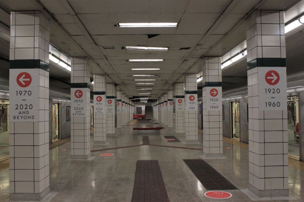
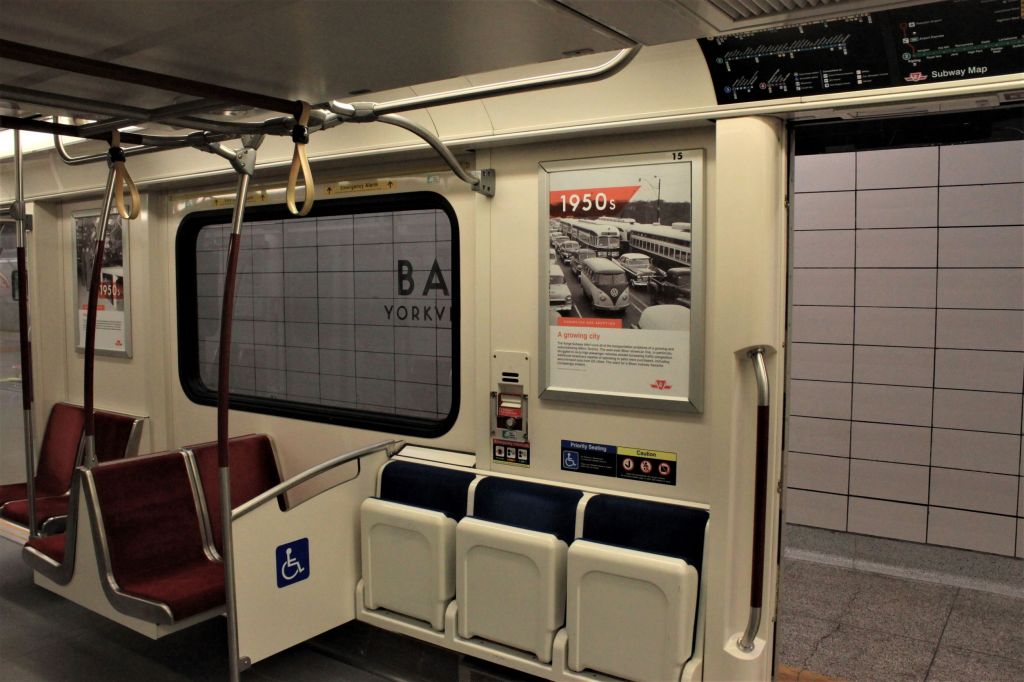
Two trains were set up with photos arranged by decade. The display is adapted from the book TTC100 which is available in hardcover or digital version from the TTCShop.
The streetcar system is a lot smaller than it was in 1949 before any of the subway was built. Streetcar trains with Peter Witt cars served Yonge, and trains of PCCs operated on Bloor-Danforth. Many other parallel routes funnelled riders into downtown.
Lower Bay is a bit worse for wear, not having seen revenue service (at least with stopping trains) since 1966. It has been used, among other things, to test various floor treatments for wayfinding.
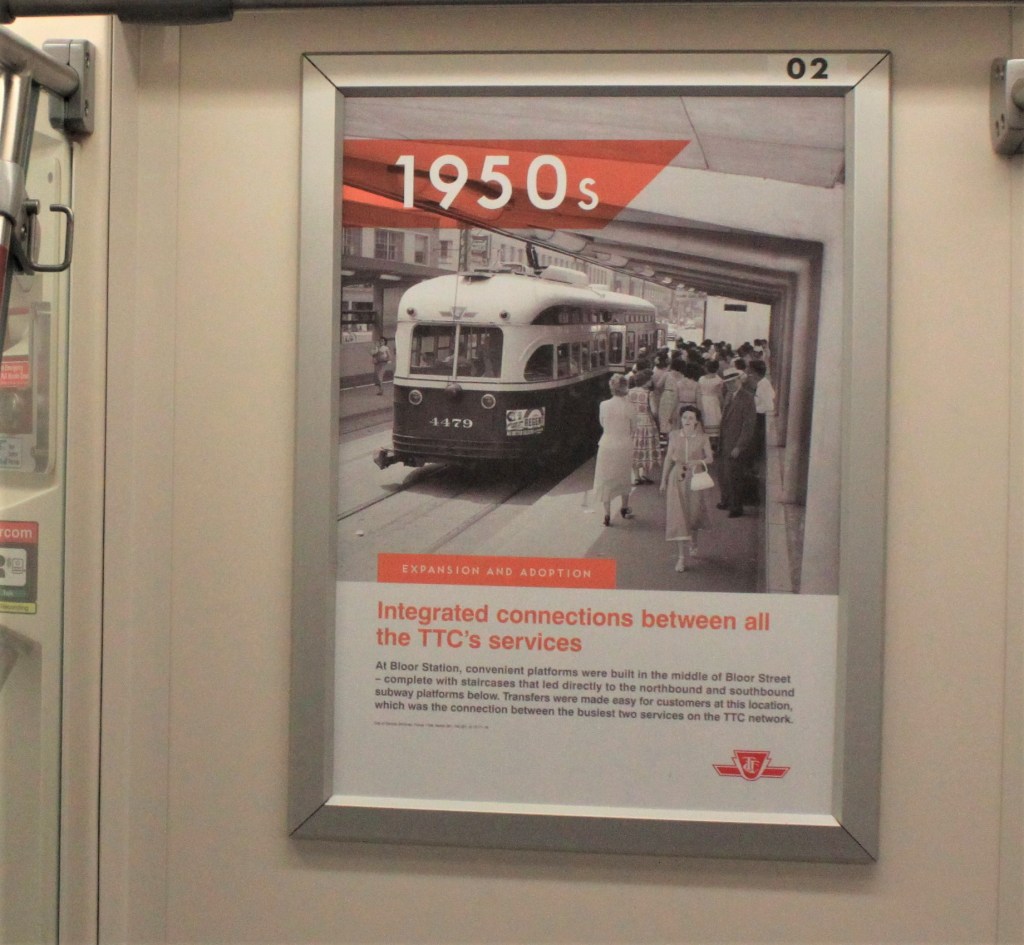
Once the Yonge Subway opened in 1954, the major interchange was at Bloor-Yonge with a protected unloading and loading platform in the middle of Bloor Street leading directly to the Bloor Station platforms below. This area will see major reconstruction in coming years as Yonge Station and the link with Bloor Station are expanded to provide a separate eastbound platform for Line 2.
Streetcar traffic to the east end was quite intensive with the combined service Bloor and Danforth trains operating close to once a minute between Bedford Loop (now St. George Station) and Coxwell. The view looks northwest on the Prince Edward Viaduct with the trees of Rosedale in the background.
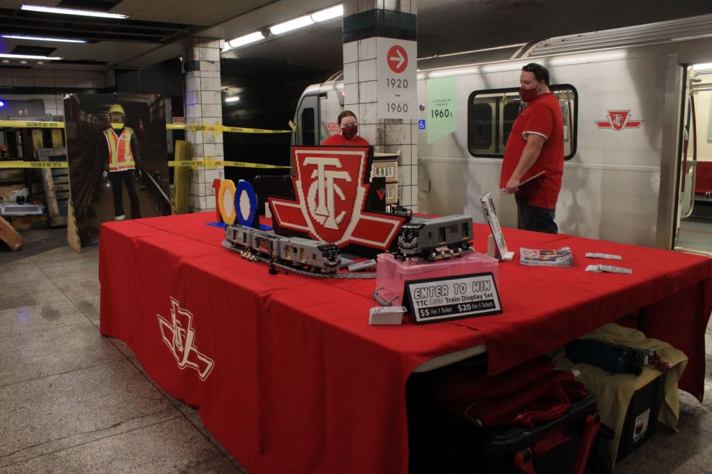
At the east end of Lower Bay, there is a TTC Lego subway train set up which some lucky soul will win in a draw.
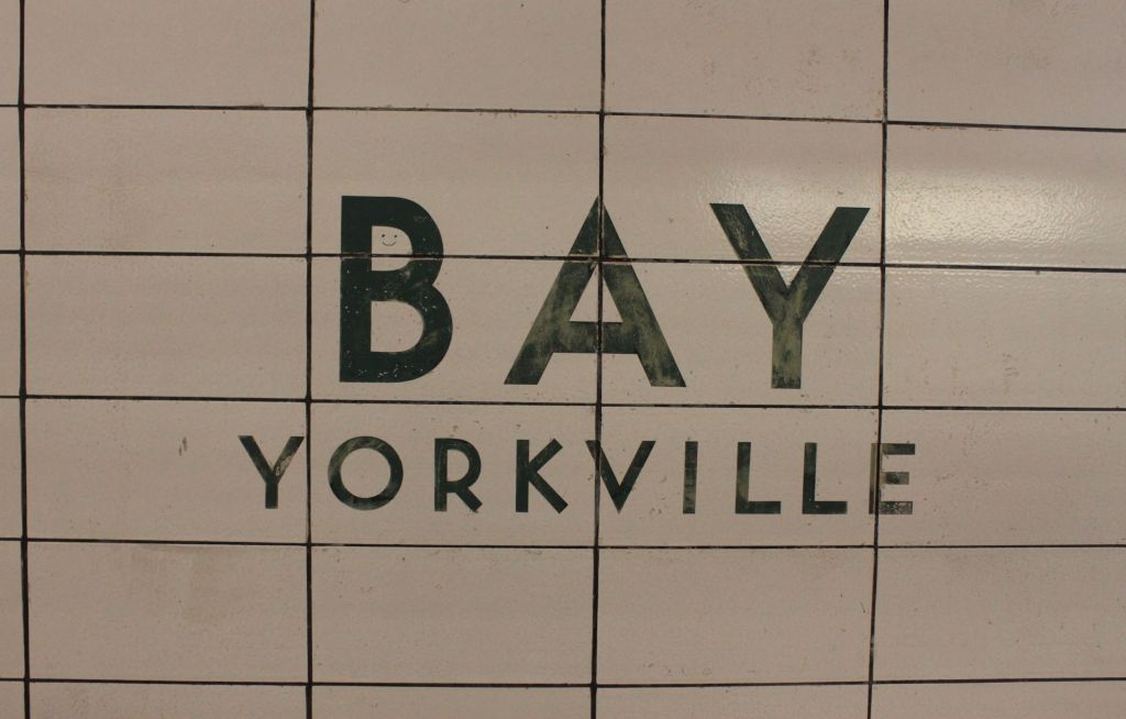
Finally, the station name is “BAY Yorkville”. This is a testimonial to the days when Yorkville was a disreputable neighbourhood full of coffee houses, people with long hair, and smokeables you can now find on any street corner. The station’s original name was to be “Yorkville” after the former town, but this was changed. This is not the only original BD station to get a different name when it was built: “Vincent” became “Dundas West”, and “Willowvale” became “Christie”.
After extensive study and public consultation, TTC staff will present a plan for bus replacement of the Scarborough RT to their Board at its April 14, 2022 meeting. Although it is a long report, much of it has appeared before during the consultative process and in an interim report to the Board. Interested readers can browse the full version, and I will only touch on the major points here.
My apologies for the resolution on some of the drawings included here. The versions in the TTC report online are not good, but if better renditions show up in the future, I will replace the originals here.
The Scarborough RT is on its last legs and, frankly, should have been replaced years ago. Let us not get into the whole subway/LRT debate as that train has left the station. However, the constant delay in making any decision has now pushed the opening of any replacement service well beyond the reasonable lifetime of the existing SRT fleet, and even that will require work to keep it operating until bus facilities are ready.
Various dates for the SRT shutdown are proposed, and these depend on completion of alternate bus terminal facilities. Thanksgiving weekend would certainly be an ironic cutover date.
The candidate dates for Q4 2023 would mean the last day of train service could be: Saturday October 14, 2023; or, Saturday November 25, 2023. If construction is complete ahead of schedule, a September closure date could also be possible, on Saturday September 2, 2023.
TTC Report at p. 15
The Recommended Option
When the need to close the SRT before the Scarborough Subway Extension opened became apparent, the first thought was that riders would be consigned to buses plying the roads from Scarborough Town Centre to Kennedy Station for many years.
To no great surprise, there was a better idea that emerged during the consultations: use as much of the existing SRT right-of-way as possible for a bus roadway bypassing local street and intersection congestion and providing a direct access to Kennedy Station. That is the scheme that has been recommended, named in the report “Option 1 Hybrid Line 3 ROW” (Right-of-way).
As shown in the map below, the bus service will operate from STC station to Kennedy on street to Ellesmere Station and then on a new road in the existing SRT right-of-way to Kennedy Station. Stops will roughly match the existing SRT, except for McCowan. A new stop will be added at Tara Avenue, ironically a proposed station location decades ago when the SRT was to be built as a conventional LRT line.
The frequency of service is such that aggressive transit priority measures will be needed for the on-street portion.
On March 27, 2022, Premier Doug Ford and a very chilly bunch of his political colleagues gathered near Exhibition Station for an official “groundbreaking” for the Ontario Line. Never mind that Metrolinx will not award the first of the main construction projects until late April, and the posed set of excavation machinery sat idle in the background. This was very much an event plugging the Tories’ overall platform and positioning construction, wherever and whatever it might be, as an economic engine for Ontario.
Concurrently with the press conference, which revealed absolutely nothing new, a new set of renderings for Ontario Line stations was released. In some cases these were quite large and were intended for media use. I have downsized them where needed to work better online.
Absent from these renderings are any of the development schemes that Infrastructure Ontario has proposed under its Transit Oriented Communities program.
The Premier’s speech contained a basic error in math when he claimed that the Ontario Line would add more than 50 per cent to the Toronto subway network. No. it is the four Ford “priority projects” announced in 2019 that will do this. It’s in the press release. Some speech writer screwed up.
Probably the most annoying part of the press conference was a statement by Metrolinx CEO Phil Verster who spoke glowingly of how well Metrolinx had worked with communities both in Riverside and in Thorncliffe Park to create an acceptable design. This materially misrepresents the very contentious relationship with both communities, and continues Metrolinx’ gaslighting of critics to give the impression that all is well, and it is the critics who are out of step.
If Metrolinx had been truly involved with communities along the line while it was being designed, a great deal of contention could have been avoided.
Many issues affect the Thorncliffe Park section of the Ontario Line, to the point where I have split this off into a separate article.
Listening to all of the debates, I cannot help seeing that many problems arose from Metrolinx’ trademark secrecy coupled with a piecemeal approach to planning in a large, important neighbourhood.
The transit line was, in effect, dropped out of the sky as a line on the map fitted as best it could (depending on one’s definition of “best”) through the community without advance consultation. Many wider needs were beyond the project’s scope, and yet it is clear that Thorncliffe Park requires an integrated plan for its future including many elements:
The future of lands south of Overlea including an aging mall and its parking lot.
Whether low-rise commercial/industrial buildings north of Overlea will remain in the long term, and if not, what will this area become?
What should Overlea Boulevard look like as the main street of a future Thorncliffe Park? There is already a plan for the east end of Overlea, but what of the entire street?
How will a growing population be served both for public facilities such as schools and businesses providing local, walkable access?
What is the target population and demographic? Will Thorncliffe’s growth be driven by a forest of high-priced condos, or a mix of building types and affordability?
How will open space and parkland be provided in an area where parking lots are a dominant feature?
What is the future of lands in the Leaside Industrial area and how can redevelopment there be linked with the needs of Thorncliffe Park, including the MSF yard’s location?
I fully expect the response to be “this is an important transit project and we cannot wait for an overall plan”. That would be the response of a construction agency eager to do its master’s bidding, not of a city-building agency with a wider outlook. An area plan would be an iterative process that could identify key elements up front, but guarantee a wider scope for the neighbourhood’s future. Most importantly, it would occur in public to bring trust that there was no hidden agenda or deliberate sidelining of community concerns.
The remainder of this article consolidates the Q&A sessions from the online open houses.
The material here is condensed from recordings of the two meetings about the section from Gerrard to Exhibition Station. The questions and answers have been grouped to bring related topics together, mainly on a geographic basis. This is not an exhaustive Q&A as the topics depend on the interests of those participating.
Statements are not attributed to any specific person (if you really want to know who said what, listen to the recordings), but if anyone feels I have misrepresented their position, please let me know through the comments.
The sections prefaced with “Comment:” are my remarks.
After the publication of the monumental draft Ontario Line Environmental Impact Assessment Report (EIAR), Metrolinx organized four online “open houses” to present an overview of the report and to address questions. These took place in late February and early March during a 30-day period for public comment that ends on March 9. Those of you with a desire to spend many unproductive hours hours waiting for occasional pearls of wisdom to emerge can do so through the Metrolinx Engage website:
In two separate articles, I will summarize the major questions from each pair of sessions. However, there are general issues raised by the draft EIAR and the process for public input that deserve their own debate.
Politicians and managers who never read beyond the glossy brochures, or, maybe, the Executive Summary, might mistake sheer volume as a measure of transparency, an heroic effort to inform and involve affected communities.
Back in the days of real telephone directories, the size of the phone book was, among other things, a measure of how grand a community might be. Big thick book equals lots of phones and lots of people, a matter of pride even if the type got smaller and smaller as years wore on. But for all its heft, the directory had a basic organizing principle: if you knew how to spell someone’s name, or even made a reasonable guess, you could find their address and phone number.
The many thousands of pages in the EIAR and its sundry appendices, not to mention equally large reports that preceded it, are bricks in a wall of obfuscation, not revealing windows into our future. Nobody (no, not even I) has read every page if only because there is only so much time to devote to the subject, and there is a lot of badly organized, repetitive information. Key topics one might expect based on past projects (including the Relief Line South study) are missing because these details will not be worked out until after the design/construction contracts are awarded, and the opportunity for public comment only a distant memory.
If the desire were to construct a project that would frustrate public participation, it is hard to imagine how Metrolinx could have “improved” on what they achieved. An exercise in going through the motions. A triumph of superficiality disguised by the sheer volume of reports.
Metrolinx will hold two online open houses covering the draft Environmental Assessment Impact Report as it relates to the southern portion of the line from Gerrard to Exhibition.
In a previous article, I gave a grand tour of the Ontario line showing the general layout of stations and the alignment of the route. However, Metrolinx has yet to publish anything beyond station footprints – the areas stations will occupy, and by extension the buildings that will be removed or altered to accommodate them.
Infrastructure Ontario (IO) has a parallel process for the design of Transit Oriented Communities (TOCs) which are intended to focus development at stations and, in part, to recoup the cost of construction. To date they have conducted public consultations for four locations: Corktown, Exhibition, King-Bathurst, and Queen-Spadina.
Within each site’s page there are links to the videos, presentation decks and to the detailed building plans as submitted to the City of Toronto.
The illustrations in this article are taken from these presentation decks:
The online sessions have a format familiar to those who have watched or participated in Ontario Line sessions: a lengthy presentation followed by a short, moderated Q&A. For those interested in details of specific sites, to the extent that IO revealed them, I recommend watching the videos of the consultation sessions.
The proposals shown are conceptual, and there is no guarantee that what is eventually built will include key details worked out with communities and city planners. The provincial record on transit projects and consultation is far from trustworthy.
These developments are quite large compared to what is there today. Affected communities have pushed back about the scale and density. IO has made some changes, but mainly by rearranging the physical volume of buildings while leaving their overall size intact.
A common point IO makes, just as any other developer would do, is that the neighbourhoods around stations should be judged not on their current form, but on what they will become with developments already in the pipeline. This sort of catch-22 plays out all over the city. Once a very tall building is approved, often by force of provincial decisions, not by local planning, this sets a precedent for everything that will follow.
Land nearby a transit station (defined as within 800m or a 10 minute walk) puts a great deal of the city under its umbrella. Provincially-mandated growth is a blanket excuse for larger buildings even if the resulting density greatly exceeds provincial targets.
There is a more general issue about TOCs in that they are primary residential. Transit demand is easier to concentrate with commercial buildings such as in the core because of the many-to-one commuting pattern. Residential buildings tend to generate trips outward in whatever direction there is a convenient path such as a nearby highway or transit line provided to a destination. A related issue with new residential development is the amount of parking included and, therefore, the relative attractiveness of longer road trips vs transit trips.
If a so-called transit community features parking for all of its residents, this does not give transit a “leg up”. These sites, as planned, do have a preponderance of bicycle parking over auto spaces, and many buildings have no auto parking at all. Whether this ratio survives to actual construction remains to be seen.
Another key point is timing. Occupancy of the proposed buildings is aimed at the early 2030s because they will sit on top of future stations. Even at Exhibition where the TOC development is north of the joint GO/OL corridor, construction is not slated to start until 2029.
The upside is that transit will already be there when residents move in. This is totally unlike what happened on Queens Quay where development has preceded good transit service.
To jump to a specific station, click the links below:
Updated April 7, 2022 at 9:45 am: Metrolinx has responded to a query about possible errors and inconsistencies in the EA. See the Errata section at the end of this article.
In this article, I will primarily review the alignment drawings provided in the EA and some of the information about station form and construction, to the extent that Metrolinx has provided this.
Notable by their absence from these documents are drawings of the actual structures above or below ground. This makes it almost impossible to assess, for example, the on street presence of the elevated structure between the north end of the Leaside Bridge and Science Centre Station, nor of new station buildings wherever the line is above ground. Underground structures, essential to an understanding of how the stations will connect to neighbouring buildings and to other transit lines, are also not shown.
I wrote to Metrolinx asking about this, and they initially referred me to the Neighbourhood Updates segment of their engagement website. There is less information there, in most cases, than in the EA or other already-public presentations (which could be out of date). I wrote again, and they replied:
Hi Steve – those additional images will be posted as soon as they are available.
We know folks are anxious to see those images and we are working to get that information available.
It is baffling how people are supposed to assess information in the EA if they cannot see what Metrolinx proposes to build.
On a similar note, there is a general problem along the line in that significant incursions on green space have yet to be detailed, and by the time the plans are actually published, it will be impossible to adjust the design. Metrolinx misled communities giving the impression that tree inventories and replacement plans would be available during the consultation period, but it is now clear that this was never going to be the case.
For additional background, please see my recent article An Ontario Line Tour and the associated webinar.
In future articles I will turn in more detail to issues such as Natural Environment, Noise & Vibration and the effects on buildings and structures along the route.