
The Design Review Panel at Waterfront Toronto recently considered the proposed design for the surface portion of the Waterfront East LRT and Queens Quay reconfiguration now that it has reached the 60% level.
Updated June 6 at 4:10pm:
The presentation decks from the meeting will not be posted on Waterfront’s site, but I have set up a page on this site where those interested can access them. There is far more information about the designs in the presentation decks than I have included here.
This article focuses on aspects of the design affecting the Waterfront East LRT project (WELRT), one of several major City of Toronto priorities that is not yet funded. Toronto hopes to see money for this in the Federal government’s collection of key infrastructure projects, but nothing is certain.

How much of this design will survive the inevitable “value engineering” and reduce acres of green to boring concrete remains to be seen.
Responsibility for this project is split:
- The segment from Union south to Queens Quay is a TTC project, but work on that has stopped at 30% design pending certainty about funding.
- The segments on Queens Quay East, Cherry and Commissioners are split between the Port Lands Flood Protection project (funded) and the WELRT (not funded). Waterfront Toronto is responsible for design of these segments.
Two early works, shown in light blue in the map above, are the reconfiguration of the Yonge Street Slip and the extension of Queens Quay east from Small Street (where it now veers north) to Cherry Street. Readers may recall the overblown Sidewalk Labs proposal for the land around Parliament Slip and south onto Ookwemin Minising (formerly Villiers Island). This design round is far more in keeping with the style and scale of Queens Quay West’s renewal.
In its initial implementation, the WELRT will go as far as the Commissioners Street crossing of the new Don River. Tracks on Cherry will be extended south from Distillery Loop through a new portal under the rail corridor to connect with the line on Queens Quay east from Bay Street. Future expansion in various ways is possible, but how soon this might occur is anyone’s guess given the state of transit funding and the uncertainty of land development schemes. Options include:
- Southern extension via Cherry to Polson Street
- Eastern extension to a planned Broadview extension and thus to:
- Leslie Barns via Commissioners
- East Harbour Station on the Ontario Line and beyond to existing trackage on Broadview at Queen Street
This was a design presentation, and issues of constructability and eventual implementation of the WELRT are beyond its scope.

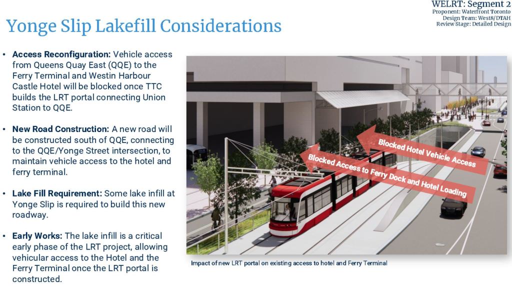
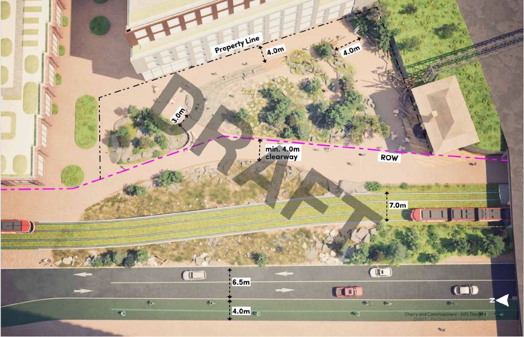
Yonge Street Slip and the LRT East Portal
The eastern portal from the LRT tunnel under Bay Street has been through a lot in the design project. Notable by its absence in the drawing below is an arched latticework canopy that was intended to offset the brutalist character of a plain tunnel mouth. That canopy (and a matching one for the west portal) was an early victim of cost cutting.
In the early WELRT plans, the portal would have been east of Yonge Street, but this ran into underground utility conflicts that would have been challenging and expensive to overcome. Shifting the portal westward eliminated one problem, but added the blockage of the existing Westin Hotel’s entrance on Queens Quay (itself no architectural gem).
To address this, the Queens Quay plan proposes partial filling of the Yonge Street slip to provide an eastern access to the hotel that would also be shared by the ferry terminal.
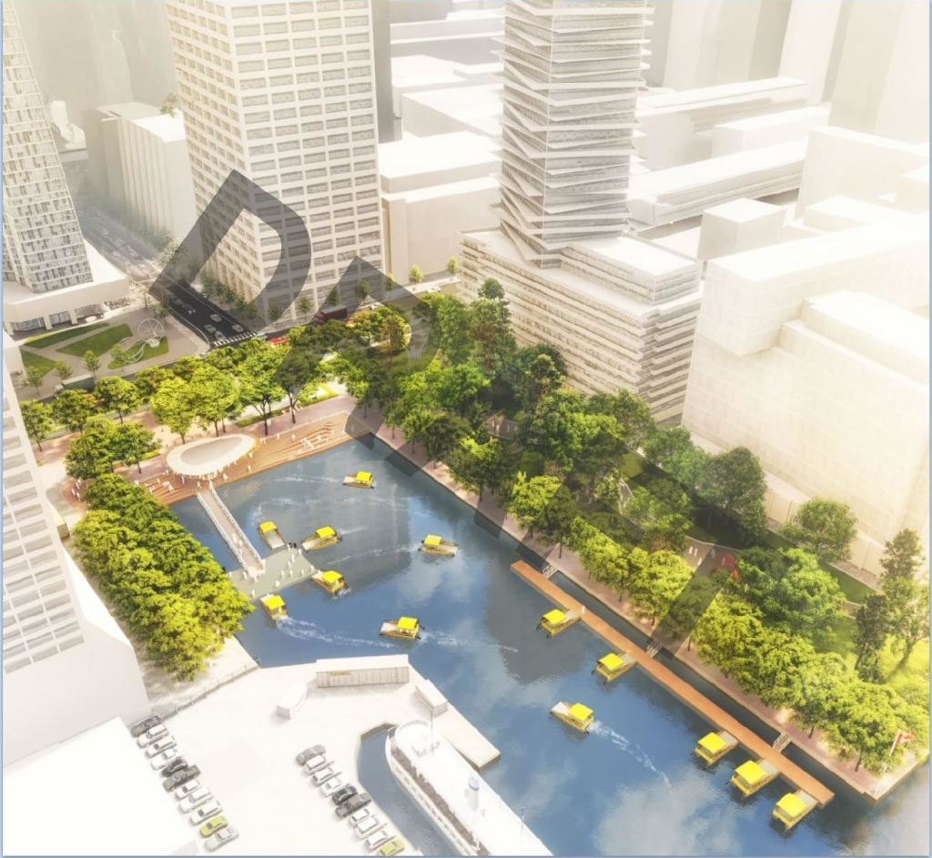
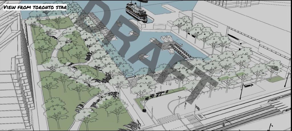
The drawing below shows the layout at the north end of the Yonge Street Slip. There are competing interests for this small chunk of land including hotel access, a water taxi terminal and hopes for a public space at the foot of Yonge.
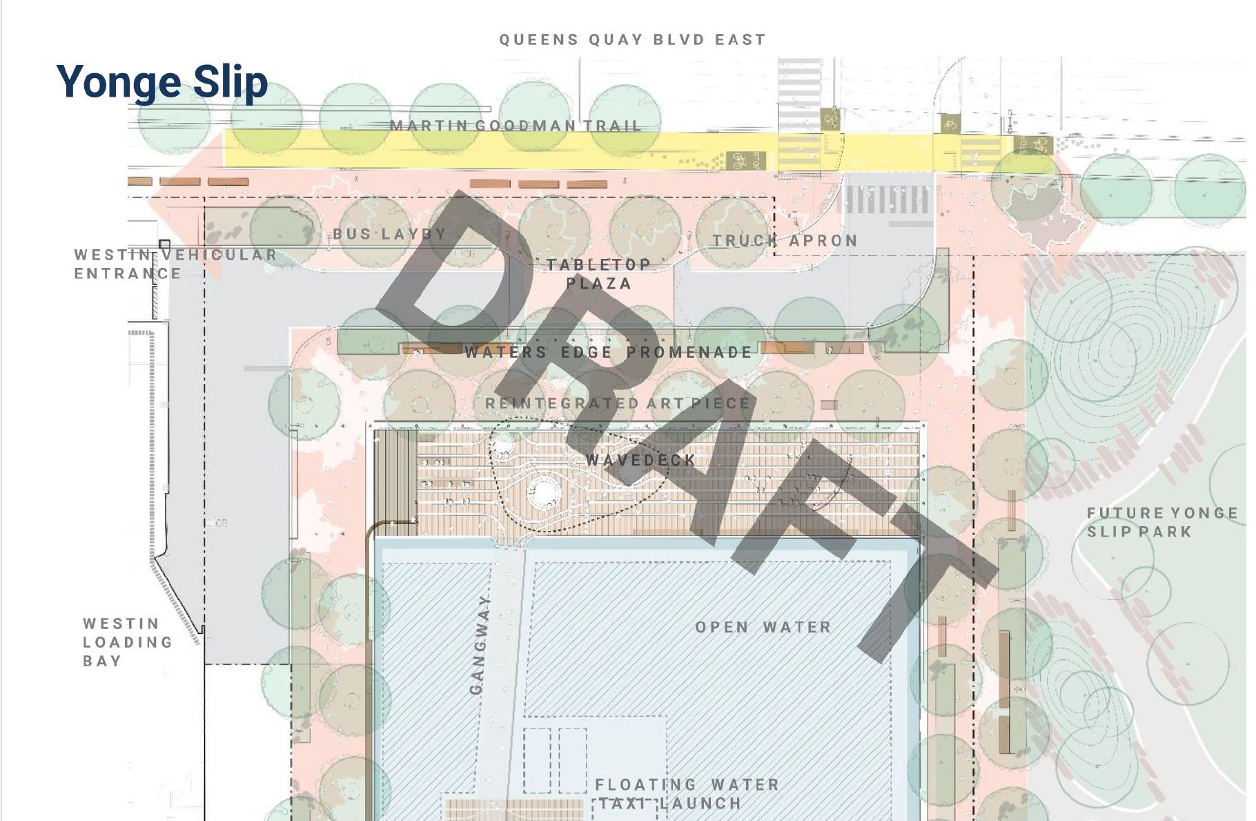
The top pair of images below show the layout from the southwest and from the northeast. The bottom pair show cross-sections looking east at the west (left) and east (right) ends of the slip.
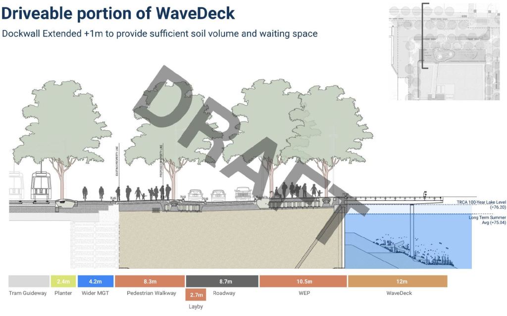
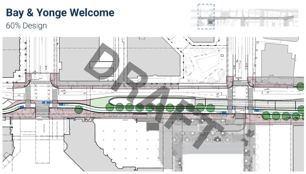
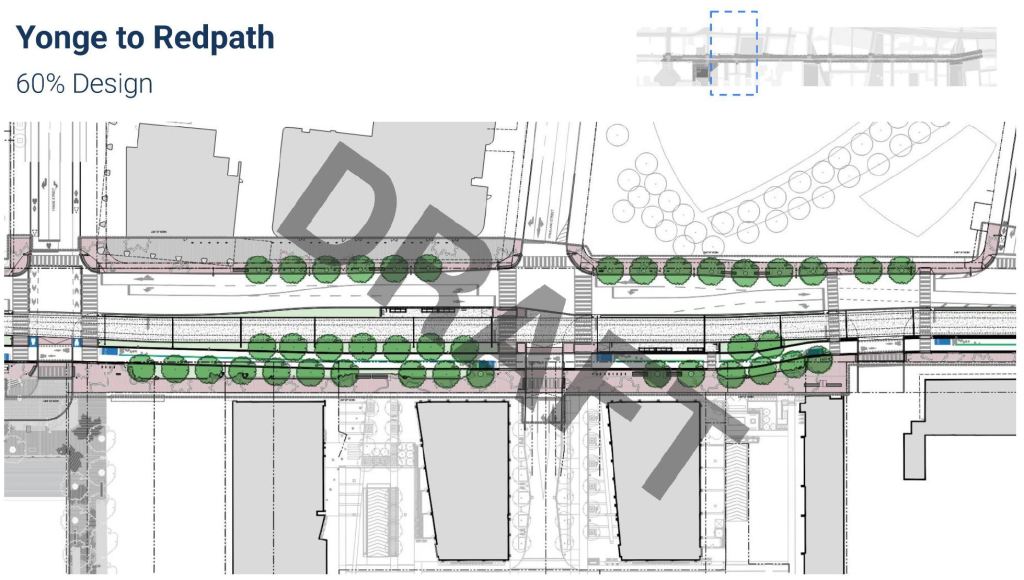
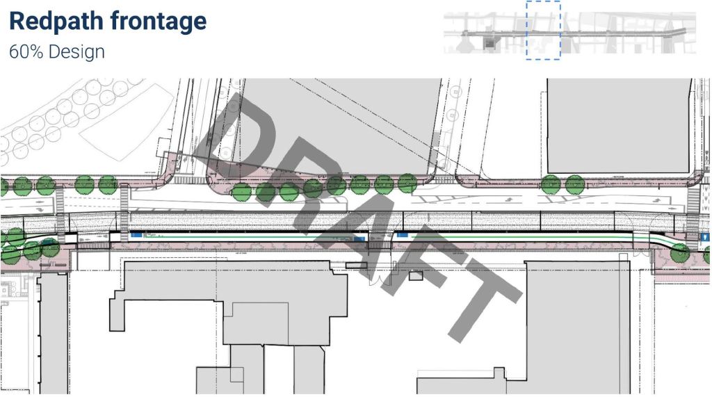
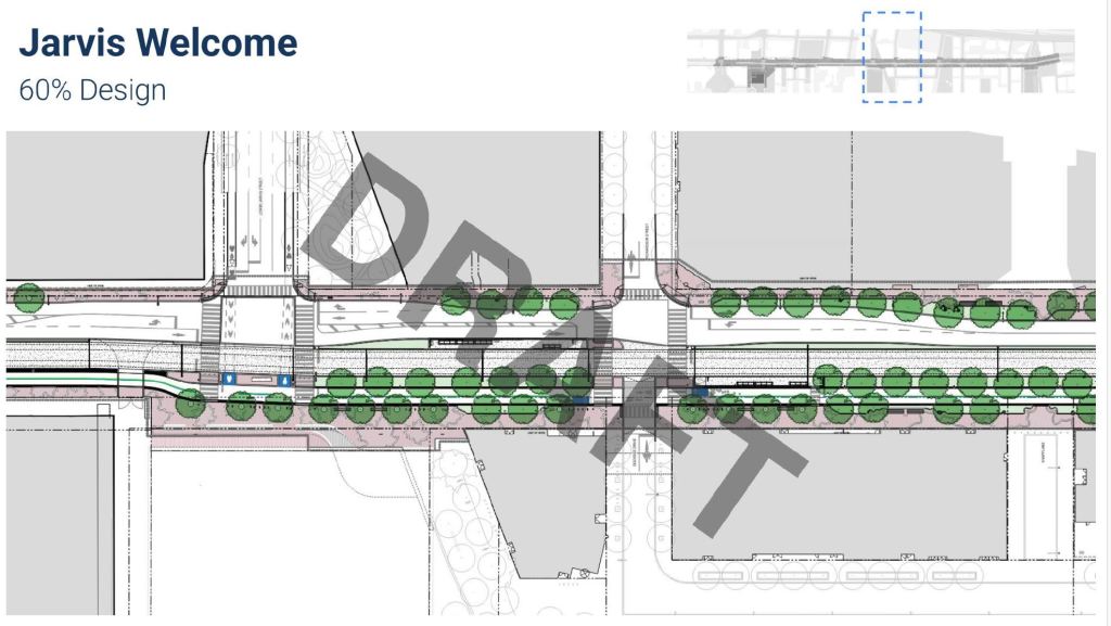
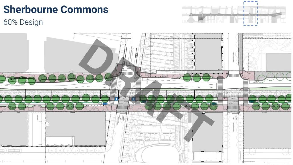
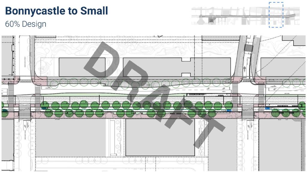
Queens Quay East
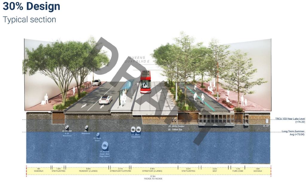
Along Queens Quay east from Yonge to Parliament, the proposed design has been changed from what was shown at the 30% design level (left) to the current 60% level (right) as noted on the drawing.
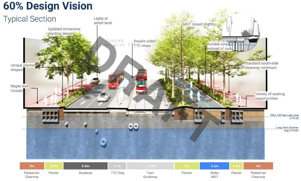
Intersections on Queens Quay must serve many types of “traffic” including pedestrians, cyclists, transit and motor vehicles, all in a limited space. Compared with Queens Quay West, there is an attempt to clearly mark the spaces for each group with a mixture of pavements and greenery.
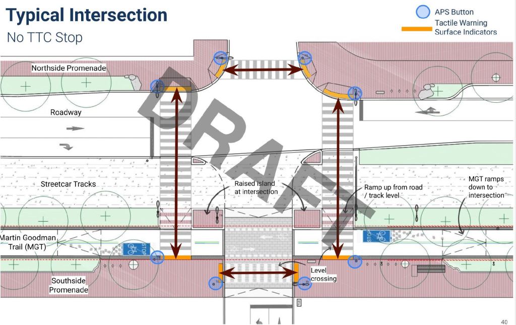
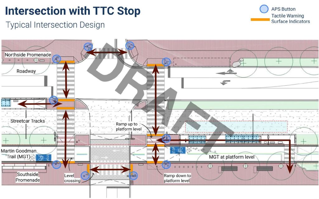
Anyone familiar with Queens Quay as it exists today will know that this represents a major reallocation of road space from what is now a car-dominated area.
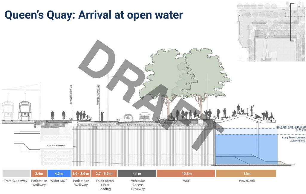
The overall proposed layout from Bay to Parliament is shown below. The “Welcome” zones correspond to major lake access points. The first drawing shows the portal area west of Yonge, and the series moved east to Parliament. Transit stops, all farside, are located at Freeland (east of Yonge), Jarvis and Small (west of Parliament).
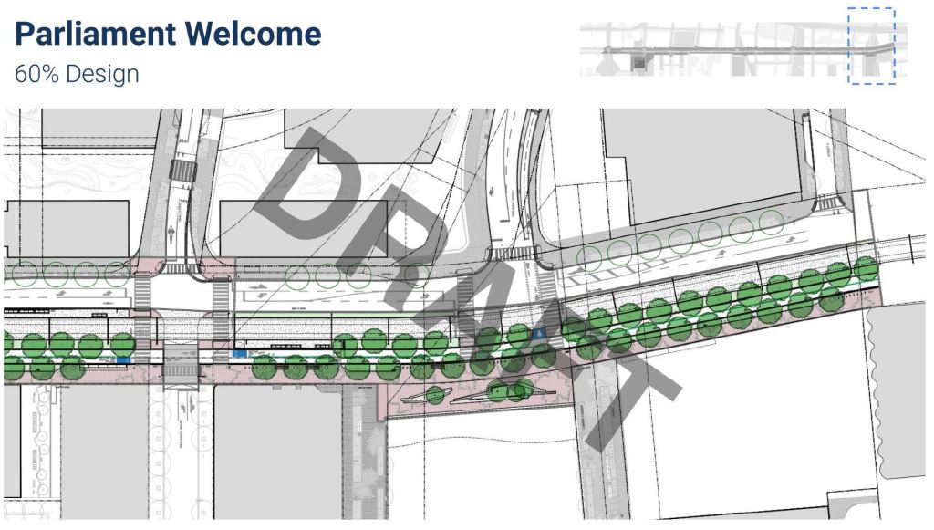
Distillery Loop and Cherry Street
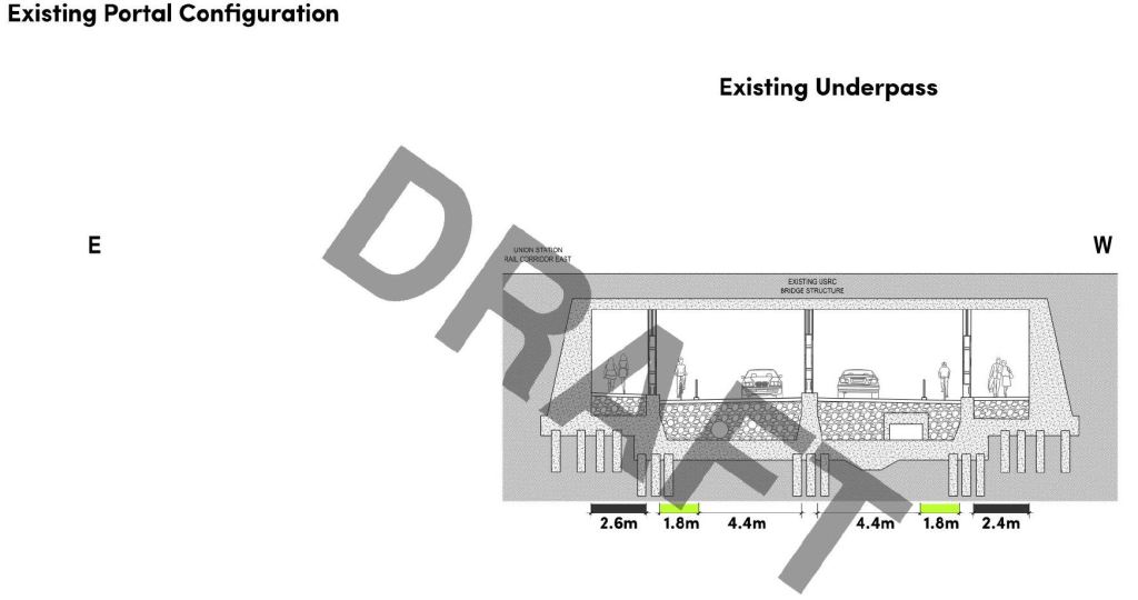
A link from the existing tracks on Cherry Street at Distillery Loop and the WELRT on Queens Quay requires the creation of a second underpass at the GO corridor so that various types of traffic can have their own space.
The first pair of images below contrasts the existing and proposed flows. The second pair shows the addition of a new eastern underpass that would be shared by pedestrians and transit. The west underpass would be reconfigured with a two-lane vehicle segment, cycling and pedestrian lanes.
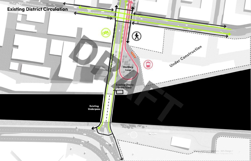
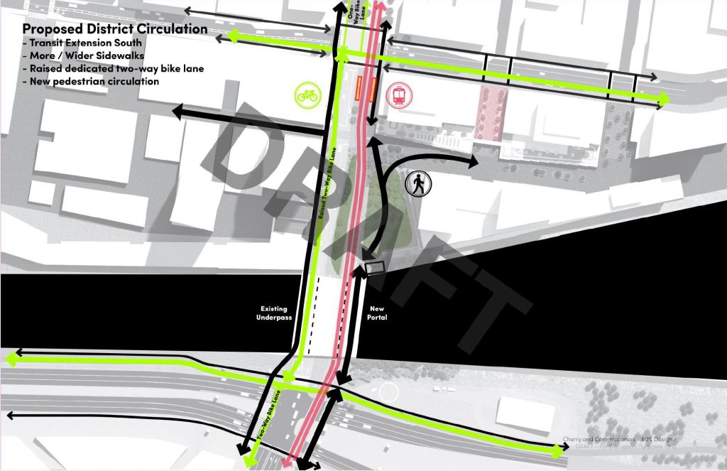
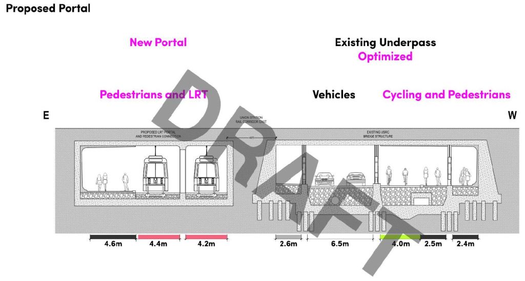
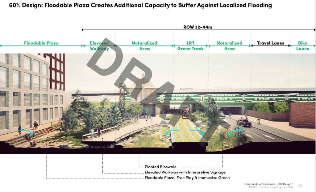
The area now occupied by Distillery Loop would become landscaped open space, but would be designed as a flood overflow area. The Cherry streetcar tracks and pedestrian walkway would be at a higher level
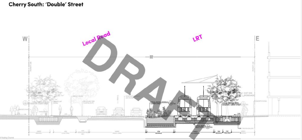
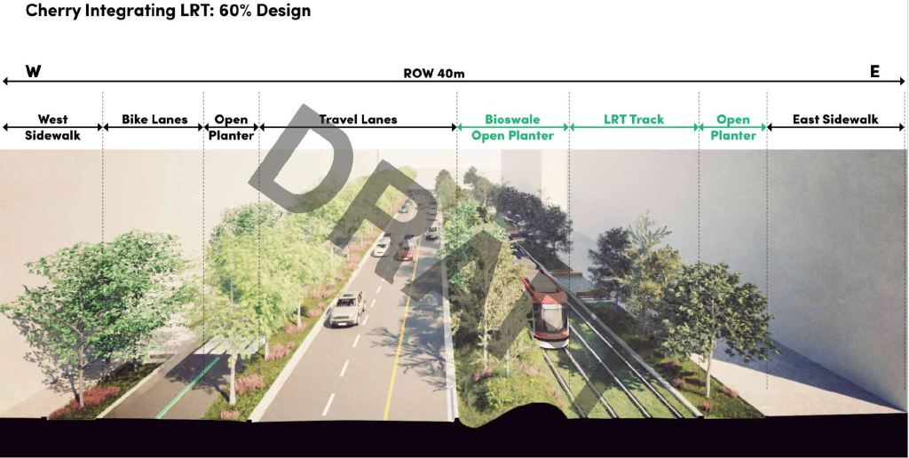
Cherry South to Commissioners
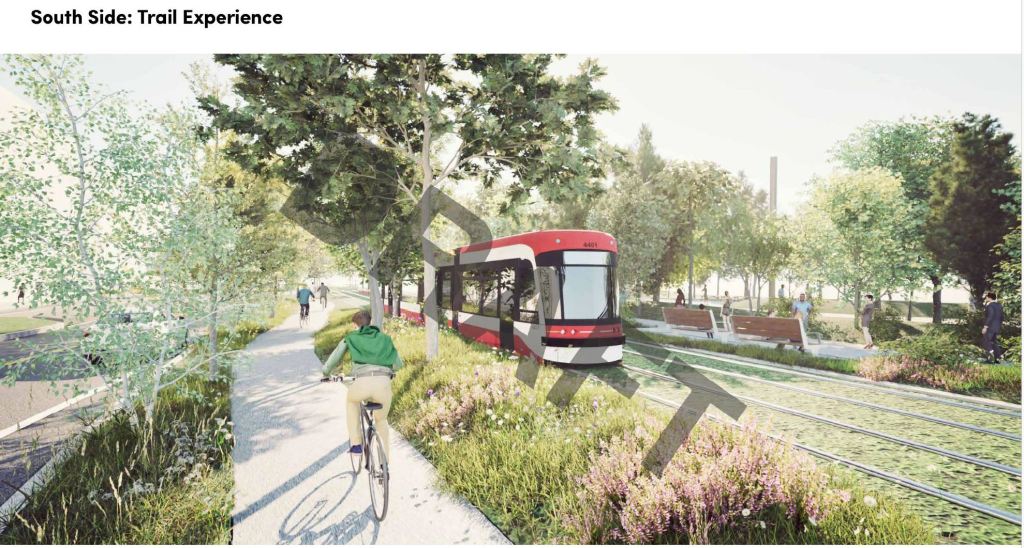
Cherry crosses the Keating Channel (former Don River outlet to Lake Ontario) with a pair of new bridges, one for road, cyclists and pedestrians, and the other for future transit use. The proposed layout shows the streetcars running in their own green space on the east side of Cherry, road lanes in the middle, and cycling on the west side
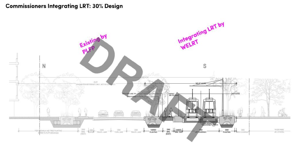
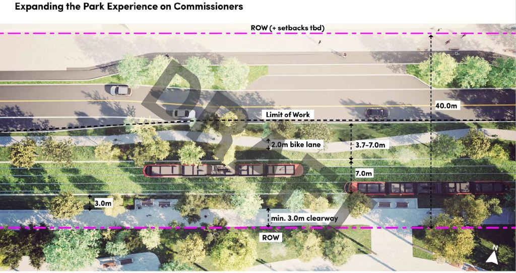
Commissioners Street
The WELRT turns east from Cherry and runs along the south side of Commissioners to an on-street loop just west of the new Don River. The design makes the streetcar line a northern extension of the park south of Commissioners Street. This is an unusually bucolic vision for a Toronto streetcar line, and I hope it looks this good “as built” compared to the drawings.
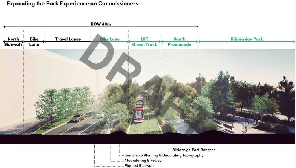
Green Track
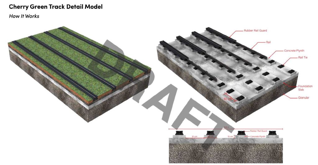
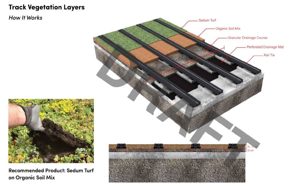
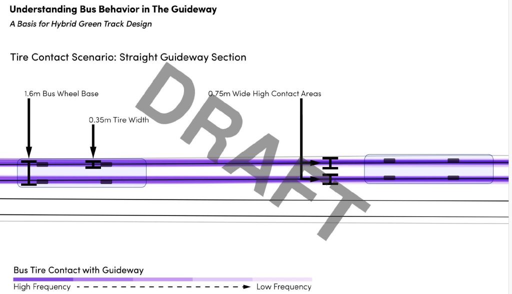
The proposal includes green track for parts of the WELRT, although the exact design has not been finalized. The intent is to be green, but also for buses to be able to use the same corridor and that requires a mix of planting and a solid surface to support bus tires.

WT has, very unfortunately, stopped posting most documents on its website while they work out how to make them AODA compliant. I strongly doubt that the purpose of AODA was to restrict information sharing and it is sad to see WT, who were once exemplary about sharing information, doing (or not doing!) this.
LikeLike
This project – Waterfront East Light Rail Transit – is now long overdue. The longer it gets delayed, the more costly it will be come. Start building it now, or it may never be built.
The construction on this project include expanding the current streetcar portal at Union subway station at the west end of the LRT line; it may likely mean some temporary shuttle bus operation on the “509 Harbourfront” streetcar route to accommodate construction.
LikeLike
The anti-transit folks at city hall and Queen’s Park keep finding ways to delay, delay, delay….
…hoping that eventually any transit project will be cancelled.
LikeLike
Those PDFs are pretty big.
The problem with phase 3 along Commissioners is that there will be a whole lot of heavy truck traffic while all the residential stuff is built further west. This will smash up any roadway put into place. Making Commissioners the nice two-lane road with separate spaces for transit and bike and pedestrians is unrealistic until the truck traffic has died down, and that will take years.
Back in the old days, the TTC might have used temporary tracks. These days, with the Flexities, that’s not really realistic.
So even with the best funding and will to build it, I don’t expect to see streetcar tracks east along Commissioners for a decade or two.
Steve: The PDFs are what I received from Waterfront. As for Commissioners, going east of the Don requires a second parallel span for the LRT as well as relocation of the Hydro towers. They may get to Broadview to link with the Ontario Line, but to Leslie Barns is a stretch.
LikeLike
No; the Queen’s Quay East Extension ought to be extended east along Lake Shore Boulevard to Woodbine Avenue and then north along Woodbine to Woodbine Subway Station, and the Cherry North Segment should be extended north to the new Ontario Line Corktown Station and the Line 2 Sherbourne Subway Station; then you’ll have something useful.
Steve: The Cherry North segment does not line up with the Corktown Station at Parliament Street. Sherbourne is even further west. Eventually there will be a direct link to the OL at East Harbour Station via the Broadview Extension. As for Woodbine Station that is wildly beyond the purpose of the WELRT, leaving aside that a streetcar line would not fit on Woodbine especially with its own right-of-way.
LikeLiked by 1 person
At the very least colourize the concrete to appear green (or red). My father worked with concrete back in the 1960’s, and he coloured his concrete to create a red patio.
LikeLike
There is apparent space for a ROW on the south side of Commissioners from New Cherry to the New Don river. Although right on the riverbank there’s an elaborate planting of trees and shrubs so they’re not expecting a span here any time soon.
Queens Quay E has got its reserved bus lanes and it does help quite a bit. Too bad the 114 is now more bunched that usual. The following bus passed my bus towards the end of the route, yesterday and today.
LikeLike
A BRT would serve this route better. The Commission should commission a study to study the benefits of BRT vs LRT for this route.
Steve: There are two major problems for a BRT. First, there is no road capacity on Bay Street or in streets near Union Station for BRT lanes. Second, the volume of transfer traffic to/from the subway at Union would overwhelm the streets, even assuming that the TTC could run a frequent service.
LikeLike
This problem can be solved by putting the BRT underground where needed, there simply isn’t enough demand on this route to justify an LRT. Nice electric articulated busses will be more versatile than streetcars and save residents from years of track work.
Steve: Buses will not fit in the existing tunnel, and expansion at Union would still be needed for capacity, not to mention problems for buses with the tight curve. This idea is a non-starter.
LikeLike
Are you an engineer? No which is why this needs to be studied by experts. You remind me of people who used to claim that flying was “a non-starter” until someone made it happen. What laws of physics would it violate to put a BRT there? If you cannot answer this, then you should stop dismissing things as non-starters.
Steve: There have already been studies of repurposing the Bay Street tunnel. You have not been paying attention. More generally, it is well known that vehicles that are not tethered by rails need more room because they cannot hold tightly to a path in narrow space. This issue has come up, for example, in critiques of the design of some streetcar rights-of-way with centre poles for overhead support. Buses cannot use them because there isn’t enough clearance. The Bay Street tunnel is quite narrow in places to the point that windows were restricted on PCCs serving the line initially so that riders would not stick out their arms or heads. An underground loop for buses at Union would be particularly difficult.
My expertise lies in IT, but I have learned enough from engineers over half a century to know when their claims have the ring of truth as opposed to convenient BS.
LikeLike
This is a fantasy project, we have been hearing about it for decades but it will never be built and rightfully so. This will go down along with Waterfront West LRT and SmartTrack to the dustbins of history.
Steve: However, the eastern waterfront development depends on transit access and was planned assuming that it would already be there by now. The foot-dragging by all governments while they pander to other parts of the GTA with vanity subway projects is disheartening.
LikeLike
They need to get this started last year. It seems like the most shortsighted blunder in the city’s history for us to not prioritize this. We have spent billions to build this new are for densification. All the infrastructure is there and ready to go. But transit? nah, lets just run a bus for now. How stupid are we as a city when we can dump billions into extending line 5 (which is not even operational, and already served by buses) But can’t fund this. This should have come before the Line 5 extensions or the SRT tear down. But here we are, will this even get underway at any point in the next year, 5 years? 10 years? probably 20 years for us to get a half built butchered mess that serves no real utility and leaves Union a giant clusterfuck like it is today. Sorry but it’s hard to stay optimistic sometimes.
Steve: I am in much the same boat as you having been involved in community consultation about both halves of the Harbourfront line for decades. There was always some other transit bauble more important.
LikeLike
John Norton is contradicting himself. On the one hand, he is complaining about the Eglinton line being extended which route is already served by busses and on the other hand, he is demanding the Waterfront East LRT which route is already served by busses. Articulated busses are the way to go when it comes to the Waterfront east and west routes.
Steve: There is far less bus service on Waterfront East today, and a lot of pending growth in demand. It is also impossible for a frequent bus service to link to Union Station given road constraints in the area.
As for Waterfront West, that scheme was born in an era when GO refused to serve riders inside Toronto. Now we are looking at increased service and a station at Park Lawn. Also, unlike the eastern waterfront line, the western line will not serve future development in its proposed corridor from Dufferin west to High Park. At most we will see a connection from Exhibition to Dufferin Loop, but even that is dubious given possible conflicts with the Ontario Line.
LikeLike
This will never be built unless there is a regime change in this country.
Steve: Toronto may have political problems but not on that scale.
LikeLike