
The October 22 meeting of Toronto’s Planning & Growth Management Committee saw the launch of the 2013 edition of a report tracking residential and commercial development patterns in the city.
How Does The City Grow Website
If anyone needs proof that downtown is the focus of development in Toronto, they need only look at the numbers in this report.
Development in the Greater Toronto Area is strong, but Toronto itself is taking a larger proportion of the total. Across the GTA, dwelling unit completions have been on a long decline since a peak in 2002 while completions within Toronto have grown. Toronto’s proportion of the total rises as a result with over 40% now located inside the City.

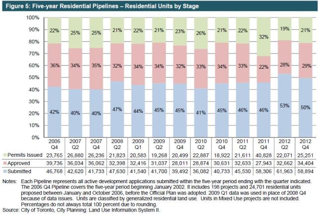
City Planning tracks development applications within a five-year “pipeline” which allows for the long lead times between initial applications, approval, construction and occupancy of buildings. This smooths out year-over-year variations, but also flags a turndown in future growth if the early stages of that pipeline start to dry up. There is little sign of this happening up to the 2012 data, although the proportion of applications relative to the total rose slightly.
The overwhelming type of new residential development is in the apartment form (this includes condo and rental projects). This is not surprising considering that there is almost no vacant land in the city suitable for low-rise development on the scale we see in greenfield subdivisions outside of Toronto.

New development is not evenly distributed across the city, but is concentrated in a few locations, notably downtown.

During the five-year period 2008-2012, 41% of the proposed residential units were downtown. This shows very strong market demand to live close to the core, but a related number is the 39% of proposed non-residential floorspace (GFA in the chart above) that is downtown. Downtown commercial development in Toronto is, today, 25% of all such development in Canada.
Although City Planning puts a brave face on things, Table 3 also reveals the comparative failure of the “Centres” as planning mechanisms to focus development. Only 8.7% of all residential and 3.5% of non-residential proposals are in the four centres: Etobicoke, North York, Scarborough and Yonge/Eglinton. Scarborough Centre has almost no development planned at all.
The data presentation caused some confusion at the P&GM meeting when North York Councillor Filion compared the “38%” number for his centre with the numbers for downtown. He was gently reminded that this was 38% of the 8.7% for all of the centres combined.
Where data consolidation does mask important details is in The Avenues, those major streets that are targets for future development, and in the “Other” category.
Almost one quarter of residential proposals are sited on The Avenues (the brown stripes in Map 1 below), but this is not broken down by city region. Some areas have a great deal of development proposed and already built (many of the early projects in the 2008-2012 pipeline are already substantially completed), while other areas have nothing. Are The Avenues actually directing development or simply endorsing what would happen naturally?

Almost 40% of non-residential development lies in “Other” areas many of which are designated employment zones.
The actual development patterns are clear in the overview maps (for full size versions of all illustrations here, please download the source document from the City’s website linked above).


The growth of downtown residential population is not tracked in this report, but a few comments at recent meetings give some indication of what is happening. Cllr. Vaughan spoke of the development pressures in the Entertainment District where the population has gone up 125% in the past four years. At a recent briefing on the Gardiner Expressway, Deputy City Manager John Livey noted that the population of Planning District 1 (downtown from roughly Dundas to Lake Ontario) has tripled between 2006 and 2011. With the developments in the pipeline, this pattern will continue.
Non-residential space translates to jobs, and this puts great pressure on the transportation network. Some of these jobs will be taken by people who will walk, cycle or take surface transit to work, but many commuters will come from further afield via the subway and GO Transit. The idea that downtown “has enough subways”, to quote Mayor Ford, would be dubious with the existing level of demand, but seen in the context of future development the statement shows foolhardy disregard for investment in city infrastructure.
There will be growth in the suburbs, but not at the scale of the core area. Moreover, it is unclear that simply designating an area for growth will actually produce the desired effect without considerable incentives. Motions by Cllrs. Vaughan and Nunziata approved by the Committee speak to opposite sides of the same issue:
The Planning and Growth Management Committee:
1. Directed the Chief Planner and Executive Director, City Planning to report on how to create a policy framework to cap growth in areas of hyper intensification and re-direct development in a strategic way to other parts of the city.
2. Requested the Chief Planner and Executive Director, City Planning in consultation with the General Manager of Economic Development and Culture, to report back to the Planning and Growth Management Committee on the methods the City of Toronto could employ to stimulate economic development in areas currently underused or vacant.
In the case of downtown, there are areas where developments, many proposed at substantially above the zoned density for the land, are skewing the property market and straining services for current and future residents. In other parts of the city, notably Weston which is among the lowest income areas in Canada, there is plenty of land to develop, but no activity. How much power does the City actually have (or wish to exercise) in shaping its future growth?
Major transit lines are planned or under construction, but it will be a decade before we see their effect. Meanwhile, large areas now served by subway lines see little development. How much of this is nimby-ism throttling growth and how much is simply market forces building where there is both a market and a profit?
The disconnect between actual and proposed development, and the goals and dreams of the City Councillors and their neighbourhoods is quite striking. Without significant intervention by Council, a move that would be ideologically distasteful to many and certainly would be subject to legal challenges, controlling development, especially that which can occur “as of right”, will be very difficult. Should the transit system be built to serve what is there today and what we know will develop, or will Council persist in planning based on dreams that do not match market realities?
