
With Toronto’s Congestion Management Plan in the news, we hear about various ways to improve the movement of cars and, oh, by the way, maybe speed transit vehicles too. Toronto talks a lot about “transit priority” but this more often means giving transit vehicles the leftovers, the spare time that can be shaved at some locations from competing traffic, not absolute priority for transit vehicles.
This shows up particularly where transit vehicles have a dedicated lane, but they must wait patiently while other traffic, typically left turns, gets out of the way. This has the perverse effect of making transit slower particularly when combined with the “double stop” effect of farside stops. At these locations, the nearside space a stop would normally use is occupied by a left turn lane, and traffic in that lane has first claim on a green cycle.
Two routes with this as a near-standard stop configuration are 510 Spadina and 512 St. Clair. The Spadina car only recently returned, and I will leave comparative analysis of bus and streetcar operation there until more data have accumulated. A preliminary look is not complimentary to the streetcars because, unlike them, the buses are able to combine waiting for green signals with loading passengers.
On St. Clair, streetcars returned in Fall 2024. This article reviews tracking data for March 2025. In brief, a common situation along the route is that streetcars spend more time waiting at intersections than they do serving stops once they cross to a farside platform. The traffic signals are not organized to favour streetcar movements, and the configuration with farside stops is counterproductive.
To be fair, one cannot simply throw a red signal in front of cross traffic every time a streetcar appears as this will affect both auto and pedestrian crossings that require a minimum time. When both the St. Clair and Spadina lines were designed, a concern was the frequency of streetcar service and the high probability that there would always be a streetcar demanding priority. However, the larger Flexity cars combined with TTC service cuts makes this claim less valid.
Pre-emptive streetcar signals could be challenging at some locations, but there is the separate issue of timing of the phase for left turning autos. Should it come before or after streetcars are allowed to cross the intersection? Streetcar-only phases are only provided at some locations on Spadina where cars are turning across traffic lanes, but not for through movements. There is a streetcar-only phase at Lansdowne and St. Clair westbound, but otherwise left turning auto traffic always has priority.
A related problem lies in TTC’s glacial streetcar speeds through special work which would require a lengthy transit phase to allow streetcars to clear intersections on Spadina with streetcar junctions. With streetcars crossing on the shared north-south green, this does force motorists to wait for streetcars to get out of their way.
The data on St. Clair show a common pattern: streetcars spend more time waiting to cross intersections than they do serving the farside stops. They may operate in their own lane, but the combination of farside stops and signal design works against transit operations. This has implications for the soon-to-open “LRT” lines on Eglinton and Finch.
If we are not prepared to give transit vehicles true priority over cars, how do we expect to attract more riders to the system and, in theory, reduce overall road demand?
The remainder of this article describes the methodology behind my analysis and shows the behaviour at individual intersections along St. Clair.
Methodology
All of the charts here measure the travel time on the approach to intersections, and on the farside where in most cases there is a transit stop. To do this, I created screenlines to track vehicles crossing the middle of an intersection and points 100m on either side of that. With typical Toronto streets being 20m wide (66 feet, or 1 surveyor’s chain), this puts the east and west screenlines about 90m either side of the intersection, or roughly three car lengths.
The model I have used for some time on this site for service analysis subdivides a route into 10m segments to simplify and “flatten” the geometry (a key consideration where routes do not travel in a straight line, although not a problem on St. Clair).
In an earlier version of the TTC’s tracking data, vehicle positions were reported every 20 seconds, but not all vehicles reported in every time slot. The current version gives times with any value for seconds, but records are not evenly spaced in time with occasional bursts within a few seconds, and other periods with gaps. I round the times to the nearest 20 second mark, and discard duplicates. The vehicle position is interpolated on the 10m scale between two successive reported locations base on 20 second increments for the missing slots. This produces tracking charts showing vehicle movements without gaps.
It is possible that a vehicle will be ahead of the 10m segment containing a screenline at time “t”, and after the segment at “t+20”. In this case, the assigned crossing time is “t+10”. This granularity in the crossing times means that any calculated travel time between two screenlines will be a multiple of 10 seconds. It could also be zero if both screenlines were crossed in the same 20 second timeslot. This is equivalent to a car traveling 100m in 20 seconds or 18 km/hr.
For route level analysis, these simplifications reduce the complexity of the data, but for very fine-grained views of a route, such as here, the granularity shows up in the calculated travel times between nearby points.
Reading the Charts
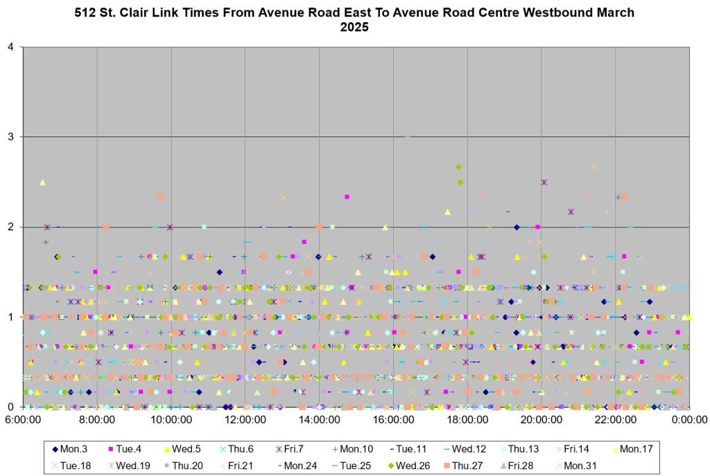
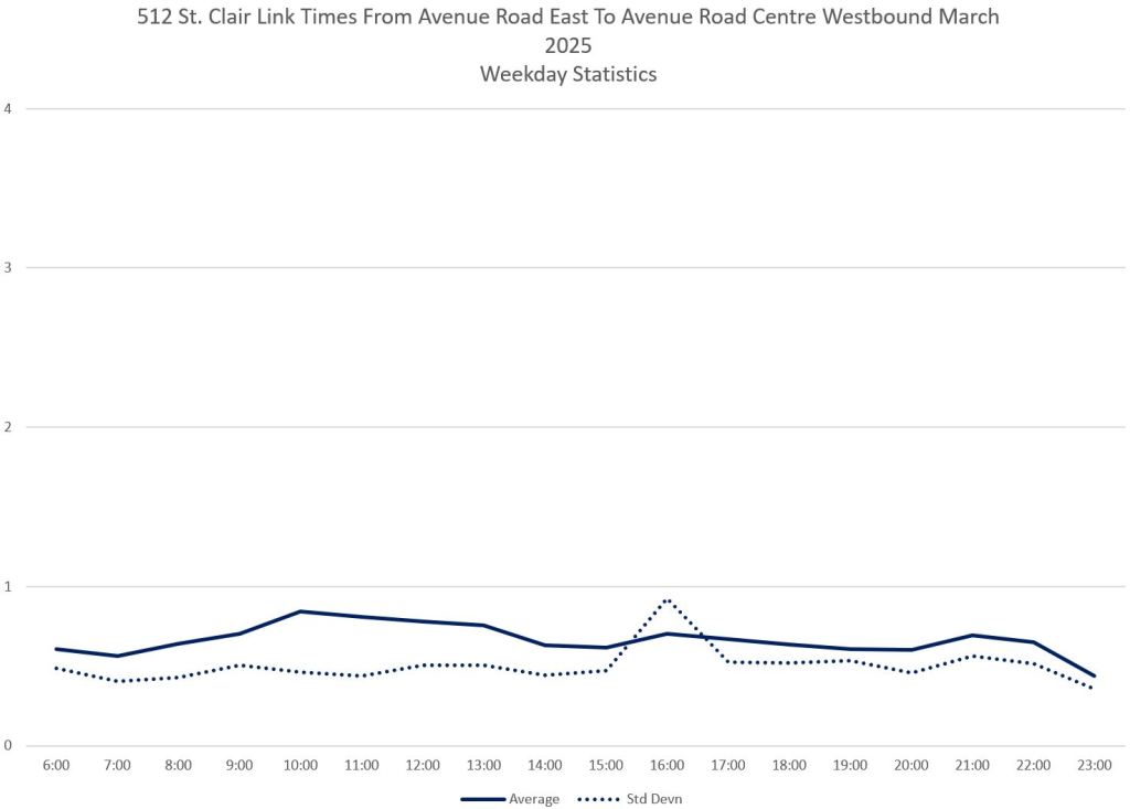
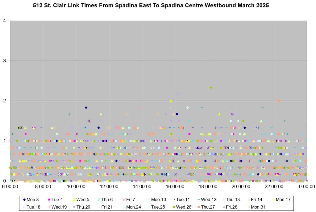
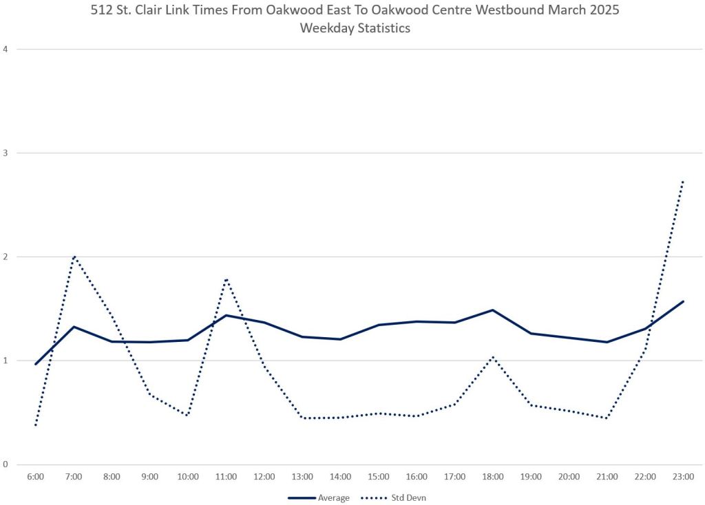
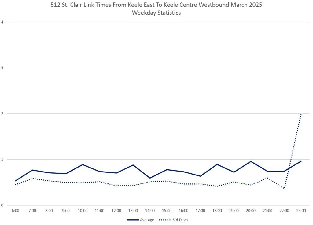
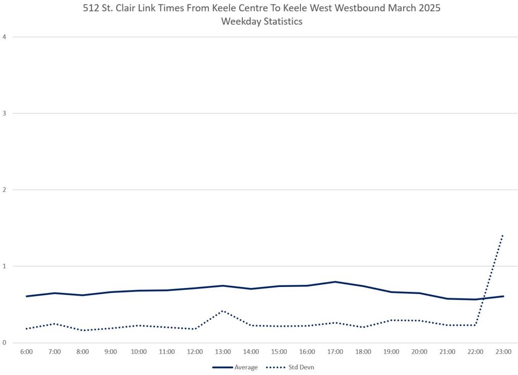
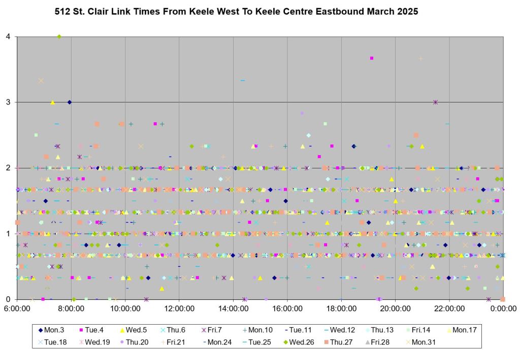
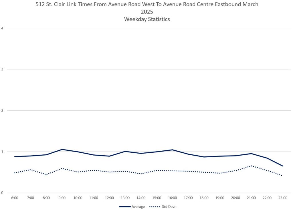
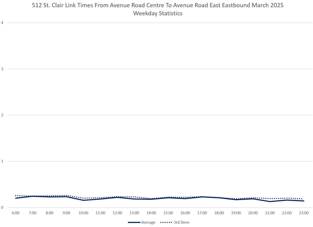
For each intersection and direction, there are four charts. On the left are the raw data points for all weekdays in March arrange by time of day (x-axis) and duration (y-axis). On the right are the average and standard deviation values (a measure of scatter in the values).
The top pair of charts show the times between the screenline on the approach to an intersection and the midpoint. The bottom pair show the times from the midpoint to the screenline marking the departure.
For intersections with farside stops (“FS”), the top pair show the time spent on the approach and waiting for a clear signal, and the bottom pair show the stop service time plus a small interval beyond the stop itself.
For intersections with nearside stops (“NS”), the top pair show the approach, stop service and waiting time, while the bottom pair show the time from the centre line of the intersection to the departure screenline.
The screenlines are named “East”, “Centre” and “West” corresponding to their relative locations.
As a general note, times on the approach side of an intersection (east side westbound, west side eastbound) are longer than on the departure side. Streetcars are caught by a red signal and have to wait to the next cycle to cross to their stop. This can easily happen thanks to time spent serving a farside stop during which the streetcar falls out of the traffic wave and arrives at the next signal too late to pick up any green extension that might be active there.
The differences between average times on the approach and departure side of intersections might appear small, but they are cumulative across the route.
Westbound
Avenue Rd (FS)
Travel times on the approach (east) are clearly higher than on the departure side of Avenue Road even though the latter includes the actual stop.
Although the values of the averages are not that far apart, the standard deviation of approach values is much closer to the average thanks to the wider range of values on that side of the intersection.
The spikes in the standard deviation values were cause by a delay where one car held at the stop (west side) and its follower held on the approach (east side). The delay was 11 minutes long and so the data point does not appear on the charts.


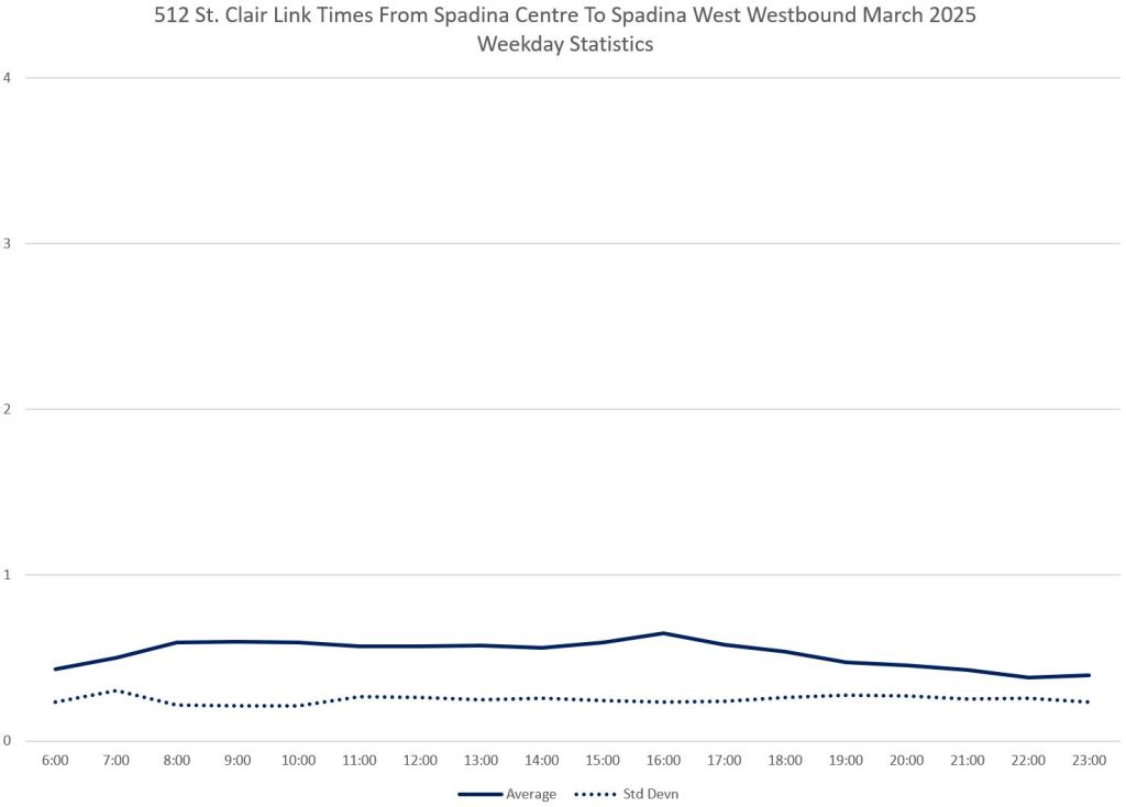
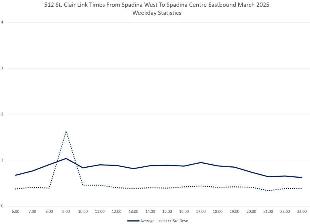
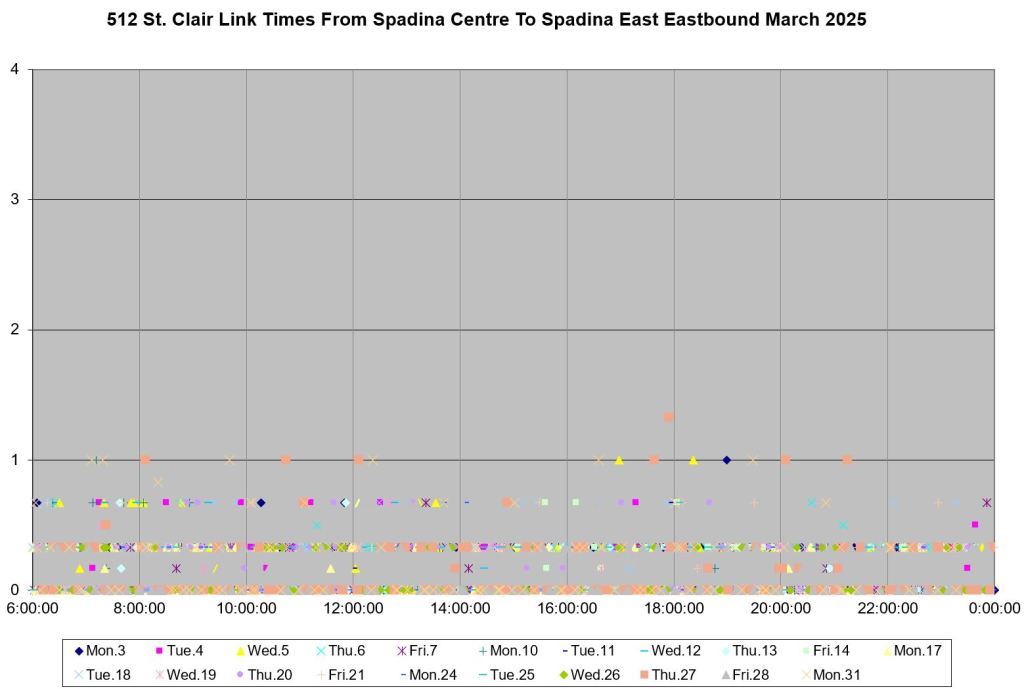
Spadina (FS)
As at Avenue Road, the travel times on the east side are scattered over a wider range than on the west side.

Bathurst (FS)
Bathurst sees extended travel times both on the approach and departure side of the intersection.


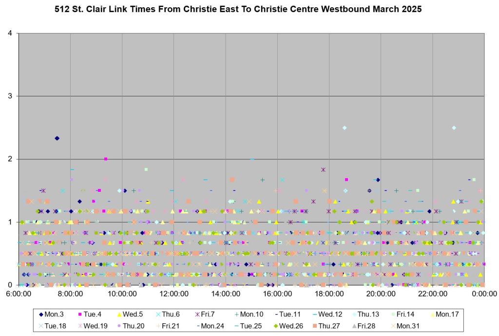
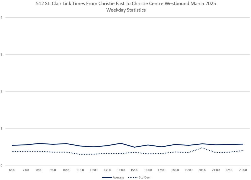
Christie (FS)
Although Christie is a minor intersection, times on the east side are longer than on the west.


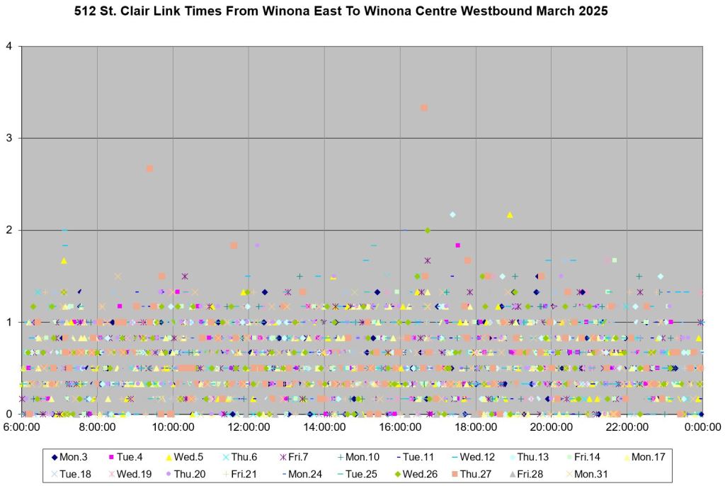
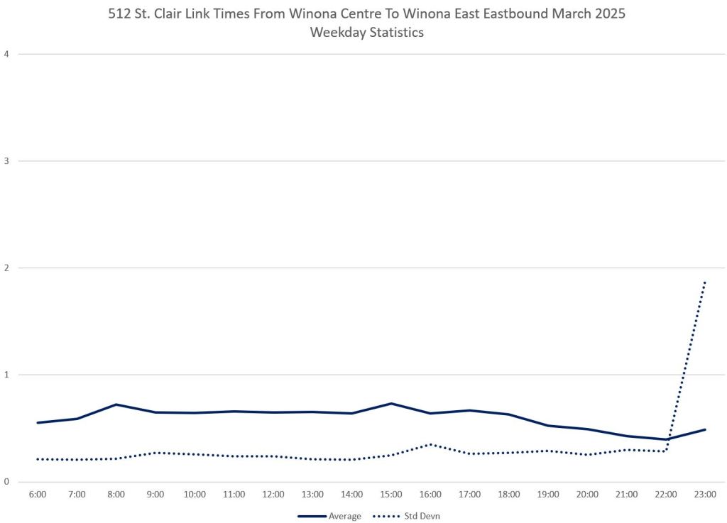
Winona (FS)
Travel times on the east and west side of Winona are not as markedly different as at some other locations, but there are still more scattered values (higher standard deviation values) on the approach (east).
The standard deviation spike at 11am on the west side of the intersection was caused by a delay near Oakwood that held service both ways on March 28. There is a corresponding spike eastbound at Dufferin.


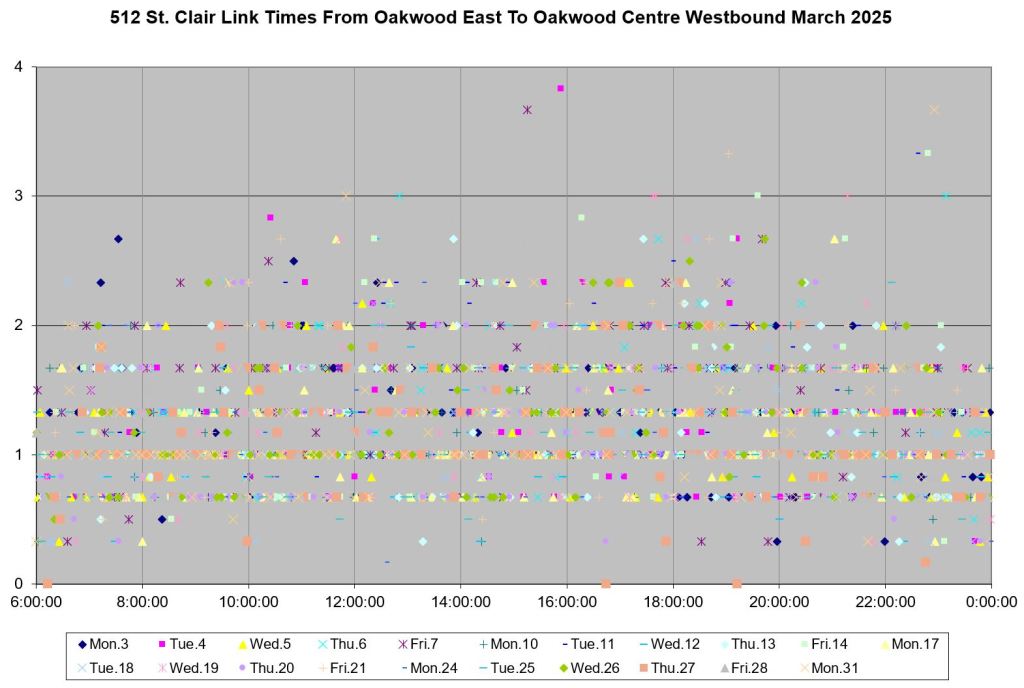
Oakwood (NS)
The stop at Oakwood westbound is nearside, and so travel times here include stop service times. There were also a few delays that skewed the standard deviation values on the east side.
By contrast, times on the west side are low. Although cars will cross the intersection at a walking pace due to the standing slow order on all special trackwork, the data points are clustered around the 20 second line.


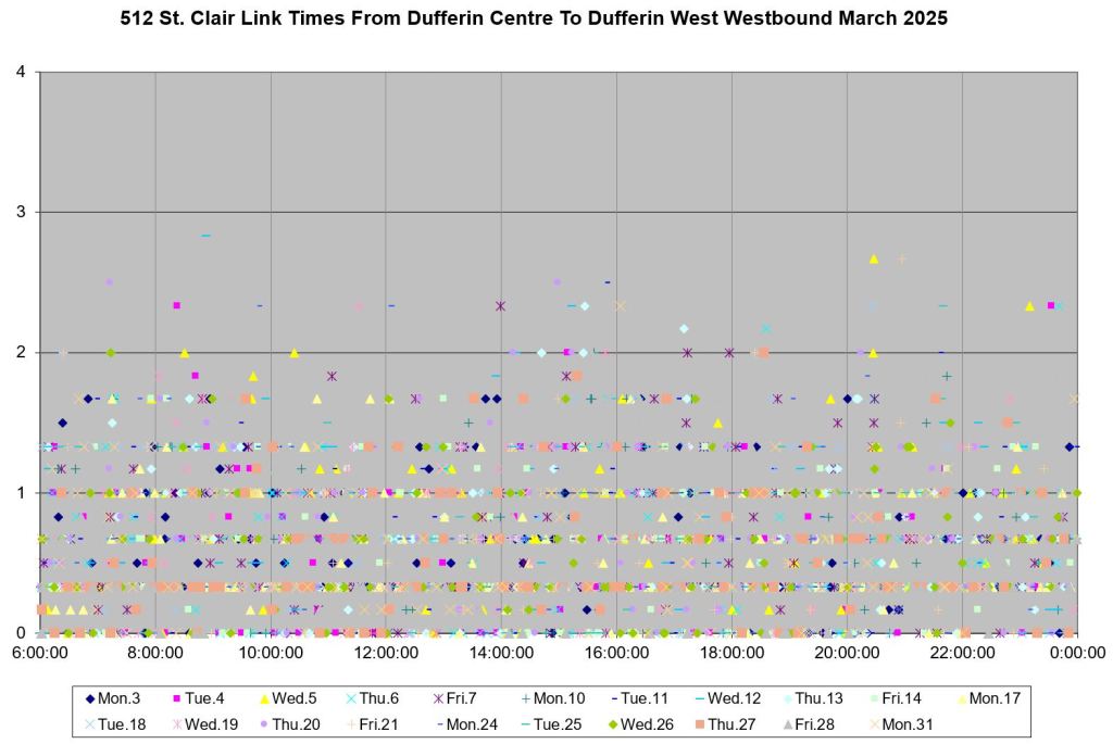
Dufferin (FS)
Dufferin westbound is unusual in having longer times on the west side including the farside stop than on the east side. This could be a case where detection for transit priority (green time extension) is working better than at other locations.


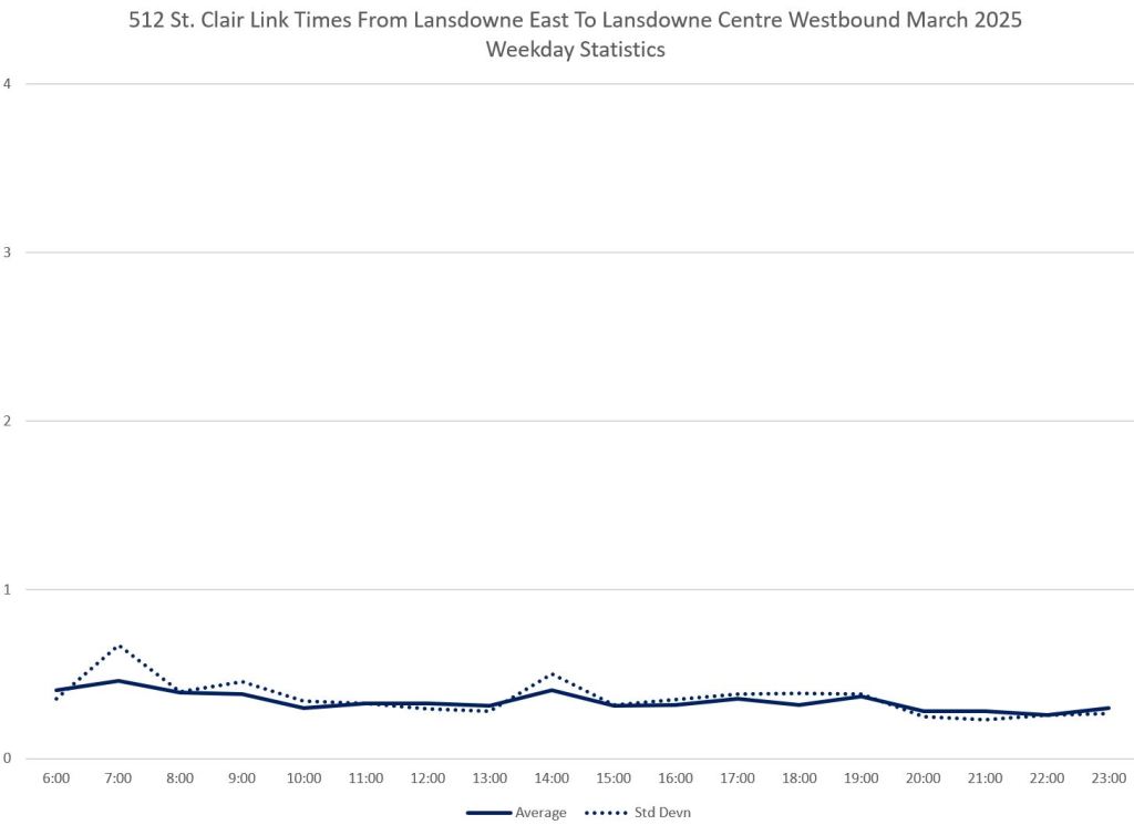
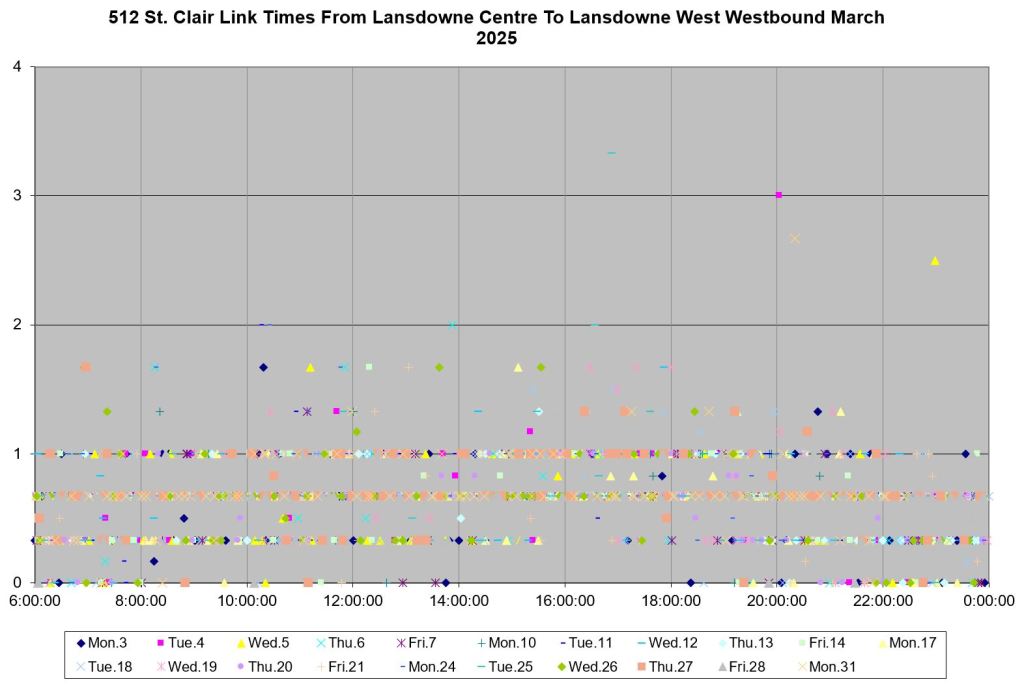
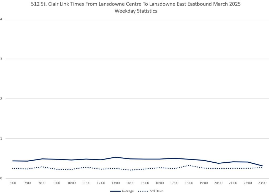
Lansdowne (FS)
The scatter in east side times at Lansdowne is higher than on the west side although the average times ar lower. This can occur due to streetcars waiting to make left turns south on Lansdowne to short turn at Earlscourt Loop.


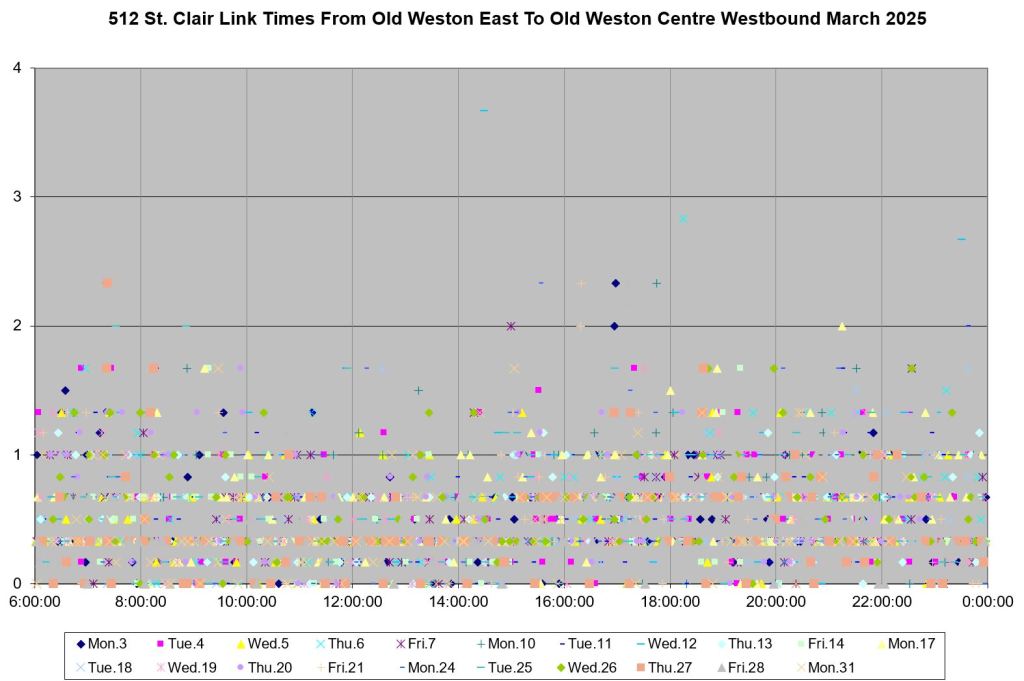
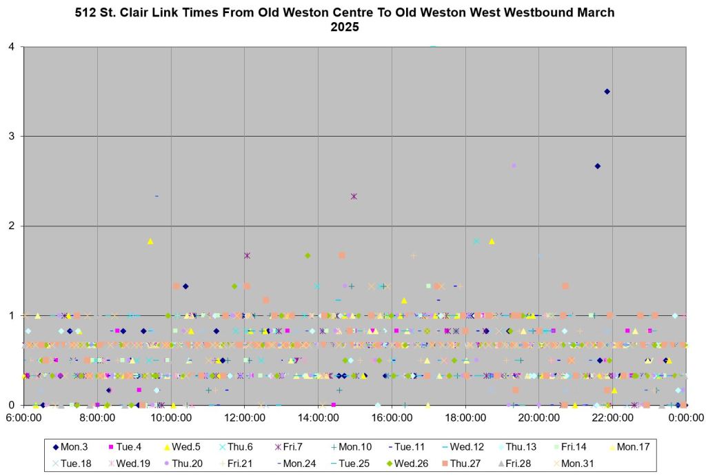
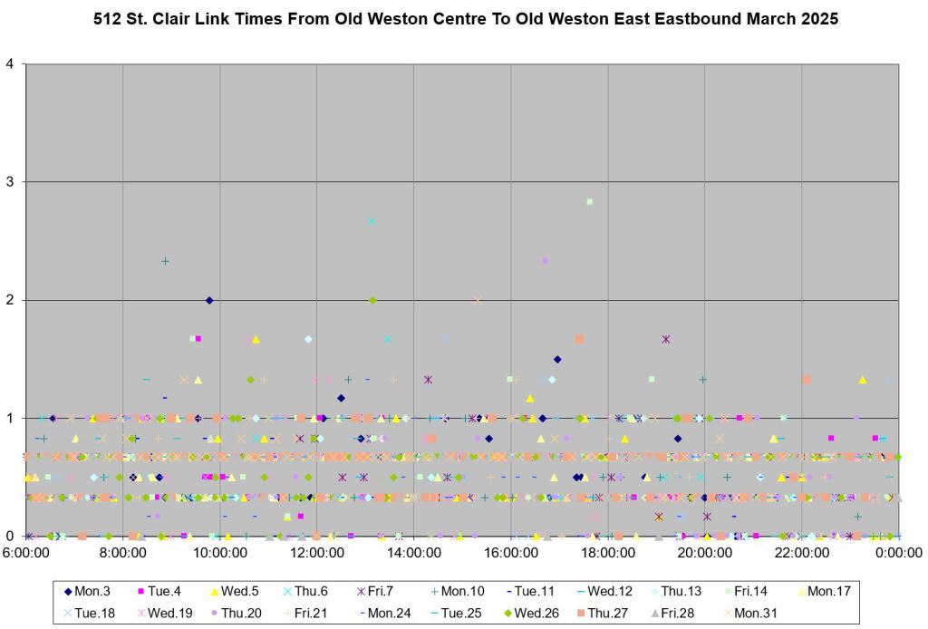
Old Weston Road (FS)
Old Weston shows the familiar pattern of longer and more scattered times on the east approach than on the west which includes the car stop.


Keele (FS)
Keele repeats the pattern seen elsewhere with more scatter in the eastern approach times and a slightly higher average.


Eastbound
Eastbound data show quite similar patterns to westbound.
Keele (NS)
The stop at Keele eastbound is nearside, and so the stop service time is part of the western approach to the intersection. On the east side, the times are very low.


Old Weston Road (FS)


Lansdowne (FS)
Approach times from the west at Lansdowne can be high because this is a crew change point.


Dufferin (FS)


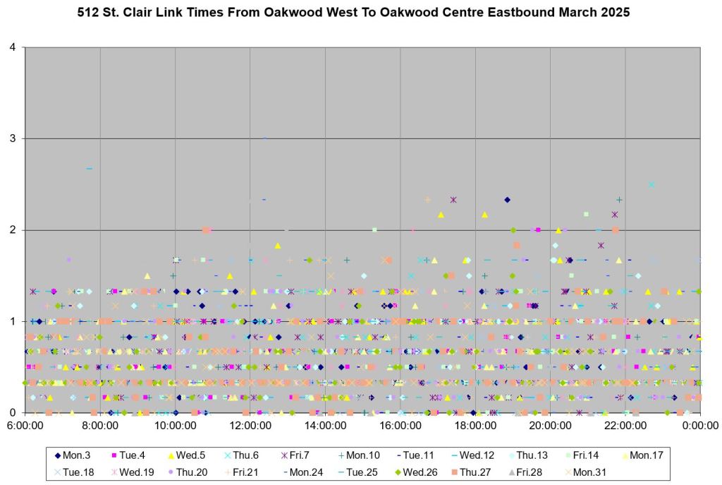
Oakwood (FS)
Times at Oakwood are generally high because these segments include the slow order on special track work at Oakwood itself and at Robina, just east of the stop.


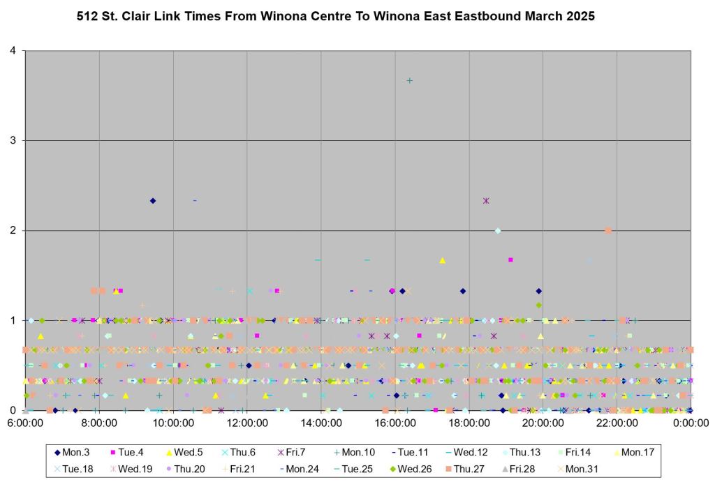
Winona (FS)
Winona is unusual in having low approach times. This could also be due to this being a minor intersection where proportionately more green time is available for all east-west traffic.


Christie (FS)


Bathurst (FS)
As with the westbound data, values for Bathurst eastbound are scattered over a wide range on the approach (west) side of the intersection.


Spadina (FS)


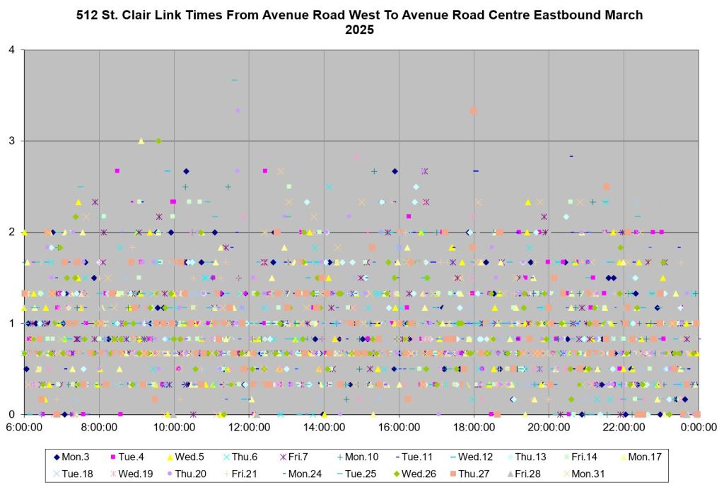
Avenue Road (FS)
Eastbound approach times at Avenue Road are scattered over a wide range, even worse than westbound data shown earlier.


Hi Steve,
Excellent analysis as always. I have spoken to Councillor Bravo on this issue and even she is at a loss on why we have so many issues even after a dedicated right of way.
The problem of streetcar bunching is partly due to this issue (of not having transit priority).
LikeLiked by 2 people
I remember as a kid in the 1950’s and 1960’s, and using the Bloor PPC streetcar trains. The two coupled PCC streetcar would have the same length as today’s single Flexity streetcar.
I would see the signal lights turn yellow, as the streetcar doors close. The streetcar train would enter the intersection still on the yellow, and the signal lights would turn red as the second car starts to enter the intersection. It would continue on, with the red signal. Cross traffic had to wait until after the streetcar train had cleared the intersection.
How could they get away with it? Because the streetcars were considered “street railways”. Railways had priority over all other motor traffic. That lasted until 1990’s, when the province decided that streetcars had to follow MTO regulations. Streetcar drivers also had to have a driver’s license after 1990, they didn’t need one before 1990. The province looked at a streetcar as a “single” vehicle, and ignored the passengers that they carried.
Steve : A long-retired operator friend of mine referred to those as “blushing ambers”.
LikeLiked by 2 people
Don’t look at Queen at Roncesvalles. A mess westbound due to mandatory stop-and-inspect at all the switches, and also a mess eastbound because they didn’t put in actual streetcar priority: streetcars coming from the Queensway right-of-way and car drivers coming from the straight-through lane have one and the same green signal and are supposed to merge into one common lane on the east side. Some streetcar drivers are rather timid about the weird merge and I’ve seen them wait an entire cycle.
This is one blindingly obvious location where detecting an eastbound streetcar and giving it a short green so it can load when no other cars are eastbound would be a huge benefit for streetcar passengers and drivers both.
Do TTC and Transportation Services even know they’re working in the same city?
Steve: There are times I think the TTC doesn’t fight hard enough, and times I think they don’t know or care. With the change in political balance of power this should also bring a more truly pro-transit stance and a demand by the Mayor and Council for changing priorities, but I have no sense that this will happen. The mess with the snow clearing is a similar problem of “hands off”, but one that the public can see.
LikeLiked by 1 person
Hi Steve, thanks for the analysis. I live near Avenue Road on St. Clair and am continually frustrated by the idiocy of the two-stop routine in “Transit City.”
(I think there’s an error in WB Winona where you refer to a delay on September 28 — that must be March 28?)
Steve: Ooops! I don’t know where “September” came from. I have fixed the text. Thanks.
LikeLike
I am confused why it makes a difference whether the left turn phase is a leading or trailing signal — at least consistently one or another.
There’s a length of red for the streetcar for the cross street to proceed. And there’s a length of red for the streetcar so that left turns can go. The two together make up a period of no-go for the streetcar, and it’s the same length of red whether the left turn phase is before or after the cross-street phase.
The only way I can see it making a difference is if the left-turn phase goes to the end of the green if there’s a streetcar that arrived on the “regular” red, otherwise it’s at the start of the green. I’m not sure how well that would actually work in practice.
We do have trailing left turn phases in Toronto, notably Lake Shore Boulevard eastbound at Windermere and Ellis Park. I am not sure if this setup is used anywhere else. There may be traffic timing considerations at work for these, though I don’t know what they might be.
Where both St Clair and Spadina suffer is because of the many signalized intersections with left turn or U turn lights. In some cases they’re every block or two. Intersections along Eglinton east of Don Mills are pretty far apart. But then again both Spadina and St. Clair are “local” streets in a high density environment. Even if you tell the cars to go hang, there are still plenty of pedestrians (including transit riders) who do need to cross the street. And what you don’t want is them crossing the street using the streetcar ROW as a “safe island”….because it’s not.
Steve: The reason for allowing streetcars to go first is that they will load earlier in the general traffic’s green phase and have a better chance of reaching the next intersection without dropping out of that wave. However, as I said, if streetcars still have to tip-toe across special trackwork (such as the many intersections on Spadina), they will need lots of time to make the crossing. On St. Clair, there are only a few such locations, and it’s less of an issue.
LikeLiked by 1 person
I wish our signals were more demand-responsive, as they typically are in Europe (especially the Netherlands). If the streetcar was detected passing through the previous intersection, then there should be a predictable travel time to the following intersection. That next intersection could then hold it’s green time or give the streetcar a first green before left turns, so it never has to stop.
Steve: That’s the way it works at some minor cross streets, but City Transportation Services holds that they cannot interrupt the cycle at a major intersection without screwing up traffic flow (and transit) on the cross street.
LikeLike
Hi Steve,
Do we have any inputs on how the TTC manages gaps between streetcars and bunching due to ramp deployment? Generally, when a ramp is deployed, it does mean it will be deployed again (for the same passenger that boarded earlier) and the combined time taken does mean it affects spacing. How actively is this monitored on St. Clair and is there any real time management (for example if the next streetcar needs to be short turned etc.)
I have seen this happening and then the bunching keeps piling up by the end of the trip.
Steve: We have not seen anything specific yet about actions the TTC is taking to manage service in general. Yes, ramp deployments take time, but they are not the only source of service bunching. Indeed, the length of a ramp deployment should not allow service to become badly bunched particularly with trios of vehicles. I am waiting until May before looking at operations on the routes where they have supposedly implemented better line management to see what is actually happening. FWIW, bus routes bunch too, and the delays caused by boarding/alighting wheelchairs and other devices are much less.
LikeLike
It is a bit surprising that they believe it is so hard to manage the signal phases. Indeed, it may be difficult to provide an absolute priority – as in all cross-street traffic stops to yield – for the streetcars at the big intersections. That level of priority could mess up the cross-street traffic, including the public transit bus routes.
But if they just extend some green phases by up to 30 sec, or shorten some by up to 20 sec; will that really affect the cross-street traffic so much. The goal isn’t to never stop a streetcar at red light; rather, to let the streetcar hit the green light more often, and avoid near-misses that delay the streetcar by the full signal cycle.
LikeLike
Thank you, Steve, for this analysis.
I took the St. Clair twice today, at 5 pm and at 9 pm. Wait times were under 5 minutes both times, and nothing off to report. Of course, I was just plain lucky, as once recently I waited 45 minutes and gave up. Yet, St. Clair is a much better streetcar service than Carlton or Dundas. From personal observation, I suspect bunching is often a matter of luck and unpredictable events along the way, not incompetence. Transit priority issues did not seem to affect my trips.
About transit priority, I am reading of the city’s Transportation Services department and somewhere within this group are people are responsible for transit priority. And somewhere within the TTC bureaucracy there is also a group which is responsible for transit priority. Who are they and do they communicate? Who has the upper hand?
Steve: Transportation Services, because they control the signals.
LikeLike
The left turn should definitely be last in the cycle. This is especially true on Spadina which has lots of major cross streets. This would allow more space to open on the cross street to receive the turning traffic. Since there is queuing space for the left turning traffic this won’t affect overall traffic flow.
So you would first get straight traffic + streetcars + pedestrians, then hold the green if there is a streetcar coming, then a left turn phase, then cross traffic.
On St Clair where many of the crossings are minor streets they should go red as soon as practicable if a streetcar is approaching.
LikeLike
The true bottleneck occurs at the Bathurst/Vaughan Triangle, where many a vessel has disappeared.
Switch at Bathurst is finicky enough that kool-kid drivers pace the streetcar so a fixed slow speed gets them up the hill, through the green light, and past the switch in one fell swoop.
Diabolical switch at Vaughan coïncides with lethally dangerous traffic, which can and does whip around corners in every direction, including directions seemingly impossible from the apparent geometry (e.g., southbound to eastbound).
It takes minutes upon minutes upon minutes to travel between St. Clair West station and Wychwood. And there was a five-year period in which the Christie bus would miss up to seven, but typically four, red lights at Bathurst because a ninny of a supervisor had lost his nerve and banned the bus from driving up the ramp.
Last but not least, the hill from Bathurst to St. Clair West station is so anti-human and unforgiving that people will arbitrage which vehicle is leaving the station first just to avoid having to climb up it. Going downhill isn’t much more pleasant.
All discussions of delays on St. Clair conveniently disregard the actual culprits, which I have equally conveniently listed for you here.
LikeLike