
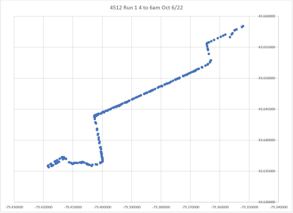
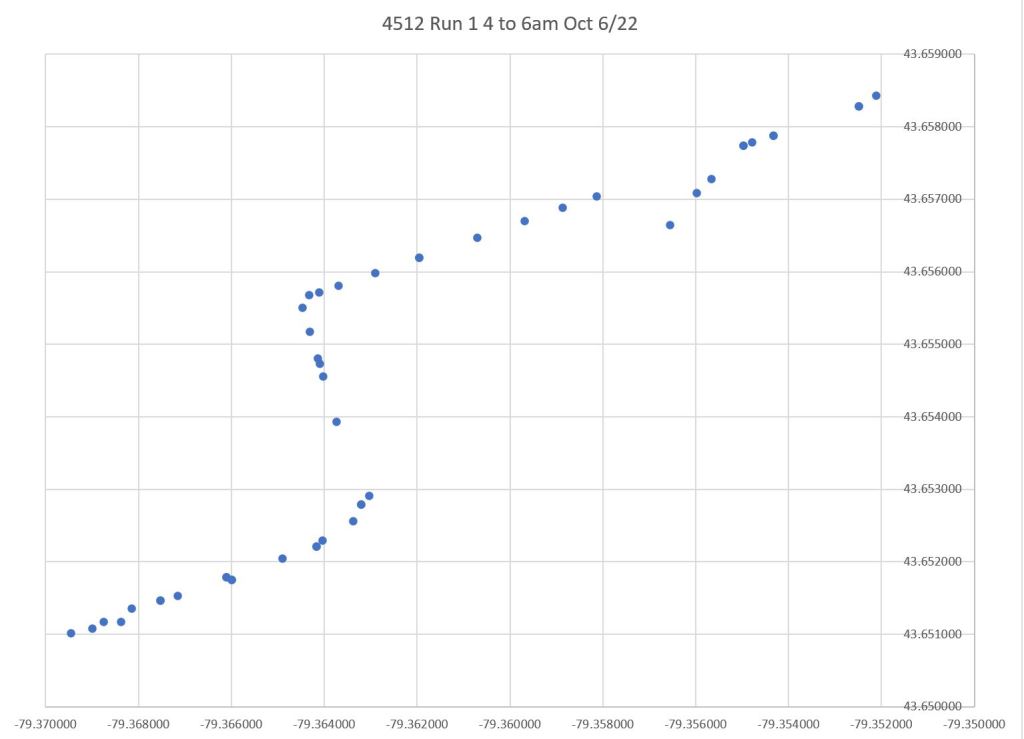
The charts here plot the reported GPS data for three cars during selected times to show distortion of vehicle locations at points where the 504A and 504B routes diverged between Parliament and the Don River.
The first pair of images show the early period for Run 1. It is a 504A Distillery car, but it enters service from Leslie Barns. The divergence of data points from Queen Street at River Street is quite evident here. These points are sequential in the GPS logs.
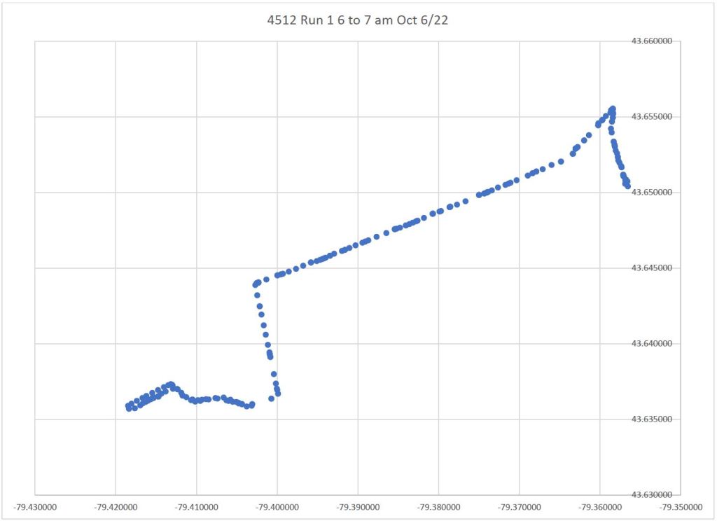
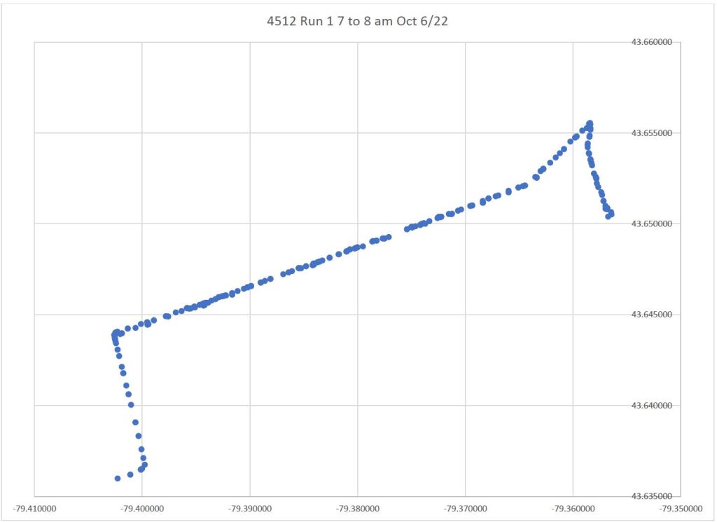
The next pair of images show Run 1 data from 7 to 8 and from 8 to 9 am. The route between the Distillery Loop and Exhibition Loop is clear. There is no distortion of location near King and Parliament.
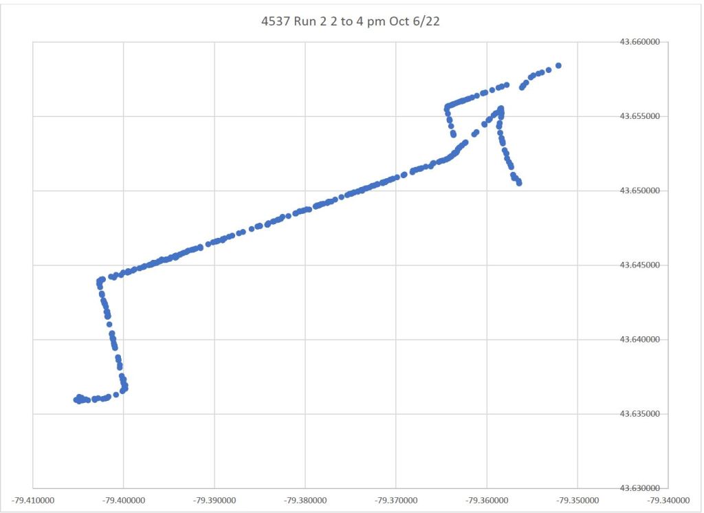
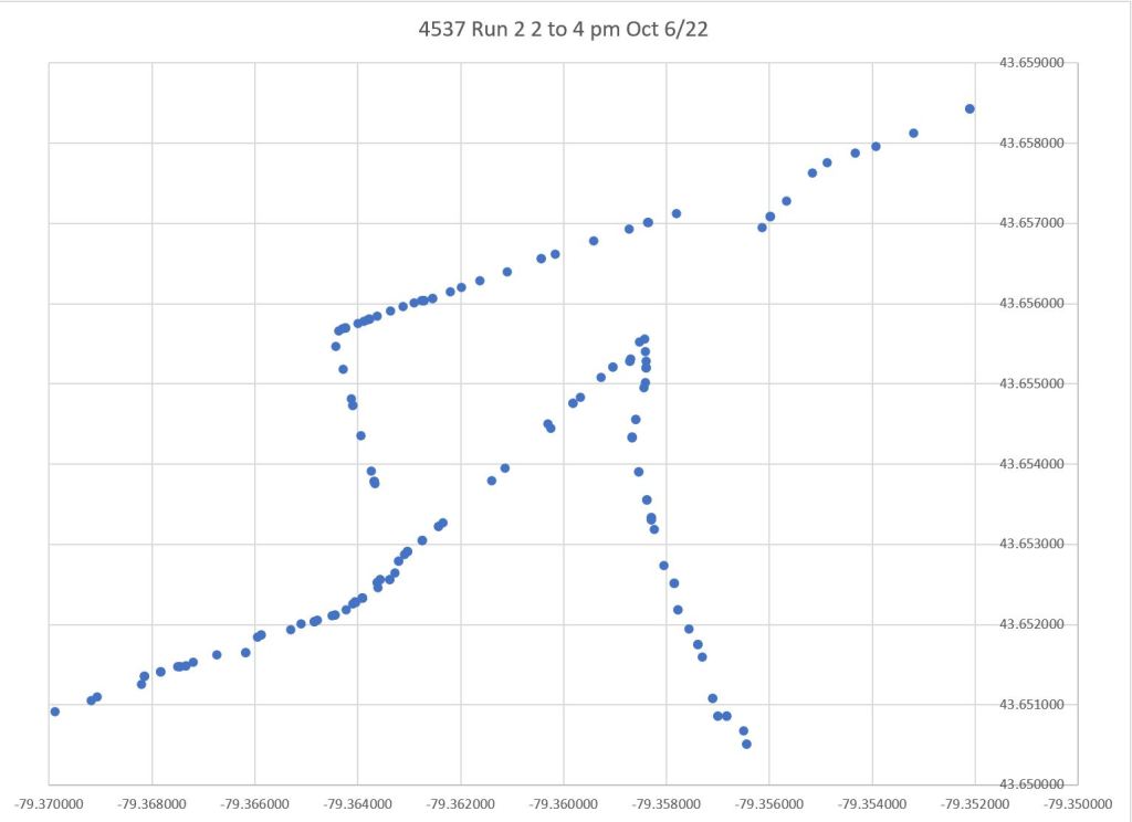
This is Run 2 which enters service n the early afternoon. It too is a 504A car. These images show data from 2 to 4 pm, and this includes the trip into service plus the return trip to the Distillery. The same diversion of data points westbound at River is seen here, but the eastbound data along King at Parliament are ok.
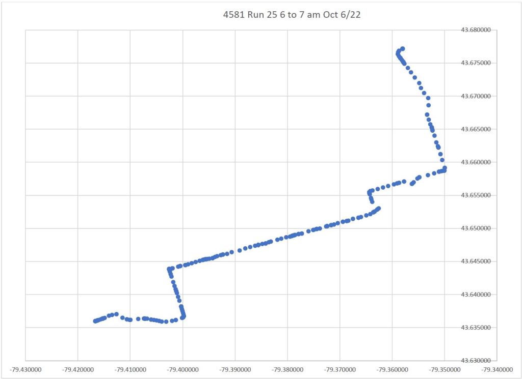
Here is Run 25, a 504B car. It enters service via Queen and Parliament, and the data at River are shifted off of Queen in the same pattern as above.
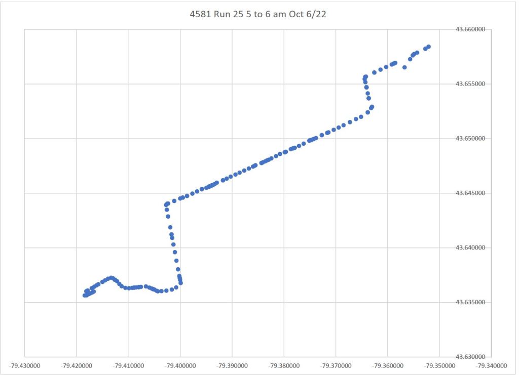
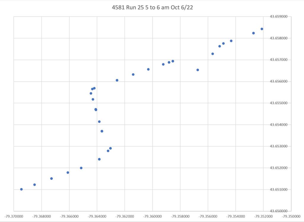
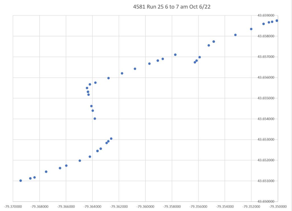
On the return trip to Broadview Station, data points are plotted on King for a short distance east of Parliament, as well as on King west of River, although the car clearly travels via Queen & Parliament.
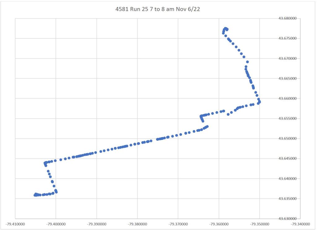
The same pattern appears later in the data.
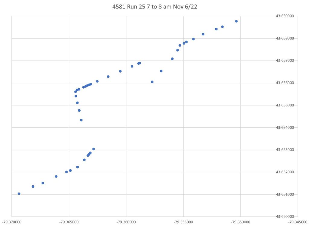
Along the entire plot there is no scatter away from the route. This is simply not credible as “raw” data especially in the downtown canyon where GPS readings are thrown off by tall buildings.
It appears that the cleansing algorithm can be confused when two possible route paths are available and close by, and that vehicle locations are shifted to the “wrong” path until the divergence is too large to ignore.
