Updated December 15 at 1:00 am:
Car 4165 made two test runs on the western section of the St. Clair route on Monday, December 14. The first pass was done slowly to check clearances, and the second was done at speed without incident. Testing will continue through the week.
On Saturday, December 19 from 11 am to 3 pm, there will be charter service using PCCs 4500 and 4549. Here is Councillor Joe Mihevc’s announcement of this event.
Save Saturday, December 19 for a fun shop local event from 11 a.m. to 4 p.m. when there will be free rides on two TTC heritage streetcars between Bathurst and Lansdowne. The heritage streetcars are the red-maroon and yellow “Presidents’ Conference Committee” streetcars that first operated in Toronto in the late 1930s and ended in the mid-1980s. These PCC streetcars are a real treat that will take you down memory lane to Toronto’s past.
The Hillcrest Village Choir will be performing for much of the day on one streetcar, and Toronto historian Mike Filey will be speaking about local history on the other. This is a great opportunity to come to St. Clair to enjoy a rare ride and support local businesses by finishing some last minute holiday shopping or enjoying a St Clair meal with friends and family.
The basic idea is have local residents support local businesses along the strip and use the PCC streetcars to jump on and off at your pleasure. So you may want to have a brunch or lunch at a local eatery, and then catch the streetcar as it comes by, make a big loop and return to where you began, perhaps jumping off at a store that you always wanted to check out. Boarding the streetcar will be from the new passenger islands.
I will be at World Class Bakers at Christie for most of the time. Feel free to come by and say hello.
IMPORTANT NOTE: The free ride only extends between Bathurst and the Earlscourt loop at Lansdowne. There will be no free transfers to other lines. The streetcar will only use the St Clair West subway station to turn around (no passengers will be permitted to exit into the subway. If you want to go to the subway, you will need to use the buses which will continue on the road and pickup passengers from the sidewalk.)
Joe Mihevc
The original December 5 post follows the break below.
There is a post over on UrbanToronto showing the wandering track installed on St. Clair near Oakwood. The pictures have been picked up by the National Post with an article quoting former TTC Chair Howard Moscoe saying that the tracks will have to be fixed. Comments in the UrbanToronto thread, and elsewhere on this site echo these sentiments.
[Note: I have moved the comments regarding St. Clair from the Finch LRT thread where they were posted to this thread for continuity.]
For its part, the TTC says that the curves on the western portion of St. Clair are comparable to what we already have on the eastern portion, and this is not an issue.
My suspicion was that the photos made the worst of the situation by the focal length of the shots — a long telephoto shot that compresses distances and accentuates the wobbles. However, I wanted to be sure and spent a few hours making my way from Yonge to Lansdowne photographing the line.
Update: The particular location of interest, east from Dufferin, includes left turn lanes at Westmount that were not part of the original design as shown in the EA document. Similarly the eastbound left turn at Dufferin was an add-on. Some of the peculiarities in this particular section arise from those late changes, but this specific issue should not be used to attack the entire line.
The photos here were all taken at the same focal lengths — 70mm for the “conventional” view and 200mm for the “telescopic” view — and none of them has been cropped. They were taken from the same positions. The only editing done has been to compress the images for online use and, in one case, to correct an overexposure. (To those who bother to look at the properties of the images and see minor variations like “194mm”, it’s a zoom lens and I was positioning it reasonably close to the desired setting. Don’t kvetch.)
My overall impression was that, yes, the western part of the line is curvier than the eastern part, but this is due to the greater number of intersections and left turn lanes. The curves are comparable and generally follow both the layout of turn lanes and the narrowing of the right-of-way where the centre poles vanish at intersections.
At the risk of sounding like an apologist for the TTC, the situation on St. Clair has been misrepresented by the choice and composition of the photos. There are many problems with the St. Clair design (not the least of which is those darned centre poles to which the TTC clings adamantly), but the track does not wobble to the point that this will compromise operating speed or passenger comfort. I believe that the shots that have been published suit the agenda of the anti-St. Clair and, by extension, anti-Transit City factions who seek to discredit what the TTC is doing by any means possible.

West from Yonge. The track here curves back to the middle of the road around the eastbound left turn lane.


East from Dunvegan. Note the change in track spacing at the transition from side to centre poles. The meander at Avenue Road in the distance is a function of the street alignment. When the same view is shown as a telephoto shot, the curves are more pronounced.

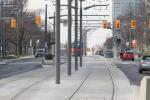
West from Dunvegan. Note the meander of the westbound track at the Russell Hill intersection in the distance. This is much more pronounced in the telephoto version.


West from Spadina. This shows clearly the meanders for the left turn bays in each direction, but the track looks much worse in the telephoto view.
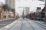

East and West from Wychwood. I have presented these views only in the standard format as the telephoto version adds nothing to the overall argument. The track meanders, but no differently than on the eastern section of the line.
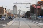
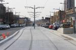
East and West from Arlington. As at Wychwood, there are some meanders, but nothing untoward.
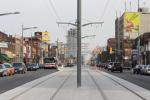
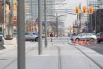
East from Atlas. This is a particularly good example of the effect of a telephoto view which makes the track look quite odd. As it comes to the intersection at Arlington, the right-of-way shifts to the north to make room for a left turn bay at the same time as the width of the right-of-way narrows by 1m due to the absence of centre poles. This requires the eastbound track to shift further north than its westbound counterpart, then back again to align with the westbound left turn bay, and finally to make room for the centre poles east of Arlington.
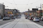
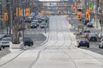
West from Atlas toward Winona. This section of the line has no centre poles and includes special ramps to allow fire trucks to cross the right-of-way from the station out of frame to the left (south). Note that this requires the line to level out for the street crossing, an effect particularly visible in the telephoto shot. As the line continues west up the hill to Oakwood, it is unusually straight because at that location both platforms are on the east side of the intersection and a left turn meander is not required.

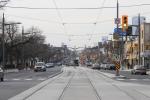
East and West from Oakwood. These are among the longest clear views of the wandering track because of the high vantage point. A track crew working west of Oakwood blocks the full effect of the view west to Dufferin. Note that the overhead special work has not yet been installed to access Oakwood Loop, and some of the overhead is still attached to spans only by temporary ropes. Also, note the openness of the view without any centre poles on both sides of the intersection.
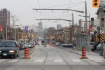
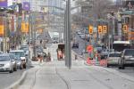
East from Dufferin. This view shows clearly the effect of the meander when seen in telephoto, but also the visual blight of the centre poles (which has been obvious in preceding photos). Urban design is not the TTC’s strong suit.

This shows the eastbound stop at Dufferin and the recent modification needed to make the traffic lane wide enough to better handle north-to-east turns.

A closeup of the comparable fix to the westbound stop. This work was completed quite recently after the original design was found to be unworkable.
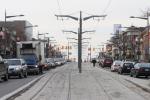
West from Dufferin. Fairly straight track, but a lot of unattractive poles. This is a “normal” shot, not a telephoto view. Shame on the TTC for forcing this design on St. Clair.
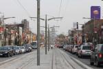
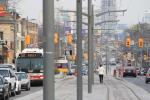
East from Via Italia toward Dufferin. The gentle meander of the normal view changes substantially in the telephoto version.
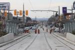
West from Earlscourt toward Lansdowne where the line will end, temporarily until the Gunn’s Road section opens in 2010.

Does the fact that the City sold its poles to Hydro have anything to do with the TTC setting up its own poles?
Steve: No. The TTC has always had an agreement about using a mix of hydro poles and TTC poles to hold up its overhead on streetcar routes. Typically you will find hydro poles on one side of the street and TTC poles on the other. Also, the TTC feeders tend to be on the TTC poles, while the hydro feeders are on the hydro side. However, this is not a hard rule. There will always be low voltage hydro lines on both sides to power the street lighting.
LikeLike
I notice in the comments the absence of the person who took all those telephoto shots of the “drunken sailor” track and posted them online, starting this whole discussion. He didn’t indicate that the pictures were telephoto shots, which just made this easy pickings for any and all critics. If the curving of the track ends up having no impact on the operation of the line, which it looks like it likely will not, shame on the photographer for being a bit dishonest about it and doing a disservice to the whole project. Yes, it has plenty of other things to be critical of, but this was an exaggeration.
Steve: I think Dave’s intent was more to show the amount of variation caused by what may have been a last-minute design change to add left turn lanes both ways at Westmount, combined with the presence of a short run of centre poles. All of this causes an unusual amount of meander in a fairly short distance.
That said, the Post and Global TV ran with the story and interviewed Howard Moscoe as if this was typical of the line. Why they chose him considering his now-tenuous link to the TTC I don’t know, but it certainly misrepresented the problem.
LikeLike
And shame on Howard Moscoe! “They’re gonna have to rebuild the thing…” or something to that effect was he quoted as saying. I am truly ashamed that he may still be my city councillor. That is an inciting remark, made purely for the benefit of unscrupulous media coverage and maybe his own personal gain, i don’t really know.
LikeLike
Dave can probably explain what he was thinking when he made the post.
For my part, I think (will assume?) that his point was that TTC made a lot of concessions for car drivers and this has created this meandering which will make the ride a bit wobbly.
The message some people received was that the TTC had allowed shoddy work on a stretch of St. Clair, that this way typical & to be expected, etc.
I do not know if that was because of their own prejudices about the TTC or because Dave was trying to get people to think along those lines.
But Steve, thank you for providing the shots of the area w/o telephoto to give a contrast to the images.
Whoever said pictures don’t lie should bookmark this post as a reminder that pictures may not lie but they can make us believe lies.
Regards
Moaz Yusuf Ahmad
Kuala Lumpur, Malaysia
LikeLike
Simon S-G says:
December 5, 2009 at 5:54 pm
“None of the old LRT Lines (Spadina, Queen’s Quay) that were built in years past have these centre poles. The only LRT lines that have them other than St. Clair is on Queen’s Quay between Spadina and Bathurst Spadina south of Front, and the tracks along Fleet into Exhibition Loop. So the TTC could have just looked at THEIR OWN SYSTEM to figure out whether it would work or not. And yet they didn’t. (In fairness, the sections I talked about don’t have exactly the same problems as what we’re discussing on St. Clair, but they could have still looked at them for examples).”
You have not been on the Queensway lately. It is mainly centre pole, but with the ballasted right of way it does not look bad except near curves where the centre poles are very close together.
As far as traffic signal priority is concerned I too have noticed an improvement on St. Clair and on the Queen’s Quay. The lights on Queen’s Quay seem to turn green as a street car approaches and they will also stay green long enough to let 2 cars through. They also stay green longer if there is a car coming from each direction. Things are improving but they still could be better.
LikeLike
Speaking of Queen’s Quay, why exactly did we need an ROW on Fleet St.?
Steve: That is a mystery, although the alleged purpose was for the original route of the Waterfront West line. However, by the time they actually built the Fleet Street right-of-way, the proposal had shifted north to Fort York Blvd. Fleet is particularly ugly because the centre poles are closely spaced for the curve. Overkill and ugly design all in one go.
LikeLike
Many US cities manage to build better LRT systems than the TTC. They don’t have previous experience nor streetcar operating in decades. We must as well hire a foreign company to design our new lines too. Considering TTC had more than a century of experience, we should be ashamed. Oh well, we love our stubborn engineers and urban planners.
The Queensway ROW is completed in 1957 and it’s straighter than St. Clair. Maybe the previous 1920s St. Clair ROW was straighter too. How do we even do this?
If we don’t design a specific left turning line, maybe we’ll solve a lot of problems. First, we don’t have a curve in the track. Second, we can actually have near-side stops and solve some signal priority problems. Third we would annoy many cars with left turning cars waiting on the outer lane. Of course they can switch to using The Better Way. Fourth, we save money with less time spent on designing or redesigning. Fifth, at least it looks better!
LikeLike
@Jonathon
Speaking of Queen’s Quay, why exactly did we need an ROW on Fleet St.?
During the Molson Indy, Caribana, the Ex etc, Fleet Street gets clogged with autos, bringing the 511 & 509 streetcars to a standstill. It would take over an hour in some cases for the streetcars to reach the subway. A ROW on Fleet is long overdue. Moreover, we need to separate as much streetcar track from autos as possible, but car drivers are a powerful force in politics.
LikeLike
“The Queensway ROW is completed in 1957 and it’s straighter than St. Clair. ”
The Queensway is much wider. It is originally 3 car lanes in each direction plus the streetcar ROW. It was recently rebuilt to 2 car lanes, plus a bike lane and some grass and trees on either side of the ROW. I suspect when they originally built The Queensway they where working with undeveloped land and had a blank slate to do what they wanted.
“Maybe the previous 1920s St. Clair ROW was straighter too.”
It was, but there basically only one lane of car traffic in each direction.
LikeLike
Robert you’re right, I haven’t been on The Queensway lately. I live in North York so I don’t get down there very often. But I didn’t mention Queensway because it was built many years before these latest projects. Queen’s Quay, Spadina, St. Clair have all happened within my lifetime, when the city started to build streetcar tracks again.
LikeLike
There was no Queensway at the south end of High Park before 1957. The south end of High Park was the railway tracks. Since the Queensway was built in the 1950’s there was no Environmental Assessment needed, they just built it. If the Queensway and the streetcar right-of-way was built today, there would have been a big uproar over taking parkland away for a roadway.
Steve: Imagine trying to propose the Gardiner today!
LikeLike
I don’t know what the problem is with the curves. Have you guys ridden the line? I have an it does not have an impact that is noticeable on the car. I drove along St. Clair this evening and all the overhead is in to Caledonia except for Oakwood loop. Now that everyone is driving in the car lanes the traffic appears to be moving smoothly but I have not been there in the rush hour. I shall wait to see the line when it is operational.
Steve: There will be test cars out next week, and both PCCs on Saturday Dec 19 from 11 am to 3 pm.
LikeLike
It’s nice to know that the old 1920s St. Clair ROW had centre poles too.
At least there wasn’t that many cars back then and no traffic lights.
I personally think they place way too many traffic signals on the ROW today.
Steve: The comparison of the two views is quite interesting. On the old right-of-way, the poles didn’t have the decorative “fins” of their modern cousins, and they appear to be a bit further apart. Also, as you note, there isn’t a traffic signal every five feet, and there are no left turn bays with associated meanders, and the right-of-way is consistently wider than it needs to be. This makes for a much less crowded feel.
The Highway Traffic Act requires that there be two heads for every signal, and this leads to a ridiculous, almost confusing proliferaton of signal heads at each intersection. One pair for the through traffic, one pair for left/U turns and one pair for transit. This is unlikely to change as urban design is the last thing on anyone’s mind when specifications like this are created, and Toronto is the only city this affects in Ontario.
Old view New view
LikeLike
“The Highway Traffic Act requires that there be two heads for every signal, and this leads to a ridiculous, almost confusing proliferaton of signal heads at each intersection. One pair for the through traffic, one pair for left/U turns and one pair for transit. This is unlikely to change as urban design is the last thing on anyone’s mind when specifications like this are created, and Toronto is the only city this affects in Ontario.”
Given that LED’s have about a 25 year life and that there are many LED’s in newer signal heads and that these signals are only to be used by transit vehicles, perhaps it is time that the city asked the province to amend the Highway Traffic Act to allow transit only signals that out of town motorists would not confuse for regular signals and go screaming along the right of way or through an intersection in front of a street car. Just about every other city in the world that has LRT uses transit specific signals with out obliterating half the population of the area.
LikeLike
Queen’s Quay used to have (still has?) separate traffic light signals for the streetcars, a white vertical bar as I recall. I haven’t been on the line for a few years & can’t recall if they’re still being used.
Steve: The vertical bar (a railway standard equivalent to a semaphore in the upright or clear position) is used at several intersections for a transit only phase. This avoids showing a green aspect that could confuse motorists.
LikeLike
By the way, since when was a streetcar consider a vehicle and requires to follow traffic law? Being tied to tracks and not requiring an license plate, streetcars should have a different set of laws. They should really consider a different scheme for future LRT lines in Ontario.
There is also a vertical bar for buses turning left onto Sheppard exiting from the Don Mills Station bus terminal.
LikeLike
Steven says:
December 11, 2009 at 9:42 pm
“By the way, since when was a streetcar consider a vehicle and requires to follow traffic law? Being tied to tracks and not requiring an license plate, streetcars should have a different set of laws. They should really consider a different scheme for future LRT lines in Ontario.
“There is also a vertical bar for buses turning left onto Sheppard exiting from the Don Mills Station bus terminal.”
I cannot remember the year but I believe that the federal government repealed the “Street Railway Act” and left Toronto’s streetcars, and maybe Calgary’s street running, to the provincial Highway Traffic Act. And even in the old days streetcars still had to stop at red lights.
LikeLike
This free PCC run is sure to frustrate riders who will want to travel as far as St Clair West and beyond, by making people get off and transfer on the street. People have already waited far too long to be able to ride streetcars on St Clair again, and to have some of the rides taken up by these charters, while a nice PR event, seems a needless frustration.
Steve: This is standard TTC operation. Those cars a charters by the ward Councillor, Joe Mihevc, not a formal TTC operation. They won’t collect fares and, by TTC rules, cannot pick up or drop off in fare paid areas. Also, there are only two cars, and the headway won’t be spectacular. Wait until Sunday if you must.
LikeLike
Steve, you’ve previously mentioned they (the TTC) are redesigning Gunn’s Loop. Do you have any details on that? Like a planning document, or blueprints? Also, do you know when they might finish redoing Gunn’s Loop?
Steve: I have no documents, but my understanding is that the redesign is to accommodate a future extension to Jane Street. According to a friend who was at a recent community meeting, the loop won’t be done until August 2010 because the track for the new layout has to be fabricated.
LikeLike
All this because the TTC made the mistake of paving the track area in the early 20th century. Don’t get me wrong-I’ve always been 110 % for this project. It’s just that when the track area got paved, it just meant that fixing that mistake was proved costly and controversial.
LikeLike
Why would they? So that more cars can just go down the street like they do now and always have? Get real.
LikeLike
It’s been asked before, but does the TTC actually have enough functioning streetcars to reopen this line?
I was on a 512 streetcar last week that was literally a clunker – the trolley pole was bouncing off the overhead every couple seconds releasing a loud “chunk” each time it did. This was at night and the way the arcs reflected off the surrounding buildings was pretty spectacular. This particular streetcar hasn’t been on St Clair in years – it announced Warren Rd stop WB, even though that has been renamed and announced as Dunvegan both directions for years now.
As the Bathurst track is still ripped up, I can’t see them going to the trouble of sending an obviously subpar streetcar up to St Clair. I figure they found it sitting in the back lot at Hillcrest and shoved it into service.
My suspicions are only heightened by the number of buses I see mixed in with streetcars downtown. I see 506 buses regularly running on College (mixed with streetcars – it’s not a diversion!) and occasionally on Dundas.
Oh, TTC, what are you hiding from us?
Steve: The TTC claims that it is working on its streetcars, but the failure rate is such that as fast as they fix one, another one breaks. Yes, life will be interesting next week. Their medium range fleet plans include using buses to cover some streetcar services pending the arrival of the new fleet. The whole replacement project was left too long, and I don’t think everyone realizes how close we might have come to complete collapse of the streetcar lines thans to the endless deferral of a replacement program.
LikeLike
There can be no valid reason to delay completing the line to Gunn’s Loop just because it needs some redesign for straight through track. The road and track have all been ripped up and redone except the smallest part. Connect it up ASAP and redo the short part at the loop. Not rocket science. KISS.
LikeLike
As Ray says: “There can be no valid reason to delay completing the line to Gunn’s Loop just because it needs some redesign for straight through track.”
There were some interesting old photos on the Miscellany Toronto: Then & Now thread on the Urban Toronto site last week showing how the TTC used to install temporary diversion track when they were doing repairs. If it is going to take many months to get special trackwork built for the new (improved) Gunns Loop then they should do something similar here to allow the 512 to get into Gunns Loop. It is surely expensive to run a bus service from Oakwood Loop to Gunns Loop and clearly inconvenient for customers.
LikeLike
Regarding the redesign of Gunns loop, would it be to much to ask for a storage/passing track to be added? The added operational flexibility would be beneficial to the rest of the line. One should have been added at St Clair Station as well.
LikeLike
There already is a short stub end storage track that will hold 1 car.
As for the problem with the loop this only comes into play when/if the line is extended westward. Normally a loop goes to the right and then loops counterclockwise back to the left onto the street. A spur is usually run straight ahead and deadends where the loop curves back in the opposite direction. In the case of this loop the track runs straight ahead then curves clockwise and crosses over the westbound track and curves left to go east. This would have to be redone to allow for both through cars (to Jane?) and short turning cars at Gunn’s. Why bother? Just make Earlscourt the short turn loop. Is there really a need for another one at Gunns?
Steve: The existing tail track is too short to hold one of the new cars once they arrive.
LikeLike
I have noticed the diamond signs indicating that the right-of-way is for streetcars AND buses only. If the signs say so, why are not the current 512 and 126 buses using the right-of-way at this time, other than having to clean the debris off it?
Steve: Yes, but the signs on the islands say “board buses at curb”. Don’t expect consistency from TTC signage.
LikeLike
The diagram on page 19 of the Feb 26th 2009 presentation show a much longer tangent track in the loop than currently exists. It looks long enough to store two or three new cars. The existing loop would barely hold one. I believe this is one of the major reasons for redesigning the loop; the ability to hold more than 1 car at a time. Alas there is no spare track which would make a lot of sense.
LikeLike
The idea being of course that it is physically possible and therefore legally allowed for buses to use the ROW. I can recall one case of a police blockage of the roadway where buses were forced onto it for a block. They managed. But allowing for the lowest common denominator, they don’t as a rule.
LikeLike
I understand why the ROW had to be a metre wider with centre-poles, in order for free-wheeled vehicles to navigate.
But why did the tracks themselves have to be installed further apart? Streetcars don’t need that extra space to navigate, do they? How were the streetcar’s space requirements any different than in the 1920’s, when the St Clair streetcar line still had centre poles, but with much straighter track?
Steve: The weaving track arises from a desire to accommodate left turn lanes and as much parking as possible, plus considerably larger loading islands. The changes are not specifically for the streetcars, but the TTC concocted a story that they needed their own set of poles. This arose from the original design for the hydro poles that would have been further apart, but were actually installed on roughly the same spacing as the old TTC poles. Trying to talk to people about this at public meetings was like talking to a very thick wall.
LikeLike
Since this thread has been reopened, there is one item I would like to add.
I agree that the centre posts create more visual pollution than crosswires strung to the light standards. I know that the TTC says that a) it wants to have full control of the system, including the poles and b) placing the pole in the centre of the ROW means the power cable will not be brought down by a motorist colliding with a curbside pole.
I have never fully bought into this reasoning, but they can use it to defend their choice as utility over aesthetics. I feel the only way to attack this (and here I am thinking of future Transit City projects, rather than changing St. Clair) is via the pocketbook.
It seems to me that snow removal will be much slower and significantly more expensive with the centre poles. In the current model, the snow can be removed from the tracks by a single pass of a large machine (blower or melter) each direction. However, a bank of snow builds up in the centre of the ROW between the posts, and this needs to be removed manually. If the poles were not there, this bank might be picked up in the initial passes (if the blades were wide enough), but even if it wasn’t surely a third run down the ROW would be cheaper than gangs of workers shovelling the snow (or at best using small machines like Bobcats).
Steve: More to the point, how often have we had delays to service from motorists downing hydro poles and TTC feeders? Is moving the poles to the centre of the right-of-way worth the way this interferes with operations of any vehicles on the transit lanes and eats up an extra metre of scarce right-of-way on St. Clair?
LikeLike